Category:Leuchtturm Bremerhaven Oberfeuer
Jump to navigation
Jump to search
| Object location | | View all coordinates using: OpenStreetMap |
|---|
lighthouse in Free Hanseatic City of Bremen, Germany   | |||||
| Upload media | |||||
| Instance of | |||||
|---|---|---|---|---|---|
| Part of | |||||
| Made from material | |||||
| Location | Mitte, Stadtbezirk 1 Nord, Bremerhaven, Bremen, Germany | ||||
| Located in or next to body of water | |||||
| Street address |
| ||||
| Heritage designation | |||||
| Service entry |
| ||||
| Inception |
| ||||
| Significant event |
| ||||
| Height |
| ||||
 | |||||
Deutsch:
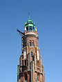
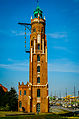
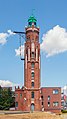
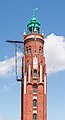
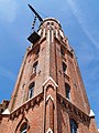
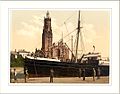
Der Leuchtturm Bremerhaven is a protected cultural monument in the Free Hanseatic City of Bremen with the number 1546 registered with the State Office for Monument Preservation. → Datenbankeintrag
English: Bremerhaven lighthouse
Media in category "Leuchtturm Bremerhaven Oberfeuer"
The following 55 files are in this category, out of 55 total.
-
 2007-03-29 Bremerhaven 025 (2717335979).jpg 3,072 × 2,304; 2.58 MB
-
 2007-03-29 Bremerhaven 029 (2718174470).jpg 3,072 × 2,304; 2.91 MB
-
 2021-08-16 Bremerhaven Oberfeuer 01.jpg 1,789 × 2,676; 776 KB
-
 Bhv-sluice2 hg.jpg 4,104 × 2,832; 1.54 MB
-
 Bremen Bremenhaven 02.jpg 6,016 × 4,016; 5.82 MB
-

-
 Bremerhaven 09 (10332315016).jpg 1,704 × 2,272; 890 KB
-
 Bremerhaven 2010-05-18-2862.jpg 3,168 × 4,752; 7.53 MB
-
 Bremerhaven 2012 (40).jpg 3,136 × 4,734; 6.82 MB
-
 Bremerhaven 9577.jpg 1,088 × 1,920; 1.52 MB
-
 Bremerhaven Leuchtturm Oberfeuer Loschenturm.jpg 2,736 × 3,648; 2 MB
-
 Bremerhaven Oberfeuer 01.jpg 960 × 1,280; 236 KB
-
 Bremerhaven Oberfeuer 02.jpg 960 × 1,280; 248 KB
-
 Bremerhaven Oberfeuer 03.jpg 960 × 1,280; 213 KB
-
 Bremerhaven Oberfeuer 04.jpg 960 × 1,280; 254 KB
-
 Bremerhaven Oberfeuer 05.jpg 960 × 1,280; 263 KB
-
 Bremerhaven Riesenradblick 6.jpg 3,820 × 2,866; 1.89 MB
-
 Bremerhaven Unterfeuer 1.jpg 1,089 × 1,500; 340 KB
-
 Bremerhaven, Alter Leuchtturm (Großer Leuchtturm oder Loschenturm) (10679924534).jpg 2,045 × 3,810; 6.6 MB
-
 Bremerhaven, Alter Leuchtturm (Großer Leuchtturm oder Loschenturm) (10679924576).jpg 2,523 × 3,808; 7.83 MB
-
 Bremerhaven, Alter Leuchtturm (Großer Leuchtturm oder Loschenturm) (15111038539).jpg 1,797 × 2,734; 3.48 MB
-
 Bremerhaven, Germany (7065484763).jpg 2,592 × 3,888; 9.8 MB
-
 BremerhavenHafenbild.jpg 2,560 × 1,920; 1.12 MB
-
 CAM02613-D-.JPG 1,496 × 2,137; 2.36 MB
-
 De rede van Bremerhaven Rijksmuseum SK-A-1038.jpeg 3,656 × 2,496; 768 KB
-
 Drehbrücke Schleuse Neuer Hafen und Loschenturm, Bremerhaven.jpg 3,264 × 4,928; 4.9 MB
-
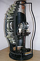 Fresnel lens loschen hg.jpg 1,659 × 2,535; 423 KB
-
 Geestemünde (ship, 1975), Seestadtfest 2018 in Bremerhaven.jpg 5,184 × 3,456; 5.95 MB
-
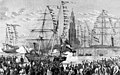 Germania und Hansa - Bremerhaven - 1870.jpg 1,772 × 1,104; 1.4 MB
-
 Großer Leuchtturm - panoramio.jpg 3,672 × 4,896; 8.87 MB
-
 HafensperrtorNeuerHafen (Bremerhaven).jpg 2,075 × 1,484; 1.62 MB
-
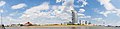 Havenwelten - Bremerhaven 02.jpg 16,442 × 3,926; 33.31 MB
-
-

-
 Leuchtturm Bremerhaven.jpg 2,048 × 1,536; 555 KB
-
 Leuchtturm Bremerhaven2.jpg 1,280 × 852; 87 KB
-
 Leuchtturm Oberfeuer am Neuen Hafen - Bremerhaven 01.jpg 3,319 × 5,776; 11.14 MB
-
 Leuchtturm Oberfeuer am Neuen Hafen - Bremerhaven 02.jpg 3,017 × 5,380; 9.23 MB
-
 Leuchtturm Oberfeuer am Neuen Hafen - Bremerhaven 03.jpg 2,910 × 5,381; 9.6 MB
-
 Leuchtturm-Bremerhaven-Oberfeuer 1.jpg 1,432 × 1,032; 550 KB
-
 Leuchtturm-Bremerhaven-Oberfeuer 2.jpg 1,200 × 1,600; 1.08 MB
-
 Lighthouse Bremerhafen Hanover (i.e. Hannover) Germany.jpg 1,072 × 837; 142 KB
-
 Lighthouse, Bremenhaven, Germany - panoramio.jpg 3,299 × 4,352; 6.7 MB
-
 Lighthouse, Bremerhafen, Hanover (i.e. Hannover), Germany-LCCN2002713715.jpg 3,686 × 2,748; 2.73 MB
-
 Lighthouse, Bremerhafen, Hanover (i.e. Hannover), Germany-LCCN2002713715.tif 3,686 × 2,748; 28.98 MB
-
 Loschen Turm Bremerhaven.jpg 3,468 × 4,624; 3.28 MB
-
 Loschent + Obelisk 20180526.jpg 1,438 × 1,920; 1.53 MB
-
 Loschenturm Bremerhaven.jpg 1,134 × 2,271; 686 KB
-
 Oberfeuer am Neuen Hafen.jpg 3,264 × 4,928; 7.53 MB
-
 Schleuse Neuer Hafen adL 20111001.jpg 1,172 × 1,565; 765 KB
-
 Schleuse Neuer Hafen, Seestadtfest 2018 in Bremerhaven.jpg 5,184 × 3,456; 4.11 MB
-
 Ship Adler Princess.jpg 1,536 × 1,152; 215 KB
-
 Simon-Loschen-Leuchtturm bei Nacht.jpg 1,440 × 1,920; 1.52 MB
-
 Simon-Loschen-Lighthouse at night Dec2008.jpg 1,350 × 1,800; 1.24 MB
-
 Zoo am Meer, Simon-Loschen-Leuchtturm, Bremerhaven, 2009.jpg 2,726 × 1,650; 1.07 MB
.jpg)
.jpg)


.jpg)
.jpg)

.jpg)


_(10679924534).jpg)
_(10679924576).jpg)
_(15111038539).jpg)
.jpg)


,_Seestadtfest_2018_in_Bremerhaven.jpg)


.jpg)


_Germany.jpg)

,_Germany-LCCN2002713715.jpg)


Categories:
- Bremerhaven range lights
- Cultural heritage monuments in Mitte (Bremerhaven)
- Gothic Revival in Bremen (state)
- 1850s architecture in Bremen (state)
- 1850s lighthouses in Germany
- Brick lighthouses in Germany
- Built in Bremen (state) in 1856
- Lighthouses built in 1856
- Lighthouses by height, 31 to 40 meters
- Simon Loschen
- Brick buildings in Bremerhaven
- Lighthouses in Germany by name
- Unpainted lighthouses
- Lighthouses by range, 5 to 9 nm
- Lighthouses with fifth order Fresnel lenses