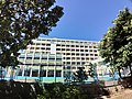
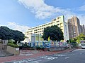
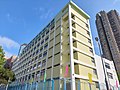
Category:Leung Kui Kau Lutheran Primary School
Jump to navigation
Jump to search
| Object location | | View all coordinates using: OpenStreetMap |
|---|
primary school in Hong Kong  | |||||
| Upload media | |||||
| Instance of | |||||
|---|---|---|---|---|---|
| Location | Sha Tin District, Hong Kong, PRC | ||||
| Street address |
| ||||
| official website | |||||
 | |||||
Media in category "Leung Kui Kau Lutheran Primary School"
The following 15 files are in this category, out of 15 total.
-
 2021年7月-路德會梁鉅鏐小學A.jpg 5,664 × 4,248; 5.5 MB
-
 2021年7月-路德會梁鉅鏐小學B.jpg 3,264 × 2,448; 3.47 MB
-
 2021年7月-路德會梁鉅鏐小學C.jpg 5,664 × 4,248; 7.19 MB
-
 2021年7月-路德會梁鉅鏐小學D.jpg 3,264 × 2,448; 3.01 MB
-
 2022年5月-梁鉅鏐小學A.jpg 9,248 × 6,936; 12.95 MB
-
 2022年5月-梁鉅鏐小學B.jpg 9,248 × 6,936; 13.64 MB
-
 Good Moring (38936410620).jpg 3,000 × 4,000; 1.25 MB
-

-

-

-

-

-

-

-
 Hong Kong Sports Institute.jpg 1,600 × 1,200; 694 KB


.jpg)


