Category:Levelling
Jump to navigation
Jump to search
English: Spirit leveling
Français : Nivellement
in topography, measurement of height difference between points | |||||
| Upload media | |||||
| Subclass of |
| ||||
|---|---|---|---|---|---|
| Different from | |||||
| |||||
Subcategories
This category has the following 8 subcategories, out of 8 total.
B
L
- Levelling rods (21 F)
P
- Peugeot 1007 IGN (3 F)
R
- Rotating lasers (24 F)
S
V
- Visierstollen Göschenen (5 F)
Media in category "Levelling"
The following 124 files are in this category, out of 124 total.
-
1930 за нивелиром.jpg 1,190 × 915; 121 KB
-
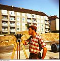
Bundesarchiv Bild 183-L0704-0007, Bauarbeiter am Nivelliergerät.jpg 800 × 611; 38 KB
-
Clarke levelling of England 1860.jpg 5,000 × 6,300; 4.07 MB
-
Danmarks Jernbanemuseum - Nivelleringsapparat.jpg 1,389 × 2,085; 1.52 MB
-
Dislivello positivo e negativo.jpg 774 × 404; 59 KB
-
EDM 예제1.png 814 × 689; 25 KB
-
Theodolite Fortepan 79607.jpg 6,514 × 4,772; 9.19 MB
-
Fotothek df n-06 0000179.jpg 790 × 787; 201 KB
-
Fotothek df n-06 0000458.jpg 800 × 816; 253 KB
-
Fotothek df n-06 0000459.jpg 800 × 816; 255 KB
-
Fotothek df n-22 0000184 Baufacharbeiter, Brauerei.jpg 798 × 820; 228 KB
-
Fotothek df n-22 0000185 Baufacharbeiter, Brauerei.jpg 800 × 816; 220 KB
-
Fotothek df n-22 0000186 Baufacharbeiter, Brauerei.jpg 800 × 817; 205 KB
-
Fotothek df n-22 0000589 Vermessungsfacharbeiter, Lagerhalle.jpg 798 × 820; 240 KB
-
Fotothek df n-22 0000591 Vermessungsfacharbeiter, Lagerhalle.jpg 798 × 820; 233 KB
-
Fotothek df n-22 0000592 Vermessungsfacharbeiter, Lagerhalle.jpg 800 × 818; 188 KB
-
French archaeologists at work 2015 Pompeii.jpg 4,361 × 2,701; 10.19 MB
-
Frosch Vermessung.jpg 4,288 × 2,848; 6.05 MB
-
G. Bruno - Le Tour de la France par deux enfants p203.jpg 848 × 720; 165 KB
-
Geodetic Survey in the U.S. Virgin Islands.jpg 1,290 × 860; 256 KB
-
Geodezisto en Ĉajanda minejo 01.jpg 4,608 × 2,592; 4.1 MB
-
Geodezisto en Ĉajanda minejo 02.jpg 2,592 × 4,608; 4.41 MB
-
Geodezisto en Ĉajanda minejo 03.jpg 2,592 × 4,608; 4.12 MB
-
Geodezisto en Ĉajanda minejo 04.jpg 4,608 × 2,592; 4.32 MB
-
Geodezisto en Ĉajanda minejo 05.jpg 4,608 × 2,592; 4.27 MB
-
Geodezisto en Ĉajanda minejo 06.jpg 2,592 × 4,608; 3.64 MB
-
Geodezisto en Ĉajanda minejo 07.jpg 4,608 × 2,592; 4.28 MB
-
Geodezisto en Ĉajanda minejo 08.jpg 2,592 × 4,608; 4.31 MB
-
Geodezisto en Ĉajanda minejo 09.jpg 2,592 × 4,608; 4.32 MB
-
Gregoriuskirken - Arkeologisk utgravning i Søndre gate (1974) (22625906554).jpg 1,925 × 1,933; 2.72 MB
-
Hedin making surveys in Kara-Koschun.jpg 4,640 × 2,843; 15.05 MB
-
Historischer Nivellements-Grenzpfeiler 6950 (Lageansicht).jpg 2,048 × 1,536; 1.26 MB
-
HK Sheung Wan Wing Lok Street Land Surveying.JPG 1,600 × 1,200; 1.14 MB
-
Hukseflux netradiation sectionview.png 360 × 191; 16 KB
-
Hydrostatisches Nivellement.jpg 880 × 598; 100 KB
-
Hydrostatisches Nivellement.PNG 809 × 535; 124 KB
-
HydScreed-300dpi.jpg 1,280 × 960; 97 KB
-
IGN personnels.jpg 768 × 550; 100 KB
-
Japanese Vertical Datum Open Day P5228658.jpg 2,560 × 1,920; 1.02 MB
-
Lasermètre pour voie ferrée.jpg 4,608 × 3,456; 2.88 MB
-
Levelling in the forest.jpg 4,536 × 3,024; 932 KB
-
Mira y nivel.JPG 297 × 380; 66 KB
-
Muro de Champas 1.JPG 496 × 347; 59 KB
-
Naters Observatorium Simplontunnel 1900.jpg 1,604 × 1,020; 1.16 MB
-
NHP 1879 Berlin Sternwarte Ansicht Gehaeuse Tafel X.jpg 4,349 × 5,263; 3.15 MB
-
NHP 1879 Berlin Sternwarte Grundriss Tafel VIII.jpg 2,933 × 2,754; 918 KB
-
NHP 1879 Berlin Sternwarte Kontrollbolzen Tafel VIII.jpg 4,795 × 3,167; 1.93 MB
-
NHP 1879 Berlin Sternwarte Nordseite Tafel VI.jpg 3,200 × 4,817; 2.13 MB
-
NHP 1879 Berlin Sternwarte Schnitt Scalastein Tafel VII.jpg 4,773 × 3,067; 1.43 MB
-
NHP 1879 Berlin Sternwarte Skalastein Tafel IX.jpg 4,070 × 5,854; 3.42 MB
-
NHP 1879 Berlin Sternwarte Vorderansicht offen Tafel VII.jpg 3,903 × 2,788; 1.58 MB
-
NHP-1879 Nivellement Schleife Berlin Tafel XII.jpg 4,226 × 5,654; 3.34 MB
-
NHP-1879 Nivellement Trigonometrische Abteilung Tafel XI.jpg 5,911 × 4,792; 3.59 MB
-
NivellementExample.jpg 880 × 689; 88 KB
-
NivellementExample.svg 1,000 × 850; 11 KB
-
Nivellieren stilisiert.svg 571 × 600; 8 KB
-
Niwelacja w przód.png 875 × 438; 29 KB
-
Niwelacja ze srodka.svg 560 × 300; 9 KB
-
Parc Mouscron (travaux) J11.jpg 6,000 × 4,000; 20.98 MB
-
PikiWiki Israel 13931 Measuring areas.JPG 454 × 600; 56 KB
-
Preĝejo de Anunciacio (Tjumeno) 01.jpg 1,536 × 2,048; 317 KB
-
Schematic trig leveling.png 720 × 272; 24 KB
-
Statens Kartverk Hønefoss (kartmuseet) - Presisjonsniveller, Carl Zeiss 1916.jpg 4,032 × 3,024; 2.54 MB
-
Statens Kartverk Hønefoss (kartmuseet) - Signalniveller, Carl Zeiss 1909.jpg 4,032 × 3,024; 2.64 MB
-
Sven Hedin Wikivoyage banner.jpg 4,640 × 663; 3.03 MB
-
Taccola levelling 2.jpg 1,553 × 1,565; 902 KB
-
Taccola levelling 3.jpg 1,771 × 1,725; 835 KB
-
Tanvir Khan doing levelling 2014-08-09 23-51.jpg 2,560 × 1,920; 2.75 MB
-
Trigonometrisches Nivellement.jpg 880 × 634; 83 KB
-
Trigonometrisches Nivellement.PNG 891 × 592; 112 KB
-
Unidad 06 imagen 002.jpg 454 × 175; 13 KB
-
Unidad 06 imagen 003.jpg 459 × 216; 19 KB
-
Unidad 06 imagen 004.jpg 443 × 188; 17 KB
-
Unidad 06 imagen 015.jpg 532 × 162; 19 KB
-
Unidad 5 Imagen 006.gif 651 × 308; 5 KB
-
Unidad 5 Imagen 007.gif 569 × 147; 2 KB
-
Ur-Nivellement (1894).jpg 2,984 × 2,342; 2.61 MB
-
Ur-Nivellement-1894-Band-8-Tafel-5.png 2,048 × 1,623; 7.37 MB
-
Ur-Nivellement-1896-1900-Gebietsabgrenzung-Hefte.png 4,453 × 3,542; 2.03 MB
-
Us land survey officer.jpg 500 × 328; 33 KB
-
Vermesser Jägerstraße Stuttgart September 2011.JPG 2,796 × 2,734; 1.48 MB
-
Vermessungsgerät Nivelliergerät usw.jpg 2,812 × 2,696; 1.87 MB
-
Waterpas modern.jpg 2,112 × 2,816; 482 KB
-
Żabka niwelacyjna.jpg 645 × 649; 160 KB
-
Полевая работа с нивелиром.jpg 3,399 × 5,098; 2.27 MB
-
Раскоп 2011 - panoramio (1).jpg 3,072 × 2,304; 2.8 MB
-
교호 수준측량.png 1,141 × 731; 39 KB
-
기포관 감도.png 705 × 685; 22 KB
-
수준측량 등 시준거리.png 999 × 612; 27 KB
-
수준측량 예시.jpg 532 × 162; 23 KB
-
수준측량 전시, 후시.jpg 3,589 × 1,393; 502 KB
-
수준측량 터널 표척 문제.jpg 2,289 × 1,633; 654 KB


