Category:Lewknor
Jump to navigation
Jump to search
village and civil parish in South Oxfordshire district, Oxfordshire, England  | |||||
| Upload media | |||||
| Instance of | |||||
|---|---|---|---|---|---|
| Location | South Oxfordshire, Oxfordshire, South East England, England | ||||
| Population |
| ||||
| Area |
| ||||
| official website | |||||
 | |||||
Subcategories
This category has the following 7 subcategories, out of 7 total.
1
- 1941 in Lewknor (17 F)
C
L
- The Leathern Bottle, Lewknor (2 F)
P
- Postcombe (8 F)
S
- St Margaret's Church, Lewknor (12 F)
- Stokenchurch Gap (10 F)
Media in category "Lewknor"
The following 200 files are in this category, out of 632 total.
(previous page) (next page)-
 "Gathering" on The Talking Trail - geograph.org.uk - 3674002.jpg 1,600 × 1,200; 743 KB
-
 "One Ear" on The Talking Trail - geograph.org.uk - 3674017.jpg 2,118 × 1,518; 1.02 MB
-
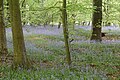
 A bluebell lined ride in Cowleaze Wood - geograph.org.uk - 6138298.jpg 2,025 × 2,700; 1.07 MB
-
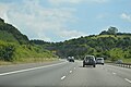
 A busy M40 heading north - geograph.org.uk - 2887637.jpg 640 × 480; 48 KB
-
 A field of cattle near Postcombe - geograph.org.uk - 5202658.jpg 6,000 × 4,000; 4.42 MB
-
 A fifth window - geograph.org.uk - 3662156.jpg 400 × 600; 63 KB
-
 A lay-by on the A40 east of Tetsworth - geograph.org.uk - 2234371.jpg 3,072 × 2,304; 3.51 MB
-
 A Sculpture on the Talking Trail - geograph.org.uk - 3682152.jpg 1,920 × 2,359; 1.46 MB
-
 A track in Cowleaze Wood - geograph.org.uk - 6138308.jpg 2,025 × 2,700; 1,014 KB
-
 A track in Cowleaze Wood - geograph.org.uk - 6138313.jpg 2,700 × 2,025; 952 KB
-
 A track in Cowleaze Wood - geograph.org.uk - 6138323.jpg 2,700 × 2,025; 811 KB
-
 A track in Cowleaze Wood - geograph.org.uk - 6138324.jpg 2,700 × 2,025; 700 KB
-
 A track in Cowleaze Wood - geograph.org.uk - 6138325.jpg 2,025 × 2,700; 724 KB
-
 A40 approaches junction with Chalford Road - geograph.org.uk - 2894101.jpg 3,497 × 2,609; 1.57 MB
-
 A40 approaching B4012 junction - geograph.org.uk - 3924370.jpg 640 × 442; 54 KB
-
 A40 approaching Postcombe - geograph.org.uk - 3924038.jpg 640 × 344; 38 KB
-
 A40 at Postcombe - geograph.org.uk - 3924374.jpg 640 × 413; 52 KB
-
 A40 heads west - geograph.org.uk - 3857351.jpg 640 × 480; 124 KB
-
 A40 near Aston Rowant - geograph.org.uk - 3861895.jpg 640 × 480; 116 KB
-
 A40 passes the Lambert Arms - geograph.org.uk - 2894351.jpg 3,648 × 2,736; 1.56 MB
-
 A40 southeast of Tetsworth - geograph.org.uk - 2894056.jpg 3,648 × 2,736; 1.87 MB
-
 A40 west of Postcombe - geograph.org.uk - 2894081.jpg 3,442 × 2,658; 1.17 MB
-
 Abba on the A40 - geograph.org.uk - 3320103.jpg 2,345 × 1,872; 1.37 MB
-
 Across the churchyard - geograph.org.uk - 3506506.jpg 1,024 × 683; 251 KB
-
 Adwell Farm, Postcombe - geograph.org.uk - 3320133.jpg 2,262 × 1,629; 1.74 MB
-
 Alcove by the altar - geograph.org.uk - 5820458.jpg 1,024 × 683; 76 KB
-
 Allotments off the road - geograph.org.uk - 3506630.jpg 1,024 × 683; 266 KB
-
 Along Church lane - geograph.org.uk - 3506607.jpg 533 × 800; 134 KB
-
 Along the nave - geograph.org.uk - 3506368.jpg 533 × 800; 58 KB
-
 Along the south side - geograph.org.uk - 5821564.jpg 1,024 × 683; 230 KB
-
 Altar and back wall - geograph.org.uk - 3506367.jpg 1,024 × 683; 119 KB
-
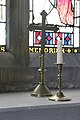
 Altar and Chancel Window - geograph.org.uk - 3660611.jpg 900 × 600; 79 KB
-
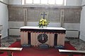
 Altar and Flowers - geograph.org.uk - 3506365.jpg 1,024 × 683; 122 KB
-
 Altar in St Laurence - geograph.org.uk - 5820233.jpg 533 × 800; 78 KB
-
 Altar in St Margaret - geograph.org.uk - 3690548.jpg 900 × 600; 86 KB
-
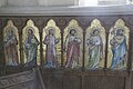
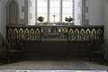 Altar screen - geograph.org.uk - 5820455.jpg 1,024 × 683; 98 KB
-
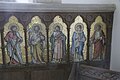
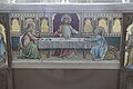 Altar screen centre - geograph.org.uk - 5821291.jpg 1,024 × 683; 149 KB
-
 Altar screen left side - geograph.org.uk - 5821292.jpg 1,024 × 683; 158 KB
-
 Altar screen right side - geograph.org.uk - 5821290.jpg 1,024 × 683; 150 KB
-
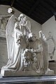 Angels on the Tomb - geograph.org.uk - 3659181.jpg 400 × 600; 52 KB
-
 Another endstop - geograph.org.uk - 3690840.jpg 400 × 600; 36 KB
-

-
 Around to the north - geograph.org.uk - 5821366.jpg 1,024 × 683; 188 KB
-
 Ascending the M40 - geograph.org.uk - 5653844.jpg 640 × 426; 50 KB
-
 Ascending the M40 - geograph.org.uk - 5653846.jpg 640 × 380; 44 KB
-
 Ascending the M40 - geograph.org.uk - 5653849.jpg 640 × 404; 47 KB
-
 Aston Hill, Aston Rowant - geograph.org.uk - 5504322.jpg 2,048 × 1,536; 883 KB
-
 Aston Hill, Aston Rowant - geograph.org.uk - 5504323.jpg 2,048 × 1,536; 928 KB
-
 Aston Rowant National Nature Reserve - geograph.org.uk - 512722.jpg 640 × 480; 274 KB
-
 Aston Rowant Nature Reserve - geograph.org.uk - 1034201.jpg 640 × 480; 153 KB
-
 Aston Rowant Nature Reserve - geograph.org.uk - 1034210.jpg 640 × 480; 147 KB
-
 Aston Rowant Nature Reserve - geograph.org.uk - 1034216.jpg 640 × 480; 153 KB
-
 Aston Rowant Nature Reserve - geograph.org.uk - 6265480.jpg 2,700 × 2,025; 529 KB
-
 Aston Rowant Nature Reserve - geograph.org.uk - 6265483.jpg 2,700 × 2,025; 744 KB
-
 Aston Rowant Nature Reserve - geograph.org.uk - 744853.jpg 640 × 480; 107 KB
-
 Aston Rowant Nature Reserve - geograph.org.uk - 744890.jpg 640 × 480; 101 KB
-
 Aston Rowant Nature Reserve - geograph.org.uk - 745015.jpg 640 × 480; 117 KB
-
 Attington Toll House - geograph.org.uk - 5200624.jpg 1,024 × 769; 145 KB
-
 B4009 approaching Lewknor - geograph.org.uk - 3924018.jpg 640 × 395; 34 KB
-
 B4009 junction with Watlington Road - geograph.org.uk - 2893522.jpg 3,648 × 2,736; 1.81 MB
-
 B4009 leaving M40 junction 6 - geograph.org.uk - 3924024.jpg 640 × 416; 44 KB
-
 B4009 north of Field Farm House - geograph.org.uk - 2893552.jpg 3,482 × 2,584; 1.21 MB
-
 B4009 passes under M40 - geograph.org.uk - 2894355.jpg 3,648 × 2,736; 1.73 MB
-
 Bald Hill - geograph.org.uk - 1435612.jpg 640 × 425; 169 KB
-
 Bald Hill - geograph.org.uk - 1435623.jpg 640 × 426; 170 KB
-
 Bald Hill - geograph.org.uk - 3288116.jpg 1,280 × 913; 1.24 MB
-
 Bald Hill from Cowleaze Wood - geograph.org.uk - 1284779.jpg 640 × 427; 91 KB
-
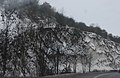
 Beacon Hill cutting - geograph.org.uk - 2451829.jpg 640 × 303; 41 KB
-
 Beacon Hill from M40 southbound - geograph.org.uk - 2213237.jpg 640 × 360; 252 KB
-
 Beacon Hill, Aston Rowant National Nature Reserve - geograph.org.uk - 3151789.jpg 2,048 × 1,536; 672 KB
-
 Beacon Hill, Aston Rowant nature reserve - geograph.org.uk - 3154419.jpg 2,007 × 1,326; 1.24 MB
-
 Beacon Hill, Lewknor - geograph.org.uk - 2333226.jpg 640 × 427; 130 KB
-
 Beacon Hill, Lewknor - geograph.org.uk - 2523038.jpg 1,600 × 1,200; 538 KB
-
 Behind the tomb - geograph.org.uk - 3657926.jpg 400 × 600; 47 KB
-
 Bell on St Laurence - geograph.org.uk - 5821549.jpg 533 × 800; 58 KB
-
 Bench - "Courtesy of HMP Springhill" - geograph.org.uk - 512860.jpg 640 × 480; 377 KB
-
 Between the inscriptions - geograph.org.uk - 3683735.jpg 2,048 × 1,536; 912 KB
-
 Bishop of Hong Kong - geograph.org.uk - 3662122.jpg 900 × 600; 52 KB
-
 Blue Angels - geograph.org.uk - 3662112.jpg 400 × 600; 57 KB
-
 Bluebells in Aston Wood - geograph.org.uk - 5772720.jpg 6,000 × 4,000; 5.37 MB
-
 Bluebells in Aston Wood - geograph.org.uk - 5772731.jpg 6,000 × 4,000; 5.65 MB
-
 Bluebells in beech woods at Aston Rowant Nature Reserve - geograph.org.uk - 1839997.jpg 3,008 × 2,000; 1.6 MB
-
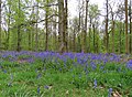
 Bluebells in Cowleaze Wood - geograph.org.uk - 6138301.jpg 2,700 × 2,009; 931 KB
-
 Bluebells in Cowleaze Wood - geograph.org.uk - 6138302.jpg 2,700 × 2,027; 714 KB
-
 Bluebells in Cowleaze Wood - geograph.org.uk - 6138303.jpg 2,700 × 1,979; 872 KB
-
 Bluebells in Cowleaze Wood - geograph.org.uk - 6138304.jpg 2,700 × 2,025; 828 KB
-
 Bluebells in Cowleaze Wood - geograph.org.uk - 6138305.jpg 2,025 × 2,700; 1.04 MB
-
 Box ^ Board, South Weston - geograph.org.uk - 3435377.jpg 2,560 × 1,920; 1.59 MB
-
 Bridge by Hailey Wood - geograph.org.uk - 2655958.jpg 2,560 × 1,920; 1.69 MB
-
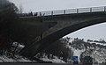
 Bridge carrying the M40 over Salt Lane. - geograph.org.uk - 2234376.jpg 3,072 × 2,304; 4.12 MB
-
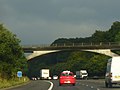
 Bridge over the M40 - geograph.org.uk - 2451797.jpg 640 × 394; 42 KB
-
 Bridge over the M40 - geograph.org.uk - 2690363.jpg 640 × 430; 51 KB
-
 Bridge over the M40 - geograph.org.uk - 2887623.jpg 640 × 480; 61 KB
-
 Bridge over the M40, Stokenchurch Gap - geograph.org.uk - 4462515.jpg 640 × 480; 263 KB
-
 Bridge west of M40 junction 5 - geograph.org.uk - 2213255.jpg 640 × 360; 199 KB
-
 Bridleway through Wormsley Estate - geograph.org.uk - 2152718.jpg 427 × 640; 256 KB
-
 Bridleway through Wormsley Estate - geograph.org.uk - 2152727.jpg 640 × 427; 213 KB
-
 Bridleway through Wormsley Estate - geograph.org.uk - 2152734.jpg 640 × 426; 209 KB
-
 Bright morning light on a ploughed field - geograph.org.uk - 5202677.jpg 6,000 × 4,000; 3.63 MB
-
-

-
 Bust in the Memorial - geograph.org.uk - 3660894.jpg 400 × 600; 52 KB
-
 Bust on a memorial - geograph.org.uk - 3690554.jpg 400 × 600; 46 KB
-
 Candle holders - geograph.org.uk - 5821365.jpg 1,024 × 683; 54 KB
-
 Candle ^ cross - geograph.org.uk - 5821344.jpg 533 × 800; 82 KB
-
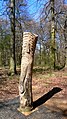 Carving on the Talking Trail - geograph.org.uk - 3835056.jpg 2,232 × 3,968; 2.12 MB
-
 Carving over the porch - geograph.org.uk - 3506519.jpg 533 × 800; 106 KB
-
 Chair ^ pulpit - geograph.org.uk - 5821352.jpg 533 × 800; 83 KB
-
 Chalford Road, Postcombe - geograph.org.uk - 2522136.jpg 1,600 × 1,200; 538 KB
-
 Chalk cutting by the M40 - geograph.org.uk - 2451810.jpg 640 × 416; 80 KB
-
 Chalk downland grasses and flowers - geograph.org.uk - 512534.jpg 640 × 480; 145 KB
-
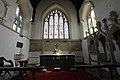
 Chancel Arch and Nave - geograph.org.uk - 3660867.jpg 900 × 600; 83 KB
-
 Chancel in St Laurence South Weston - geograph.org.uk - 5820229.jpg 533 × 800; 59 KB
-
-
 Chapel in St Margaret - geograph.org.uk - 3657590.jpg 900 × 600; 74 KB
-
 Chiltern Edge Scenery - geograph.org.uk - 6483443.jpg 5,472 × 3,648; 3.53 MB
-
 Chiltern Scarp ^ M40 Cutting - geograph.org.uk - 3320012.jpg 2,560 × 1,737; 1.47 MB
-
 Chinnor Road - geograph.org.uk - 5203478.jpg 6,000 × 4,000; 7.66 MB
-
 Chinnor Road heading towards the M40 and Lewknor - geograph.org.uk - 5203504.jpg 6,000 × 4,000; 7.78 MB
-
 Church Lane - geograph.org.uk - 3506600.jpg 1,024 × 683; 262 KB
-
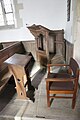
 Church Organ - geograph.org.uk - 3690442.jpg 400 × 600; 49 KB
-
 Churchyard by the hedge - geograph.org.uk - 5821558.jpg 1,024 × 683; 210 KB
-
 Clearing in Cowleaze Wood - geograph.org.uk - 3526769.jpg 1,024 × 768; 329 KB
-
 Climbing The Chilterns, M40 - geograph.org.uk - 2690338.jpg 640 × 430; 62 KB
-
 Close up of the headstone - geograph.org.uk - 3496463.jpg 1,024 × 683; 225 KB
-
 Clover and hawkbits - geograph.org.uk - 512731.jpg 640 × 480; 375 KB
-
 Coat of arms on top - geograph.org.uk - 3657930.jpg 900 × 600; 73 KB
-
 Cowleaze Wood, Lewknor - geograph.org.uk - 1034165.jpg 640 × 480; 211 KB
-
 Crossroads by the pub - geograph.org.uk - 3506616.jpg 1,024 × 683; 147 KB
-
 Cuckoo Pen - geograph.org.uk - 815436.jpg 640 × 480; 62 KB
-
 Cutting by the M40 - geograph.org.uk - 2451800.jpg 640 × 361; 54 KB
-
 Cutting Edge - geograph.org.uk - 2655950.jpg 2,560 × 1,920; 2.37 MB
-
 Cutting Up on the M40 - geograph.org.uk - 2655936.jpg 2,560 × 1,920; 1.64 MB
-
 Damaged carving - geograph.org.uk - 3683730.jpg 900 × 600; 80 KB
-
 Detail at the feet - geograph.org.uk - 3683729.jpg 900 × 600; 73 KB
-
 Detail of the Angels - geograph.org.uk - 3659178.jpg 900 × 600; 69 KB
-
 Detail of the Effigies - geograph.org.uk - 3662275.jpg 900 × 600; 72 KB
-
 Detail of the Effigy - geograph.org.uk - 3659186.jpg 900 × 600; 74 KB
-
 Detail of the second set - geograph.org.uk - 3683727.jpg 400 × 600; 46 KB
-
 Dogleg junction on the A40, Aston Rowant - geograph.org.uk - 4862921.jpg 2,048 × 1,536; 1.49 MB
-
 Dogleg junction on the A40, Aston Rowant - geograph.org.uk - 5504321.jpg 1,990 × 1,454; 953 KB
-
 Door in the tower - geograph.org.uk - 3496468.jpg 1,024 × 683; 213 KB
-
 Door to the vestry - geograph.org.uk - 5821289.jpg 533 × 800; 54 KB
-
 Eagle Lectern - geograph.org.uk - 3690450.jpg 400 × 600; 44 KB
-
 Effigies in the chancel - geograph.org.uk - 3662274.jpg 900 × 600; 65 KB
-
 Effigy by the tomb - geograph.org.uk - 3657934.jpg 900 × 600; 74 KB
-
 Effigy Detail - geograph.org.uk - 3659329.jpg 400 × 600; 43 KB
-
 End stop detail - geograph.org.uk - 3690558.jpg 900 × 600; 48 KB
-
 England's Rose - geograph.org.uk - 5203459.jpg 6,000 × 4,000; 7.44 MB
-
 England's Rose, Postcombe - geograph.org.uk - 3857334.jpg 640 × 428; 88 KB
-
 Entering the Wormsley Estate - geograph.org.uk - 2152708.jpg 640 × 427; 252 KB
-
 Entrance past the school - geograph.org.uk - 3496195.jpg 1,024 × 683; 199 KB
-
 Entrance, Parkwood Stud - geograph.org.uk - 3857318.jpg 640 × 480; 110 KB
-
 Evening Light on The Knapp - geograph.org.uk - 3333602.jpg 1,600 × 1,200; 569 KB
-
 Farmland near Postcombe - geograph.org.uk - 3321386.jpg 2,391 × 1,821; 1.41 MB
-
 Farmland, Lewknor - geograph.org.uk - 2818768.jpg 640 × 480; 129 KB
-
 Farmland, Lewknor - geograph.org.uk - 2818796.jpg 640 × 480; 127 KB
-
 Farmland, Lewknor - geograph.org.uk - 2819631.jpg 640 × 480; 161 KB
-
 Farmland, Lewknor - geograph.org.uk - 2819636.jpg 640 × 480; 150 KB
-
 Farmland, Lewknor - geograph.org.uk - 4200291.jpg 640 × 425; 216 KB
-
 Farmland, Postcombe, Lewknor - geograph.org.uk - 2813687.jpg 640 × 480; 183 KB
-
 Farmland, Postcombe, Lewknor - geograph.org.uk - 2819546.jpg 640 × 480; 157 KB
-
 Farmland, Postcombe, Lewknor - geograph.org.uk - 2819643.jpg 640 × 480; 135 KB
-
 Farmland, track and trees, Lewknor - geograph.org.uk - 2333093.jpg 640 × 480; 146 KB
-
 Field below Beacon Hill - geograph.org.uk - 5203495.jpg 6,000 × 4,000; 7.28 MB
-
 Field Farm, Lewknor - geograph.org.uk - 1849213.jpg 1,024 × 683; 183 KB
-
 Field near Aston Rowant - geograph.org.uk - 5203500.jpg 6,000 × 4,000; 3.83 MB
-
 Field near Aston Rowant - geograph.org.uk - 5772658.jpg 6,000 × 4,000; 5.39 MB
-
 Field of Rape - geograph.org.uk - 815418.jpg 640 × 480; 97 KB
-
 First Effigy - geograph.org.uk - 3683779.jpg 900 × 600; 69 KB
-
 Floral display - geograph.org.uk - 5821293.jpg 1,024 × 683; 119 KB
-
 Flowers by the cross - geograph.org.uk - 5821296.jpg 1,024 × 683; 137 KB
-
 Flowers on the Altar - geograph.org.uk - 3690459.jpg 400 × 600; 62 KB
-
 Flush Bracket on St Margaret - geograph.org.uk - 3496470.jpg 533 × 800; 117 KB
-
 Footpath below Beacon Hill - geograph.org.uk - 5772668.jpg 6,000 × 4,000; 6.33 MB
-
 Footpath in Aston Rowant National Nature Reserve - geograph.org.uk - 2355748.jpg 3,648 × 2,736; 3.1 MB
-
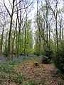
 Footpath in Cowleaze Wood - geograph.org.uk - 6138315.jpg 2,025 × 2,700; 752 KB
-
 Footpath in Cowleaze Wood - geograph.org.uk - 6138316.jpg 2,025 × 2,700; 884 KB
-
 Footpath in Cowleaze Wood - geograph.org.uk - 6138318.jpg 2,025 × 2,700; 1.08 MB
-
 Footpath on Beacon Hill - geograph.org.uk - 1502155.jpg 427 × 640; 88 KB
-

-
 Footpath to Beacon Hill - geograph.org.uk - 1502148.jpg 640 × 416; 107 KB
-

-
 Former pub on the High Street - geograph.org.uk - 3496193.jpg 1,024 × 683; 159 KB
-
 Four headstones - geograph.org.uk - 5821550.jpg 1,024 × 683; 164 KB
-
 Fretwork in the chancel - geograph.org.uk - 3660603.jpg 900 × 600; 77 KB
-
 From Bald Hill - geograph.org.uk - 1435615.jpg 640 × 425; 198 KB
-
 From the back - geograph.org.uk - 5820243.jpg 1,024 × 683; 103 KB
-
 Fun Park for Horses - geograph.org.uk - 4377028.jpg 4,000 × 3,000; 1.56 MB
-
 Garage and junction at Postcombe - geograph.org.uk - 3924036.jpg 640 × 448; 68 KB
-
 Gate and footpath to Beacon Hill - geograph.org.uk - 1502142.jpg 640 × 427; 90 KB
-
 Gate at St Laurence South Weston - geograph.org.uk - 5821583.jpg 1,024 × 683; 268 KB
-
 Gate on the path - geograph.org.uk - 6265481.jpg 2,700 × 2,025; 854 KB
-
 Gates in the Chapel - geograph.org.uk - 3659337.jpg 400 × 600; 55 KB
-
 Gorytes laticinctus female, probably - Flickr - gailhampshire.jpg 2,065 × 1,976; 484 KB
-
 Headstones in the grass - geograph.org.uk - 3496459.jpg 1,024 × 683; 287 KB
-
 Heaters in the church - geograph.org.uk - 5820242.jpg 533 × 800; 76 KB
-
 Hidden Effigy - geograph.org.uk - 3662159.jpg 900 × 600; 54 KB
-
 High Street in Lewknor - geograph.org.uk - 3506612.jpg 1,024 × 683; 233 KB
-
 High Street, Lewknor - geograph.org.uk - 3896658.jpg 4,320 × 3,240; 4.41 MB


