Category:Lindengracht 45, Amsterdam
Jump to navigation
Jump to search
| Object location | | View all coordinates using: OpenStreetMap |
|---|
 | |||||
| Upload media | |||||
| Instance of |
| ||||
|---|---|---|---|---|---|
| Location | Amsterdam, North Holland, Netherlands | ||||
| Street address |
| ||||
| Located on street | |||||
| Heritage designation |
| ||||
 | |||||
|
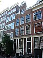
This is a category about rijksmonument number 3542
|
| Address |
|
Media in category "Lindengracht 45, Amsterdam"
The following 6 files are in this category, out of 6 total.
-
 Amsterdam Lindengracht 45.JPG 2,448 × 3,264; 2.15 MB
-
 RM3542 RM3543 Amsterdam - Lindengracht 45 en 47.jpg 1,944 × 2,592; 1.79 MB
-
 Voorgevels - Amsterdam - 20019190 - RCE.jpg 1,179 × 1,200; 374 KB
-
 Voorgevels - Amsterdam - 20019192 - RCE.jpg 1,176 × 1,200; 343 KB
-
 Voorgevels - Amsterdam - 20019193 - RCE.jpg 1,191 × 1,200; 307 KB
-
 Voorgevels - Amsterdam - 20019194 - RCE.jpg 1,177 × 1,200; 342 KB


