Category:Lindetwald
Jump to navigation
Jump to search
Lindetwald ("Lindet Forest") is a wooded area in the municipalities of St. Florian am Inn, St. Marienkirchen bei Schärding and Suben, Bezirk Schärding, Austria
Subcategories
This category has the following 2 subcategories, out of 2 total.
B
- Bachtl z'Lindet-Marterl (3 F)
H
Media in category "Lindetwald"
The following 14 files are in this category, out of 14 total.
-
 Aerial image of the Schärding-Suben airfield.jpg 4,500 × 3,000; 5.15 MB
-
 Gedenkstein Wageneder im Lindetwald 01.jpg 3,208 × 3,952; 3.15 MB
-
 Gedenkstein Wageneder im Lindetwald 02.jpg 2,512 × 2,560; 1.66 MB
-
 Karte der Pfarre St. Marienkirchen im Decanate Scheerding 1845.png 654 × 517; 925 KB
-
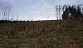
 Lindetwald - Anhöhe der Hügelgräber (2024-03-12) 01.jpg 3,584 × 2,032; 2.78 MB
-
 Lindetwald - Anhöhe der Hügelgräber (2024-03-12) 02.jpg 3,607 × 2,096; 2.67 MB
-
 Lindetwald - Anhöhe der Hügelgräber (2024-03-12) 03.jpg 3,595 × 2,104; 2.82 MB
-
 Lindetwald - Anhöhe der Hügelgräber (2024-03-12) 04.jpg 3,648 × 2,160; 4.72 MB
-
 Lindetwald - Anhöhe der Hügelgräber (2024-03-12) 05.jpg 3,557 × 2,072; 2.81 MB
-
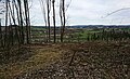
 Lindetwald - Blick von den Hügelgräbern nach Nordosten (2020).jpg 4,128 × 2,322; 6.6 MB
-
 Lindetwald - Blick von den Hügelgräbern nach Nordosten (2024).jpg 3,544 × 2,160; 6.4 MB
-
 Lindetwald - Blick von den Hügelgräbern nach Südwesten (2020).jpg 3,762 × 2,160; 4.01 MB
-
 Lindetwald 20190401 164333.jpg 2,276 × 1,216; 636 KB
-
 Lindetwald DSC00856.jpg 2,092 × 1,512; 976 KB


_01.jpg)
_02.jpg)
_03.jpg)
_04.jpg)
_05.jpg)
.jpg)
.jpg)
.jpg)

