Category:Linked-Open-Ogham-Data
Jump to navigation
Jump to search
Media in category "Linked-Open-Ogham-Data"
The following 25 files are in this category, out of 25 total.
-
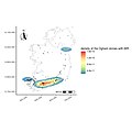 Density BIR.jpg 2,100 × 2,100; 151 KB
-
 Density CATTU.jpg 2,100 × 2,100; 150 KB
-
 Density LUG.jpg 2,100 × 2,100; 161 KB
-
 Density MAQI.jpg 2,100 × 2,100; 151 KB
-
 Density MUCOI.jpg 2,100 × 2,100; 155 KB
-
 GeoPubby CIIC 81.png 1,600 × 544; 503 KB
-
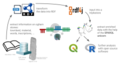
 Hybrid LOD Ogham Workflow.png 5,000 × 3,091; 1.56 MB
-
 Ogham Densitymap German.jpg 2,362 × 2,125; 184 KB
-
 Ogham map.png 1,155 × 1,279; 571 KB
-
 Ogham Ontology v1.png 3,150 × 3,150; 919 KB
-
 Ogham RDF Workflow.png 4,600 × 2,500; 1 MB
-
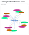 Ogham Reference Minion.png 296 × 350; 51 KB
-
 Ogham Reference Network Detail.png 1,550 × 1,000; 163 KB
-
 Ogham Reference Network.png 1,075 × 1,075; 216 KB
-
 Ogham Site Minion.png 672 × 358; 557 KB
-
 Ogham Wikidata Workflow.png 4,600 × 2,500; 1.26 MB
-
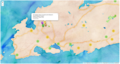
 Ogham.Inscriptions.Cornwall.jpg 1,762 × 1,381; 223 KB
-
 Ogham.Inscriptions.Wales.jpg 1,873 × 2,029; 364 KB
-
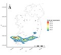
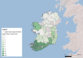
 OghamFindspotsIreland.png 3,508 × 2,479; 6.84 MB
-
 SemanticWFS FC of OS.png 1,633 × 921; 1.1 MB
-
 SPARQLing Unicorn QGIS Plugin Ogham.png 1,920 × 1,038; 862 KB
-
 Squirrel Sites Barony Aggregation.png 3,507 × 2,480; 5.55 MB
-
 Squirrel Sites County Aggregation.png 3,507 × 2,480; 5.32 MB
-
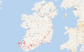
 Squirrel Sites.png 3,507 × 2,480; 5.34 MB
-
 Wikidata Ogham Sites v1.png 1,917 × 1,199; 1.32 MB


