Category:Linton, Kent
Jump to navigation
Jump to search
English: Linton is a village and civil parish in the Maidstone District of Kent, England. The parish is located on the southward slope of the Greensand ridge, south of Maidstone on the A229 Hastings road.
village and civil parish in the Maidstone District of Kent, England, UK  Linton Church Hall | |||||
| Upload media | |||||
| Instance of | |||||
|---|---|---|---|---|---|
| Location | Maidstone, Kent, South East England, England | ||||
| Population |
| ||||
 | |||||
Subcategories
This category has the following 5 subcategories, out of 5 total.
Media in category "Linton, Kent"
The following 180 files are in this category, out of 180 total.
-
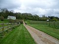 A path to Linton - geograph.org.uk - 3925978.jpg 4,000 × 3,000; 3.92 MB
-
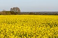 A sea of yellow rapeseed flowers.jpg 1,920 × 1,280; 764 KB
-
 A229 - B2163 crossroads - geograph.org.uk - 3030755.jpg 640 × 428; 106 KB
-
 A229 at Stile Bridge - geograph.org.uk - 3202753.jpg 640 × 430; 69 KB
-
 Allotments off Wheeler's Lane, Linton - geograph.org.uk - 3630176.jpg 3,104 × 2,328; 2.68 MB
-
 Almshouses, Linton - geograph.org.uk - 1157674.jpg 640 × 430; 85 KB
-
 Alpacas with a view - geograph.org.uk - 3920757.jpg 4,000 × 3,000; 4.19 MB
-
 Apple orchard and oast house, Loddington Farm - geograph.org.uk - 6016769.jpg 4,592 × 3,056; 7.78 MB
-
 Apple orchard, Loddington Farm - geograph.org.uk - 6016765.jpg 4,276 × 3,054; 5.8 MB
-
 Apple orchards near Linton - geograph.org.uk - 3925952.jpg 4,000 × 3,000; 3.87 MB
-
 Barn at Burford Farm - geograph.org.uk - 4630378.jpg 1,024 × 768; 162 KB
-
 Barn off Loddington Lane, Linton - geograph.org.uk - 3345482.jpg 4,608 × 3,456; 3.42 MB
-
 Barnes Lane - geograph.org.uk - 3920746.jpg 4,000 × 3,000; 4.17 MB
-
 Barnes Lane, Linton - geograph.org.uk - 4899468.jpg 3,264 × 2,448; 3.04 MB
-
 Blackthorn flowers by Greensand Way - geograph.org.uk - 2865194.jpg 640 × 480; 59 KB
-
 Bus shelter on Linton Hill - geograph.org.uk - 3920744.jpg 4,000 × 3,000; 4.13 MB
-
 Butt Green Lane - geograph.org.uk - 1158922.jpg 640 × 480; 113 KB
-
 Butt Green Lane - geograph.org.uk - 4630355.jpg 1,024 × 768; 263 KB
-
 Butt Green Lane, Linton (1) - geograph.org.uk - 3345486.jpg 4,608 × 3,456; 3.49 MB
-
 Butt Green Lane, Linton (2) - geograph.org.uk - 3345487.jpg 4,608 × 3,456; 3.43 MB
-
 Butt Green Lane, near Linton - geograph.org.uk - 4899493.jpg 3,264 × 2,448; 2.86 MB
-
 Butt Green Lane, near Linton - geograph.org.uk - 4899497.jpg 3,264 × 2,448; 2.61 MB
-
 Butt Green Lane, near Linton - geograph.org.uk - 4899503.jpg 3,264 × 2,448; 2.55 MB
-
 Butt Green Lane, near Linton - geograph.org.uk - 4899515.jpg 3,264 × 2,448; 3.17 MB
-
 Cattle in Linton Park - geograph.org.uk - 5078089.jpg 640 × 480; 89 KB
-
 Cleared crop field by Butt Green Lane - geograph.org.uk - 4630356.jpg 1,024 × 768; 223 KB
-
 Cornwallis Avenue, Linton - geograph.org.uk - 4899445.jpg 3,264 × 2,448; 3.28 MB
-
 Corwallis Academy.jpg 4,608 × 3,456; 3.56 MB
-
 Cottage on Heath Rd - geograph.org.uk - 2841514.jpg 640 × 430; 51 KB
-
 Covered Reservoir, Loddington Lane, Boughton Monchelsea - geograph.org.uk - 3344734.jpg 4,608 × 3,456; 3.44 MB
-
 Dame Briggatt (Bridget) Mayne, memorial, Linton church - geograph.org.uk - 2974261.jpg 1,496 × 2,256; 764 KB
-
 Drainage ditch by Redwall Lane - geograph.org.uk - 2865103.jpg 640 × 427; 83 KB
-
 Electricity lines and Young Trees, Loddington Farm - geograph.org.uk - 3344727.jpg 3,456 × 4,608; 3.31 MB
-
 Entering Boughton Monchelsea - geograph.org.uk - 3030781.jpg 640 × 480; 107 KB
-
 Entrance to Linton Park Estate (1) - geograph.org.uk - 3387068.jpg 4,608 × 3,456; 3.4 MB
-
 Entrance to Linton Park Estate (2) - geograph.org.uk - 3387069.jpg 4,608 × 3,456; 3.37 MB
-
 Entrance to Loddington Farm, Loddington Lane - geograph.org.uk - 3344742.jpg 4,608 × 3,456; 3.44 MB
-
 Estate houses at Linton - geograph.org.uk - 3924520.jpg 4,000 × 3,000; 4.09 MB
-
 Estate-built houses, Linton - geograph.org.uk - 5005620.jpg 640 × 480; 161 KB
-
 Exclusive Brethren Meeting Room, Heath Road, Linton - geograph.org.uk - 3344795.jpg 4,608 × 3,456; 3.61 MB
-
 Field off Barnes Lane, Linton - geograph.org.uk - 3630179.jpg 3,104 × 2,328; 2.54 MB
-
 Field off Butt Green Lane - geograph.org.uk - 3345488.jpg 4,608 × 3,456; 3.41 MB
-

-
 Fishing lake at Linton Park - geograph.org.uk - 5078072.jpg 640 × 480; 123 KB
-
 Fishing on the lake at Linton Park - geograph.org.uk - 5078080.jpg 471 × 640; 106 KB
-
 Footbridge over Vanity Lane - geograph.org.uk - 145970.jpg 427 × 640; 106 KB
-
 Footpath access off Loddington Lane - geograph.org.uk - 3345483.jpg 4,608 × 3,456; 3.42 MB
-
 Footpath and Orchard off Vanity Lane - geograph.org.uk - 3630174.jpg 3,104 × 2,328; 2.04 MB
-
 Footpath Entrance off Bon Fleur Lane - geograph.org.uk - 3630180.jpg 3,104 × 2,328; 2.32 MB
-
 Forge Cottage, Linton - geograph.org.uk - 1157677.jpg 640 × 430; 56 KB
-
 Greensand Ridge - geograph.org.uk - 44159.jpg 640 × 425; 77 KB
-

-
 Greensand Way crosses Loddington Lane - geograph.org.uk - 1196112.jpg 640 × 481; 135 KB
-
 Greensand way, Loddington Lane - geograph.org.uk - 1157655.jpg 640 × 430; 151 KB
-
 Half-timbered house along Vanity Lane - geograph.org.uk - 3925960.jpg 4,000 × 3,000; 4.13 MB
-
 Heath House - geograph.org.uk - 2841931.jpg 640 × 430; 52 KB
-
 Heath Road, near Boughton Monchelsea - geograph.org.uk - 3627202.jpg 3,488 × 2,616; 2.18 MB
-

-
 Home Farm in the trees - geograph.org.uk - 1157658.jpg 640 × 430; 121 KB
-
 Hubbards Lane Substation, Heath Road, Linton (1) - geograph.org.uk - 3344840.jpg 4,608 × 3,456; 3.64 MB
-
 Hubbards Lane Substation, Heath Road, Linton (2) - geograph.org.uk - 3344855.jpg 4,608 × 3,456; 3.55 MB
-
 Interior, St Nicholas' church, Linton - geograph.org.uk - 2974304.jpg 2,256 × 1,496; 772 KB
-
 Irrigation lagoon, Loddington Farm - geograph.org.uk - 6016772.jpg 4,592 × 3,056; 4.91 MB
-
 Irrigation lagoon, Loddington Farm - geograph.org.uk - 6016784.jpg 4,592 × 3,056; 4.88 MB
-

-
 Keepers Cottage - geograph.org.uk - 1157656.jpg 640 × 430; 85 KB
-

-
 Linton Church Hall - geograph.org.uk - 1157671.jpg 640 × 430; 67 KB
-
 Linton Hill - geograph.org.uk - 5820882.jpg 5,184 × 3,456; 7.15 MB
-
 Linton Hill, Linton - geograph.org.uk - 4899431.jpg 3,264 × 2,448; 1.84 MB
-
 Linton Hill, Linton - geograph.org.uk - 4899436.jpg 3,264 × 2,448; 2.4 MB
-
 Linton Hill, Linton - geograph.org.uk - 4899473.jpg 3,264 × 2,448; 2.26 MB
-
 Linton Hill, Linton - geograph.org.uk - 5078111.jpg 640 × 482; 104 KB
-
 Linton Park from the Greensand Way - geograph.org.uk - 3924180.jpg 4,000 × 3,000; 3.89 MB
-
 Linton Park School, Heath Road, Linton - geograph.org.uk - 3344805.jpg 4,608 × 3,456; 3.55 MB
-
 Linton Park seen across its park - geograph.org.uk - 3924260.jpg 4,000 × 3,000; 4.22 MB
-
 Linton Park, Linton - geograph.org.uk - 5077984.jpg 640 × 480; 103 KB
-
 Linton Park, Linton - geograph.org.uk - 5078063.jpg 640 × 426; 69 KB
-
 Linton Road, Loose - geograph.org.uk - 1968042.jpg 2,048 × 1,536; 1.25 MB
-
 Linton sign - geograph.org.uk - 5820887.jpg 3,456 × 5,184; 1.87 MB
-
 Linton Village - geograph.org.uk - 1157683.jpg 640 × 430; 55 KB
-
 Linton village and St Nicholas Church - geograph.org.uk - 145972.jpg 640 × 427; 67 KB
-
 Linton Village Hall - geograph.org.uk - 5820888.jpg 4,095 × 3,072; 2.31 MB
-
 Linton Village Sign - geograph.org.uk - 1942380.jpg 768 × 1,024; 174 KB
-

-
 Loddington House - geograph.org.uk - 1196117.jpg 481 × 640; 54 KB
-
 Loddington Lane - geograph.org.uk - 1157652.jpg 640 × 430; 103 KB
-
 Loddington Lane from the Greensand Way - geograph.org.uk - 3920857.jpg 4,000 × 3,000; 4.09 MB
-
 Loddington Lane, Linton (1) - geograph.org.uk - 3344906.jpg 4,608 × 3,456; 3.55 MB
-
 Loddington Lane, Linton (2) - geograph.org.uk - 3344921.jpg 4,608 × 3,456; 3.55 MB
-
 Loddington Lane, near Linton - geograph.org.uk - 4899508.jpg 3,264 × 2,448; 2.1 MB
-
 Looking across apple orchards to the Weald - geograph.org.uk - 3925938.jpg 4,000 × 3,000; 3.87 MB
-
 Looking across Linton Hill - geograph.org.uk - 3924599.jpg 4,000 × 3,000; 4.35 MB
-
 Looking South to Linton Hall - geograph.org.uk - 1157664.jpg 640 × 430; 73 KB
-
 Memorial to Charles James Mann, Linton church - geograph.org.uk - 2974292.jpg 2,256 × 1,496; 858 KB
-
 Memorial to Sir Anthony Mayne ^ wife, Linton church - geograph.org.uk - 2974246.jpg 1,496 × 2,256; 639 KB
-
 Memorial to Sir Anthony Mayne ^ wives - geograph.org.uk - 2974347.jpg 1,496 × 2,256; 754 KB
-

-
 Muddy Field near Darnold Wood - geograph.org.uk - 3333392.jpg 2,464 × 1,632; 1.05 MB
-
 Oilseed rape crop alongside Barnes Lane - geograph.org.uk - 3924490.jpg 4,000 × 3,000; 4.43 MB
-
 Old Forge Cottage, Linton - geograph.org.uk - 1157678.jpg 640 × 430; 75 KB
-
 Orchard and Lake, Linton - geograph.org.uk - 3931200.jpg 3,104 × 2,328; 2 MB
-
 Orchard at Loddington Farm - geograph.org.uk - 772725.jpg 640 × 481; 124 KB
-
 Orchard off Barnes Lane, Linton - geograph.org.uk - 3630178.jpg 3,104 × 2,328; 1.77 MB
-
 Orchard, Loddington Farm - geograph.org.uk - 3344770.jpg 4,608 × 3,456; 3.38 MB
-
 Orchard, Loddington Lane - geograph.org.uk - 3344869.jpg 4,608 × 3,456; 3.41 MB
-
 Orchards at Clock House Farm - geograph.org.uk - 2865190.jpg 640 × 480; 127 KB
-
 Orchards at Clock House Farm - geograph.org.uk - 2865191.jpg 640 × 480; 80 KB
-
 Orchards at Linton - geograph.org.uk - 1950203.jpg 1,024 × 683; 250 KB
-
 Orchards by the Greensand Way - geograph.org.uk - 1157702.jpg 640 × 430; 84 KB
-
 Orchards, Loddington Farm - geograph.org.uk - 1157648.jpg 640 × 430; 79 KB
-
 Orchards, Reason Hill - geograph.org.uk - 1157724.jpg 640 × 430; 61 KB
-
 Organ St Nicholas church, Linton, Kent - geograph.org.uk - 2974378.jpg 1,496 × 2,256; 689 KB
-
 Outbuildings, Loddington Farm - geograph.org.uk - 3344747.jpg 4,608 × 3,456; 3.48 MB
-
 Packhouse and Apple Crates, Loddington Farm - geograph.org.uk - 3344755.jpg 4,608 × 3,456; 3.49 MB
-
 Park Avenue - geograph.org.uk - 2841948.jpg 640 × 391; 53 KB
-
 Pear orchards seen from the Greensand Way - geograph.org.uk - 3924452.jpg 4,000 × 3,000; 4.37 MB
-
 Rankins Farm - geograph.org.uk - 4630343.jpg 1,024 × 768; 127 KB
-
 Redwall Bungalows, Redwall Lane, near Linton - geograph.org.uk - 4915514.jpg 3,264 × 2,448; 2.16 MB
-
 Redwall Farmhouse - geograph.org.uk - 1238012.jpg 640 × 448; 74 KB
-
 Redwall Lane - geograph.org.uk - 5005621.jpg 640 × 480; 117 KB
-
 Redwall Lane, Linton, Kent - geograph.org.uk - 1008464.jpg 640 × 480; 79 KB
-
 Redwall Lane, near Linton - geograph.org.uk - 4915504.jpg 3,264 × 2,448; 2.21 MB
-
 Redwall Lane, near Linton - geograph.org.uk - 4915527.jpg 3,264 × 2,448; 2.33 MB
-
 Reservoir at Toke Farm - geograph.org.uk - 2049331.jpg 640 × 480; 86 KB
-
 Reservoir in Bonfleur Farm - geograph.org.uk - 1212078.jpg 640 × 480; 53 KB
-
 River Beult from Stile Bridge - geograph.org.uk - 3333227.jpg 2,464 × 1,632; 4.43 MB
-
 Roadworks, Linton Hill (A229) - geograph.org.uk - 4993596.jpg 3,264 × 2,448; 2.24 MB
-
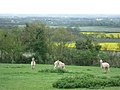
 Sheep by the Greensand Way - geograph.org.uk - 1157666.jpg 640 × 430; 105 KB
-
 Sheep near River Farm - geograph.org.uk - 4630365.jpg 1,024 × 768; 200 KB
-
 Sir Anthony Mayne, Memorial, Linton church - geograph.org.uk - 2974250.jpg 1,496 × 2,256; 767 KB
-
 Snoads Hall - geograph.org.uk - 1212077.jpg 640 × 480; 100 KB
-
 Spanish sign, Redwall Lane - geograph.org.uk - 4630358.jpg 1,024 × 768; 283 KB
-
 Stilebridge Lane - geograph.org.uk - 5005624.jpg 640 × 480; 129 KB
-
 Stilebridge Lane, near Linton - geograph.org.uk - 4899513.jpg 3,264 × 2,448; 1.58 MB
-
 Stream in Darnold Wood - geograph.org.uk - 1208960.jpg 480 × 640; 159 KB
-
 Stream near Loddington Lane - geograph.org.uk - 3345485.jpg 4,608 × 3,456; 3.4 MB
-
 Street Names, Inconsistent With Maps - geograph.org.uk - 3630181.jpg 3,104 × 2,328; 2.38 MB
-
 The Almshouses, 1-5, Linton Hill - geograph.org.uk - 1942455.jpg 1,024 × 768; 272 KB
-
 The almshouses, Linton Hill, Linton - geograph.org.uk - 5078128.jpg 640 × 472; 81 KB
-
 The Bull Inn sign - geograph.org.uk - 2049032.jpg 480 × 640; 71 KB
-
 The Bull Inn sign - geograph.org.uk - 5820768.jpg 2,801 × 3,734; 1.32 MB
-
 The Bull Inn, Linton - geograph.org.uk - 1942316.jpg 1,024 × 768; 205 KB
-
 The Bull Inn, Linton - geograph.org.uk - 5820772.jpg 5,184 × 3,456; 7.3 MB
-
 The countryside in Kent - geograph.org.uk - 772730.jpg 640 × 481; 95 KB
-
 The entrance driveway to Linton Hall - geograph.org.uk - 1157665.jpg 640 × 430; 78 KB
-
 The graveyard, Linton Church, Linton - geograph.org.uk - 1157667.jpg 640 × 430; 119 KB
-
 The Greensand Way from Loddington Lane - geograph.org.uk - 3924439.jpg 4,000 × 3,000; 4.49 MB
-
 The Greensand Way leaves Linton Churchyard - geograph.org.uk - 3920822.jpg 4,000 × 3,000; 3.94 MB
-
 The Greensand Way passes through Linton Churchyard - geograph.org.uk - 3924099.jpg 4,000 × 3,000; 4.32 MB
-
 The Greensand Way west of Linton - geograph.org.uk - 1157682.jpg 640 × 430; 74 KB
-
 The lake at Linton Park - geograph.org.uk - 3924465.jpg 4,000 × 3,000; 4.39 MB
-
 The lake in Linton Park - geograph.org.uk - 3924467.jpg 4,000 × 3,000; 4.11 MB
-
 The Linton Village Sign - geograph.org.uk - 3924611.jpg 4,000 × 3,000; 4.09 MB
-
 The River Beult - geograph.org.uk - 291713.jpg 640 × 480; 141 KB
-
 The White Lodge - geograph.org.uk - 1207561.jpg 640 × 480; 93 KB
-
 Toke Cottages - geograph.org.uk - 3924273.jpg 4,000 × 3,000; 4.44 MB
-
 Toke Place - geograph.org.uk - 1212070.jpg 640 × 480; 86 KB
-
 Tokes Place - geograph.org.uk - 2049341.jpg 640 × 480; 73 KB
-
 Trucks on Linton Hill - geograph.org.uk - 2049397.jpg 640 × 480; 115 KB
-
 Vanity Lane - geograph.org.uk - 1157686.jpg 430 × 640; 117 KB
-
 Vanity Lane, Linton - geograph.org.uk - 4899462.jpg 3,264 × 2,448; 4.01 MB
-
 Water access points and signs, Stilebridge Lane - geograph.org.uk - 3346827.jpg 2,763 × 2,072; 1.15 MB
-
 Water Tower - geograph.org.uk - 1131317.jpg 640 × 481; 103 KB
-
 Westerhill Rd (2) - geograph.org.uk - 1157712.jpg 640 × 430; 110 KB
-
 Wheeler's Lane, Linton - geograph.org.uk - 3630177.jpg 3,104 × 2,328; 2.55 MB
-
 Wheeler's Lane, Linton - geograph.org.uk - 4899439.jpg 3,264 × 2,448; 1.9 MB
-
 Wheeler's Lane, Linton - geograph.org.uk - 4899441.jpg 3,264 × 2,448; 2.11 MB
-
 Wheeler's Lane, Linton - geograph.org.uk - 4899449.jpg 3,264 × 2,448; 2.74 MB
-
 Wheeler's Lane, Linton - geograph.org.uk - 4899454.jpg 3,264 × 2,448; 3.56 MB
-

-
 A lane just outside Boughton Monchelsea - geograph.org.uk - 291701.jpg 640 × 480; 161 KB
-
 Farmland north of the River Beult - geograph.org.uk - 328563.jpg 640 × 480; 78 KB
-
 Fields just outside Boughton Monchelsea - geograph.org.uk - 291707.jpg 640 × 480; 166 KB
-
 Footbridge over feeder stream - geograph.org.uk - 328569.jpg 640 × 480; 156 KB
-
 Lake by Laceys Lane - geograph.org.uk - 346325.jpg 640 × 428; 122 KB
-
 Orchard at Loddington Farm - geograph.org.uk - 145973.jpg 640 × 427; 73 KB
-
 Row of peg-tile cottages - geograph.org.uk - 294111.jpg 640 × 427; 98 KB
-
 The White Lodge - geograph.org.uk - 346319.jpg 640 × 428; 207 KB
-
 Wares Farm - geograph.org.uk - 328571.jpg 640 × 480; 52 KB


_-_geograph.org.uk_-_3345486.jpg)
_-_geograph.org.uk_-_3345487.jpg)


_Mayne,_memorial,_Linton_church_-_geograph.org.uk_-_2974261.jpg)


_-_geograph.org.uk_-_3387068.jpg)
_-_geograph.org.uk_-_3387069.jpg)


_-_geograph.org.uk_-_3344840.jpg)
_-_geograph.org.uk_-_3344855.jpg)


_-_geograph.org.uk_-_3344906.jpg)
_-_geograph.org.uk_-_3344921.jpg)


_-_geograph.org.uk_-_4993596.jpg)


_-_geograph.org.uk_-_1157712.jpg)


