Category:Little Cheverell
Jump to navigation
Jump to search
village and civil parish in Wiltshire, United Kingdom  | |||||
| Upload media | |||||
| Instance of | |||||
|---|---|---|---|---|---|
| Location | Wiltshire, South West England, England | ||||
| official website | |||||
 | |||||
English: Little Cheverell is a village and civil parish in the English county of Wiltshire. In some sources the Latinized name of Cheverell Parva is used, especially when referring to the parish.
Nederlands: Little Cheverell is een dorp (village) en civil parish in de unitary authority Wiltshire, in het Engelse graafschap Wiltshire. De civil parish telt
Subcategories
This category has only the following subcategory.
C
Media in category "Little Cheverell"
The following 57 files are in this category, out of 57 total.
-
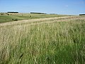
 2010 , Beech woods seen from the Wessex Ridgeway - geograph.org.uk - 2196504.jpg 4,041 × 2,366; 3.33 MB
-
 Across the field - geograph.org.uk - 6206779.jpg 4,320 × 3,240; 2.79 MB
-
 Along the field edge (1) - geograph.org.uk - 6206767.jpg 4,320 × 3,240; 3.97 MB
-
 Along the field edge (2) - geograph.org.uk - 6206774.jpg 4,320 × 3,240; 3.71 MB
-
 Barley crop, Cornbury Farm, Gore Cross - geograph.org.uk - 452087.jpg 640 × 480; 182 KB
-
 Downland near Little Cheverell - geograph.org.uk - 1449870.jpg 640 × 480; 160 KB
-
 Erlestoke, byway - geograph.org.uk - 5476764.jpg 1,024 × 769; 138 KB
-
 Fenced in - geograph.org.uk - 6206775.jpg 3,240 × 4,320; 3.66 MB
-
 Footpath, Little Cheverell - geograph.org.uk - 1867250.jpg 480 × 640; 209 KB
-

-
 Greenlands Farm (1) - geograph.org.uk - 6206780.jpg 4,320 × 3,240; 2.37 MB
-
 Greenlands Farm (2) - geograph.org.uk - 6206781.jpg 4,320 × 3,240; 2.71 MB
-
 Greenlands Farm (3) - geograph.org.uk - 6206782.jpg 4,320 × 3,240; 3.35 MB
-
 Hedge, Furze Hill Farm - geograph.org.uk - 4628640.jpg 640 × 426; 46 KB
-
 Horse paddock (1) - geograph.org.uk - 6206776.jpg 4,320 × 3,240; 3.65 MB
-
 Horse paddock (2) - geograph.org.uk - 6206777.jpg 4,320 × 3,240; 2.82 MB
-

-

-
 Little Cheverell, farm track - geograph.org.uk - 5476769.jpg 1,024 × 768; 166 KB
-
 Little Cheverell, junction - geograph.org.uk - 5476789.jpg 1,024 × 769; 140 KB
-
 Little Cheverell, warning sign - geograph.org.uk - 5476767.jpg 1,024 × 768; 219 KB
-

-
 On the Wessex Ridgeway Path, Littleton Down - geograph.org.uk - 2736519.jpg 1,024 × 768; 208 KB
-
 Over the stile (1) - geograph.org.uk - 6206764.jpg 4,320 × 3,240; 3.68 MB
-
 Over the stile (2) - geograph.org.uk - 6206778.jpg 4,320 × 3,240; 4.66 MB
-
 Path leaves the drive - geograph.org.uk - 6206783.jpg 4,320 × 3,240; 3.64 MB
-
 Postbox, Little Cheverell - geograph.org.uk - 1867243.jpg 480 × 640; 126 KB
-
 Rough grassland - geograph.org.uk - 5693280.jpg 640 × 426; 53 KB
-
 Russell Mill ^ Strawberry Hill Walk (33) - geograph.org.uk - 3998878.jpg 1,024 × 768; 129 KB
-
 Sheep pen, Salisbury Plain - geograph.org.uk - 300546.jpg 640 × 480; 91 KB
-
 Silage awaiting the baler, near Little Cheverell - geograph.org.uk - 521592.jpg 2,304 × 1,728; 1.26 MB
-
 Stormy weather near Salisbury Plain - geograph.org.uk - 762087.jpg 640 × 480; 59 KB
-
 Telephone box, Little Cheverell - geograph.org.uk - 1867246.jpg 640 × 480; 116 KB
-
 Three storey house, Little Cheverell - geograph.org.uk - 5446007.jpg 1,600 × 1,200; 805 KB
-
 Village property at Little Cheverell - geograph.org.uk - 3354471.jpg 640 × 426; 93 KB
-
 Wonderful Wiltshire (1) - geograph.org.uk - 6206772.jpg 4,320 × 3,240; 2.18 MB
-
 Wonderful Wiltshire (2) - geograph.org.uk - 6206773.jpg 4,320 × 3,240; 2.6 MB
-

-

-

-
 Field of dandelions - geograph.org.uk - 424097.jpg 640 × 427; 103 KB
-
 Fore Hill, south of Little Cheverell - geograph.org.uk - 522678.jpg 640 × 480; 301 KB
-
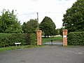 Gates to Manor Farm. Little Cheverell - geograph.org.uk - 250420.jpg 640 × 481; 73 KB
-
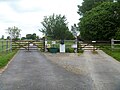
 Gore Cross access control point - geograph.org.uk - 538872.jpg 640 × 477; 80 KB
-
 Imber Range Perimeter Path - geograph.org.uk - 424073.jpg 640 × 427; 96 KB
-

-

-
 Landform near Little Cheverell - geograph.org.uk - 451957.jpg 640 × 480; 114 KB
-
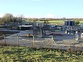 Lavington area Sewage Works - geograph.org.uk - 86872.jpg 640 × 480; 116 KB
-

-
 On Lavington Viaduct - geograph.org.uk - 84733.jpg 640 × 480; 44 KB
-
 Trees at the edge of the Imber Range - geograph.org.uk - 424084.jpg 640 × 427; 97 KB
-

-
 View over Wessex Ridgeway - geograph.org.uk - 424104.jpg 640 × 427; 91 KB
-
 View towards Lowlands Farm - geograph.org.uk - 424092.jpg 640 × 427; 91 KB
-

-
 Wildflowers near Fore Hill - geograph.org.uk - 424107.jpg 640 × 427; 100 KB


_-_geograph.org.uk_-_6206767.jpg)
_-_geograph.org.uk_-_6206774.jpg)


_-_geograph.org.uk_-_6206780.jpg)
_-_geograph.org.uk_-_6206781.jpg)
_-_geograph.org.uk_-_6206782.jpg)

_-_geograph.org.uk_-_6206776.jpg)
_-_geograph.org.uk_-_6206777.jpg)


_-_geograph.org.uk_-_6206764.jpg)
_-_geograph.org.uk_-_6206778.jpg)


_-_geograph.org.uk_-_3998878.jpg)


_-_geograph.org.uk_-_6206772.jpg)
_-_geograph.org.uk_-_6206773.jpg)


