Category:Little Sampford
Jump to navigation
Jump to search

village and civil parish in Essex, UK | |||||
| Upload media | |||||
| Instance of | |||||
|---|---|---|---|---|---|
| Location | Uttlesford, Essex, East of England, England | ||||
| Population |
| ||||
 | |||||
Subcategories
This category has the following 2 subcategories, out of 2 total.
W
- West Wood, Little Sampford (8 F)
Media in category "Little Sampford"
The following 157 files are in this category, out of 157 total.
-
 A road junction at Little Sampford - geograph.org.uk - 367784.jpg 640 × 421; 80 KB
-
 Arable land near Highgates, Little Sampford - geograph.org.uk - 4795076.jpg 1,024 × 768; 260 KB
-
 Arable land near Starr's Farm, Little Sampford - geograph.org.uk - 4795085.jpg 3,648 × 2,736; 3.35 MB
-

-
 B1051 junction towards Thaxted - geograph.org.uk - 4931952.jpg 640 × 450; 101 KB
-
 B1051 towards Great Sampford - geograph.org.uk - 4931936.jpg 640 × 458; 96 KB
-
 B1051 towards Great Sampford - geograph.org.uk - 5795974.jpg 1,024 × 684; 242 KB
-
 B1051 towards Great Sampford - geograph.org.uk - 5795979.jpg 1,024 × 684; 227 KB
-
 B1051 towards Great Sampford - geograph.org.uk - 5795987.jpg 1,024 × 684; 252 KB
-
 B1051 towards Thaxted - geograph.org.uk - 4931937.jpg 640 × 467; 85 KB
-
 B1053 Hawkin's Hill - geograph.org.uk - 6534641.jpg 1,024 × 684; 356 KB
-
 B1053 towards Finchingfield - geograph.org.uk - 6534635.jpg 1,024 × 684; 305 KB
-
 Barleyfields, Great Sampford - geograph.org.uk - 4892955.jpg 2,811 × 1,874; 2.67 MB
-
 Barn at the end - geograph.org.uk - 5796046.jpg 1,024 × 768; 303 KB
-
 Border of West Wood - geograph.org.uk - 3447835.jpg 3,648 × 2,736; 4.51 MB
-
 Bush Road - geograph.org.uk - 5310458.jpg 1,024 × 768; 223 KB
-
 Bush Road, Little Sampford - geograph.org.uk - 4892961.jpg 3,648 × 2,736; 3.25 MB
-
 Classic car on B1051 - geograph.org.uk - 5795994.jpg 1,024 × 684; 238 KB
-
 Clear Footpath - geograph.org.uk - 5392870.jpg 768 × 1,024; 223 KB
-
 Cleared Ditches - geograph.org.uk - 5302135.jpg 1,024 × 768; 284 KB
-

-
 Concrete Footbridge - geograph.org.uk - 5310515.jpg 1,024 × 768; 344 KB
-
 Crop field east of Great Sampford - geograph.org.uk - 5399151.jpg 640 × 480; 57 KB
-
 Crop field near Old House Farm - geograph.org.uk - 5399154.jpg 640 × 480; 41 KB
-
 Crop field near Old House Farm - geograph.org.uk - 5399158.jpg 640 × 480; 50 KB
-
 Driveway to Giffords Farm - geograph.org.uk - 4931913.jpg 640 × 338; 115 KB
-
 Elizabeth II postbox on the B1053, Great Sampford - geograph.org.uk - 5400920.jpg 2,848 × 2,136; 1.47 MB
-
 Entrance To West Wood - geograph.org.uk - 5302086.jpg 1,024 × 768; 306 KB
-
 Farm Track past Tile Hall Farm - geograph.org.uk - 3447815.jpg 3,648 × 2,736; 3.14 MB
-
 Farmland near Hawkes farm from the air - geograph.org.uk - 5136952.jpg 640 × 480; 159 KB
-
 Farmland near Hawkes farm from the air - geograph.org.uk - 5136954.jpg 640 × 480; 119 KB
-

-
 Farms near Thaxted from the air - geograph.org.uk - 2867972.jpg 640 × 480; 151 KB
-
 Farms near Thaxted from the air - geograph.org.uk - 5135177.jpg 640 × 480; 128 KB
-
 Field and hedge along B1051 - geograph.org.uk - 4931938.jpg 640 × 489; 129 KB
-
 Field and hedges north of Highgates - geograph.org.uk - 4931930.jpg 640 × 468; 82 KB
-
 Field by the B1051 - geograph.org.uk - 5537409.jpg 2,185 × 1,636; 855 KB
-
 Field by the B1051 - geograph.org.uk - 5537410.jpg 2,304 × 1,728; 1 MB
-
 Field by the B1053, Little Sampford - geograph.org.uk - 5514851.jpg 2,304 × 1,728; 788 KB
-
 Field entrance from B1051 - geograph.org.uk - 4931939.jpg 640 × 472; 94 KB
-
 Field Of Barley - geograph.org.uk - 5392900.jpg 1,024 × 768; 162 KB
-

-
 Fields north of Tewes Farm - geograph.org.uk - 4931953.jpg 640 × 462; 112 KB
-
 Fields to west of B1051 - geograph.org.uk - 4931940.jpg 640 × 482; 125 KB
-
 Flea Hall - geograph.org.uk - 4308135.jpg 640 × 480; 114 KB
-
 Flooded River Pant from the air - geograph.org.uk - 3844765.jpg 640 × 427; 88 KB
-
 Footpath - geograph.org.uk - 5310527.jpg 1,024 × 768; 226 KB
-
 Footpath - geograph.org.uk - 5392882.jpg 768 × 1,024; 362 KB
-
 Footpath And Field Boundary - geograph.org.uk - 5392924.jpg 768 × 1,024; 290 KB
-
 Footpath And Footbridge - geograph.org.uk - 5392921.jpg 1,024 × 768; 251 KB
-
 Footpath and gate - geograph.org.uk - 4931915.jpg 640 × 448; 183 KB
-
 Footpath and stile from the field - geograph.org.uk - 4931931.jpg 640 × 463; 184 KB
-
 Footpath and stile from the road - geograph.org.uk - 4931932.jpg 640 × 517; 157 KB
-
 Footpath Looking North - geograph.org.uk - 5302108.jpg 768 × 1,024; 356 KB
-
 Footpath Off Minor Road - geograph.org.uk - 5310537.jpg 1,024 × 768; 329 KB
-

-
 Footpath on field margin near Maynards, Little Sampford - geograph.org.uk - 4892975.jpg 3,648 × 2,432; 3.65 MB
-
 Footpath on field margin, Hawkin's Hill, Little Sampford - geograph.org.uk - 4892981.jpg 3,648 × 2,432; 4.04 MB
-
 Footpath on track to Little Sampford Hall - geograph.org.uk - 4795086.jpg 1,024 × 683; 290 KB
-
 Footpath sign - geograph.org.uk - 4931917.jpg 640 × 487; 178 KB
-
 Footpath sign - geograph.org.uk - 4931933.jpg 640 × 506; 192 KB
-

-
 Footpath towards Great Sampford - geograph.org.uk - 4931941.jpg 640 × 638; 123 KB
-
 Gamekeepers Bridge - geograph.org.uk - 5235287.jpg 768 × 1,024; 360 KB
-
 Gate into field south of Tindon End Road - geograph.org.uk - 4931919.jpg 640 × 445; 137 KB
-
 Giffords Farm - geograph.org.uk - 4931923.jpg 640 × 444; 87 KB
-
 Giffords Farm sign - geograph.org.uk - 4931920.jpg 640 × 468; 123 KB
-
 Great Clark's Farmhouse - geograph.org.uk - 5310358.jpg 1,024 × 768; 196 KB
-
 Great Clerkes Farm from the air - geograph.org.uk - 5136964.jpg 572 × 640; 144 KB
-

-
 Hall Road, Little Sampford - geograph.org.uk - 5514861.jpg 2,304 × 1,728; 818 KB
-
 Hawkes Cottage - geograph.org.uk - 6491909.jpg 1,600 × 1,067; 607 KB
-
 Herd Of Deer - geograph.org.uk - 5302124.jpg 1,024 × 768; 178 KB
-
 Highgates - geograph.org.uk - 4931934.jpg 640 × 461; 84 KB
-
 Ivy Todd Farm - geograph.org.uk - 5835311.jpg 3,264 × 2,448; 4.43 MB
-
 Junction between B1051 and Tindon End Road, Great Sampford - geograph.org.uk - 4892954.jpg 3,529 × 2,353; 2.95 MB
-
 Junction in Great Sampford - geograph.org.uk - 5514894.jpg 2,304 × 1,728; 1.25 MB
-
 Junction near Mill Hall Farm - geograph.org.uk - 4353426.jpg 4,320 × 3,240; 4.48 MB
-
 Junction near Tewes Farm - geograph.org.uk - 4353430.jpg 4,320 × 3,240; 5.7 MB
-
 Layby on the B1051 before Great Sampford - geograph.org.uk - 6451752.jpg 1,920 × 1,280; 1.15 MB
-
 Lines in the field - geograph.org.uk - 4931962.jpg 640 × 491; 90 KB
-
 Little Clark across a cereal field. - geograph.org.uk - 487494.jpg 640 × 377; 101 KB
-
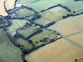
 Little Sampford from the air - geograph.org.uk - 3161976.jpg 640 × 480; 154 KB
-

-

-
 Looking to West Wood - geograph.org.uk - 3447832.jpg 3,648 × 2,736; 3.81 MB
-
 Mill Hall Farm from the air - geograph.org.uk - 3162001.jpg 640 × 480; 150 KB
-
 Minor road towards Tinkers Green - geograph.org.uk - 5399153.jpg 640 × 480; 67 KB
-
-
 Old Barn - geograph.org.uk - 5310477.jpg 768 × 1,024; 213 KB
-
 On the footpath from Maynards to Great Sampford - geograph.org.uk - 6491907.jpg 1,600 × 1,067; 488 KB
-
 Open Fields - geograph.org.uk - 5310407.jpg 1,024 × 768; 216 KB
-
 Orchids in an Oxlip Wood - geograph.org.uk - 1308097.jpg 428 × 640; 106 KB
-
 Oxlip (Primula elatior) in West Wood - geograph.org.uk - 3449531.jpg 3,648 × 2,736; 2.49 MB
-
 Oxlip - flowers ^ leaves, West Wood - geograph.org.uk - 3449535.jpg 2,560 × 2,560; 2.14 MB
-
 Oxlip amongst the Bluebells, West Wood - geograph.org.uk - 3449534.jpg 1,921 × 1,921; 1.34 MB
-
 Passing Highgates - geograph.org.uk - 5310326.jpg 1,024 × 768; 230 KB
-
 Path to West Wood - geograph.org.uk - 1308020.jpg 640 × 428; 117 KB
-
 Pitley Farm - geograph.org.uk - 289636.jpg 640 × 406; 58 KB
-
 Postbox south of Great Sampford - geograph.org.uk - 2497171.jpg 1,600 × 1,200; 482 KB
-
 Pylon And Footpath - geograph.org.uk - 5392855.jpg 768 × 1,024; 173 KB
-
 Pylon beyond a hedge - geograph.org.uk - 4308305.jpg 640 × 480; 99 KB
-
 Pylon in arable land, Little Sampford - geograph.org.uk - 4892959.jpg 3,648 × 2,432; 2.88 MB
-
 Road Farm, near Great Sampford, Essex - geograph.org.uk - 239466.jpg 640 × 432; 57 KB
-
 Road Junction - geograph.org.uk - 5310337.jpg 1,024 × 768; 255 KB
-
 Road junction south of Great Sampford - geograph.org.uk - 4308273.jpg 640 × 480; 125 KB
-
 Road towards the Sampfords - geograph.org.uk - 4308327.jpg 640 × 480; 108 KB
-
 Rose Cottages - geograph.org.uk - 5399156.jpg 640 × 480; 81 KB
-
 Rural Essex from the air - geograph.org.uk - 5835328.jpg 3,264 × 2,448; 4.36 MB
-
 Sampford Hall Lane - geograph.org.uk - 6491893.jpg 1,600 × 1,067; 581 KB
-
 Sampford Sign - geograph.org.uk - 693709.jpg 426 × 640; 113 KB
-

-
 Sharp bend on Tindon End Road - geograph.org.uk - 4931944.jpg 640 × 465; 157 KB
-
 Small building near Rose Cottages - geograph.org.uk - 4355459.jpg 4,320 × 3,240; 5.03 MB
-
 Snowdrops - geograph.org.uk - 693669.jpg 640 × 426; 87 KB
-
 Solar farm near Thaxted from the air - geograph.org.uk - 5136974.jpg 640 × 575; 225 KB
-
 Stile - geograph.org.uk - 5310521.jpg 1,024 × 768; 338 KB
-
 Stile And Footpath - geograph.org.uk - 5310531.jpg 1,024 × 768; 255 KB
-
 The B 1051, Boyton End - geograph.org.uk - 5537406.jpg 2,304 × 1,728; 831 KB
-
 The B1051 - geograph.org.uk - 5302072.jpg 1,024 × 768; 200 KB
-
 The B1051 before Great Sampford - geograph.org.uk - 6451753.jpg 1,920 × 1,280; 1.27 MB
-
 The B1051 heading to Great Sampford - geograph.org.uk - 5521459.jpg 2,238 × 1,636; 1.37 MB
-
 The B1051 heading to Great Sampford - geograph.org.uk - 5521461.jpg 2,304 × 1,728; 1.24 MB
-
 The B1053 heading towards Great Sampford - geograph.org.uk - 367812.jpg 640 × 480; 110 KB
-
 The River Pant - geograph.org.uk - 6491902.jpg 1,067 × 1,600; 745 KB
-
 Tindon End Road - geograph.org.uk - 5310469.jpg 768 × 1,024; 206 KB
-
 Tindon End Road by Byeballs Farm - geograph.org.uk - 5799199.jpg 1,024 × 684; 229 KB
-
 Tindon End Road eastwards - geograph.org.uk - 4931945.jpg 640 × 473; 92 KB
-
 Tindon End Road from B1051 junction - geograph.org.uk - 4931955.jpg 640 × 470; 65 KB
-
-
 Tindon End Road-B1051 junction - geograph.org.uk - 4931954.jpg 640 × 477; 123 KB
-
 To Great Clark's Farm - geograph.org.uk - 5310351.jpg 1,024 × 768; 323 KB
-
 Towards Flea Hall - geograph.org.uk - 4931963.jpg 640 × 446; 78 KB
-
 Towards Great Sampford - geograph.org.uk - 4931956.jpg 640 × 485; 177 KB
-
 Towards Great Sampford - geograph.org.uk - 4931964.jpg 640 × 424; 74 KB
-
 Towards Great Sampford - geograph.org.uk - 4931977.jpg 640 × 454; 97 KB
-

-
 Towards Little Sampford - geograph.org.uk - 4931935.jpg 640 × 462; 108 KB
-
 Towards Little Sampford - geograph.org.uk - 4931965.jpg 640 × 442; 63 KB
-
 Towards Thaxted - geograph.org.uk - 4931950.jpg 640 × 479; 101 KB
-
 Towards Tinkers Green - geograph.org.uk - 4931966.jpg 640 × 475; 82 KB
-
 Track in West Wood Nature Reserve - geograph.org.uk - 3448046.jpg 3,648 × 2,736; 5.89 MB
-
 Track Through Broadcroft Grove - geograph.org.uk - 5302148.jpg 768 × 1,024; 363 KB
-
 Track to West Wood - geograph.org.uk - 3917752.jpg 1,600 × 1,064; 686 KB
-
 Tractor approaching - geograph.org.uk - 4931957.jpg 640 × 506; 173 KB
-
 Tractor on the B1051, Great Sampford - geograph.org.uk - 5521465.jpg 2,304 × 1,728; 831 KB
-
 Tree on bend in track, Tindon End, Great Sampford - geograph.org.uk - 4892969.jpg 1,600 × 1,600; 1,013 KB
-
 Trees by the B1053, Little Sampford - geograph.org.uk - 5514854.jpg 2,304 × 1,728; 819 KB
-
 View From Hawkin's Hill - geograph.org.uk - 5324693.jpg 768 × 1,024; 264 KB
-
 View over valley of River Pant - geograph.org.uk - 4298949.jpg 640 × 480; 77 KB
-
 Village sign, Little Sampford - geograph.org.uk - 4355378.jpg 3,240 × 4,320; 6.26 MB
-
 West Wood Butterfly - geograph.org.uk - 1308226.jpg 640 × 428; 53 KB
-
 West Wood Coppice - geograph.org.uk - 1308247.jpg 640 × 428; 101 KB
-
 Country lane to the north - geograph.org.uk - 534206.jpg 640 × 480; 104 KB
-
 Country Lane to the south - geograph.org.uk - 534204.jpg 640 × 480; 100 KB
-
 The B1051, heading towards Thaxted - geograph.org.uk - 369932.jpg 640 × 480; 70 KB
-


_in_West_Wood_-_geograph.org.uk_-_3449531.jpg)


