Category:Llandarcy
Jump to navigation
Jump to search
English: Llandarcy is a village near Neath in Neath Port Talbot county borough, southwest Wales, and formerly the site of the UK's first oil refinery. The village, which lies near the Junction 43 of the M4 Motorway, was originally designed as a garden village to house the workers for the refinery, built by BP Oil between 1918-22.
village in United Kingdom  | |||||
| Upload media | |||||
| Instance of | |||||
|---|---|---|---|---|---|
| Location | Neath Port Talbot, Wales | ||||
 | |||||
Media in category "Llandarcy"
The following 19 files are in this category, out of 19 total.
-
 Abandoned section of the A48 - geograph.org.uk - 378132.jpg 640 × 480; 57 KB
-
 BP oil pipes - geograph.org.uk - 461650.jpg 640 × 480; 98 KB
-

-
 Coed Darcy (geograph 6359023).jpg 1,024 × 768; 137 KB
-
 Disused cats-eye - geograph.org.uk - 378509.jpg 640 × 480; 80 KB
-
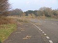 Disused sliproad - geograph.org.uk - 378541.jpg 640 × 480; 56 KB
-
 Llandarcy in 2006.jpg 640 × 480; 96 KB
-
 Llandarcy Oil Refinery, geograph-3395741-by-Ben-Brooksbank.jpg 1,800 × 1,040; 1.38 MB
-
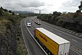 M4 Motorway at Skewen near Junction 43 - geograph.org.uk - 224315.jpg 640 × 430; 214 KB
-
 The Dram Road - geograph.org.uk - 342074.jpg 320 × 480; 82 KB
-
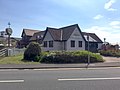 The Harvester - geograph.org.uk - 5783071.jpg 3,168 × 2,375; 1.77 MB
-
 Crymlyn Bog - geograph.org.uk - 561327.jpg 640 × 480; 213 KB
-
 Crymlyn Bog - geograph.org.uk - 561341.jpg 640 × 480; 203 KB
-
 Pant y Sais Fen - geograph.org.uk - 117747.jpg 640 × 480; 104 KB
-
 Public footpath^^ - geograph.org.uk - 378366.jpg 640 × 480; 131 KB
-
 Skewen - geograph.org.uk - 75240.jpg 640 × 476; 138 KB
-

-
 The Tennant Canal - geograph.org.uk - 202662.jpg 640 × 402; 193 KB
-
 Woodland Path - geograph.org.uk - 376408.jpg 640 × 480; 197 KB


.jpg)


