Category:Llanfair Clydogau
Jump to navigation
Jump to search
village in Ceredigion, Wales, United Kingdom  | |||||
| Upload media | |||||
| Instance of | |||||
|---|---|---|---|---|---|
| Location | Ceredigion, Wales | ||||
| Population |
| ||||
| official website | |||||
 | |||||
Cymraeg: Cymuned a phentref bychan gwledig yn ne Ceredigion yw Llanfair Clydogau. Fe'i lleolir ar lôn y B4343 tua 4 milltir i'r dwyrain o Lanbedr Pont Steffan.
English: Llanfair Clydogau is a community named after a small village, encompassing 3232 ha, located about 4 miles north-east of Lampeter, in Ceredigion, Wales. It has a population of around 770, 87.5% of which are Welsh-speaking, formerlly located within the hundred of Moythen.
Subcategories
This category has the following 5 subcategories, out of 5 total.
Media in category "Llanfair Clydogau"
The following 200 files are in this category, out of 257 total.
(previous page) (next page)-

-

-
 Across Pont Llanfair by Llanfair Clydogau in Ceredigion - geograph.org.uk - 5933293.jpg 1,440 × 1,080; 1.82 MB
-
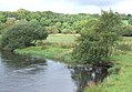
 Afon Teifi at Pont Llanfair in Ceredigion - geograph.org.uk - 5933308.jpg 1,440 × 960; 1.45 MB
-
 Afon Teifi at Pont Llanfair in Ceredigion - geograph.org.uk - 6232157.jpg 1,440 × 920; 1.38 MB
-
 Afon Teifi at Pont Llanfair in Ceredigion - geograph.org.uk - 6232160.jpg 1,280 × 960; 1.77 MB
-
 Afon Teifi at Pont Llanfair in Ceredigion - geograph.org.uk - 6232162.jpg 1,440 × 1,080; 2.18 MB
-
 Ancient beeches near Betws Bledrws, Ceredigion - geograph.org.uk - 3576656.jpg 1,024 × 743; 589 KB
-

-

-
 Approaching Llanfair Clydogau from the southwest - geograph.org.uk - 4455206.jpg 3,264 × 2,448; 3.75 MB
-

-

-
 B4343 to Llanddewi-Brefi, Ceredigion - geograph.org.uk - 4235813.jpg 1,280 × 868; 727 KB
-
 Barn and Coed Tangear - geograph.org.uk - 4681222.jpg 800 × 531; 98 KB
-
 Beech trees east of Castell Goetre, Ceredigion - geograph.org.uk - 4245915.jpg 1,024 × 768; 719 KB
-
 Beech trees east of Castell Goetre, Ceredigion - geograph.org.uk - 4245919.jpg 1,024 × 768; 754 KB
-

-

-
 Boggy land by Nant Clywodeg-uchaf in Ceredigion - geograph.org.uk - 6168931.jpg 1,440 × 960; 1.59 MB
-
 Bridge over the Nant Clywedog, B4343, Llanfair Clydogau - geograph.org.uk - 3594637.jpg 4,320 × 3,240; 3.06 MB
-
 Bridleway east of Castell Goetre, Ceredigion - geograph.org.uk - 4245921.jpg 1,024 × 768; 633 KB
-
 Building and pillow mound at Bryn Cysegrfan - geograph.org.uk - 6749211.jpg 1,600 × 900; 1.34 MB
-
 Caer Cadwgan - geograph.org.uk - 5489154.jpg 640 × 480; 105 KB
-
 Cattle north-east of Cellan, Ceredigion - geograph.org.uk - 4237496.jpg 1,024 × 768; 585 KB
-
 Ceredigion farmland east of Llanfair Clydogau - geograph.org.uk - 6169272.jpg 1,600 × 900; 1.3 MB
-
 Ceredigion farmland near Cellan - geograph.org.uk - 4246964.jpg 1,280 × 845; 740 KB
-
 Ceredigion farmland near Cellan - geograph.org.uk - 4246971.jpg 1,280 × 916; 854 KB
-
 Ceredigion pasture west of Llanfair Clydogau - geograph.org.uk - 4246046.jpg 1,280 × 867; 769 KB
-
 Ceredigion pastures west of Llanfair Clydogau - geograph.org.uk - 4245615.jpg 1,280 × 800; 573 KB
-
 Ceredigion rough pasture east of Llanfair Clydogau - geograph.org.uk - 6168206.jpg 1,440 × 960; 1.45 MB
-
 Coedmor-fach - geograph.org.uk - 2078490.jpg 1,600 × 1,200; 308 KB
-
 Cottage in Cellan - geograph.org.uk - 3594615.jpg 4,320 × 3,240; 2.99 MB
-
 Cwm Nant Clywedog-ganol in Ceredigion - geograph.org.uk - 6169282.jpg 1,440 × 960; 1.33 MB
-

-

-
 Earthwork building in the snow at Bryn Cysegrfan - geograph.org.uk - 6749206.jpg 1,600 × 900; 1.4 MB
-

-
 Entrance to Ty'n-y-coed - geograph.org.uk - 4681223.jpg 800 × 531; 117 KB
-
 Esgairlas Sunday School - geograph.org.uk - 4313932.jpg 1,600 × 1,200; 713 KB
-
 Farm land near Cellan, Ceredigion - geograph.org.uk - 2000211.jpg 800 × 519; 220 KB
-
 Farm land north of Cellan, Ceredigion - geograph.org.uk - 2001752.jpg 640 × 464; 137 KB
-

-
 Farm land south of Llanfair Clydogau, Ceredigion - geograph.org.uk - 2001819.jpg 1,024 × 523; 297 KB
-
 Farm road east of Llanfair Clydogau, - geograph.org.uk - 6173688.jpg 1,280 × 1,280; 2.2 MB
-

-

-

-
 Farm track above Cwm Nant Clywedog-ganol in Ceredigion - geograph.org.uk - 6171360.jpg 1,440 × 1,080; 1.84 MB
-
 Farm track east of Llanfair Clydogau in Ceredgion - geograph.org.uk - 5933498.jpg 960 × 1,280; 1.63 MB
-

-
 Farm track near Pont Glanrhyd in Ceredigion - geograph.org.uk - 6166989.jpg 960 × 1,280; 1.88 MB
-
 Farmland above Cae-garw - geograph.org.uk - 4681233.jpg 800 × 531; 114 KB
-

-
 Farmland and woodland near Pont Glanrhyd in Ceredigion - geograph.org.uk - 6167010.jpg 1,440 × 1,080; 1.94 MB
-
 Farmland at the head of Cwm Cynon - geograph.org.uk - 837544.jpg 640 × 428; 128 KB
-
 Farmland by Nant Clywedog-uchaf in Ceredigion - geograph.org.uk - 5933540.jpg 1,440 × 960; 1.54 MB
-
 Farmland by Nant Clywedog-uchaf in Ceredigion - geograph.org.uk - 5933735.jpg 1,440 × 1,080; 1.89 MB
-
 Farmland near Blaenau-isaf - geograph.org.uk - 4681227.jpg 800 × 531; 116 KB
-

-

-
 Farmland north of Cellan, Ceredigion - geograph.org.uk - 4239132.jpg 1,280 × 795; 669 KB
-
 Farmland north of Cellan, Ceredigion - geograph.org.uk - 4239136.jpg 768 × 1,024; 461 KB
-

-
 Farmland north-east of Cellan, Ceredigion - geograph.org.uk - 4236409.jpg 1,024 × 697; 490 KB
-
 Farmland north-east of Cellan. Ceredigion - geograph.org.uk - 4236412.jpg 768 × 1,024; 462 KB
-

-

-

-
 Field and footpath north of Cellan, Ceredigion - geograph.org.uk - 4246945.jpg 1,024 × 768; 531 KB
-
 Field and trees - geograph.org.uk - 4003241.jpg 640 × 426; 216 KB
-
 Field and trees - geograph.org.uk - 4003254.jpg 1,232 × 820; 556 KB
-
 Field boundary by Castell Goetre, Ceredigion - geograph.org.uk - 4245338.jpg 1,024 × 768; 560 KB
-
 Field gate and upland grazing - geograph.org.uk - 4680481.jpg 1,024 × 680; 278 KB
-
 Field near Ael-y-bryn - geograph.org.uk - 4681225.jpg 800 × 531; 109 KB
-
 Field on Bryn Cysegrfa - geograph.org.uk - 4003238.jpg 640 × 426; 221 KB
-
 Fields south-east of Castell Goetre, Ceredigion - geograph.org.uk - 4245360.jpg 1,024 × 768; 505 KB
-

-
 Footbridge near Cellan, Ceredigion - geograph.org.uk - 4236420.jpg 1,280 × 960; 936 KB
-
 Footbridge near Cellan, Ceredigion - geograph.org.uk - 4236422.jpg 768 × 1,024; 701 KB
-
 Footbridge north of Cellan, Ceredigion - geograph.org.uk - 4246976.jpg 1,024 × 768; 578 KB
-

-

-

-

-

-

-

-

-
 Forest lake east of Llanfair Clydogau in Ceredigion - geograph.org.uk - 5527745.jpg 1,280 × 960; 1.24 MB
-
 Forest road by Llyn y Gwaith in Ceredigion - geograph.org.uk - 5528481.jpg 1,280 × 764; 1.08 MB
-

-
 Forestry road and Llyn y Gwaith in Ceredigion - geograph.org.uk - 5528177.jpg 1,280 × 775; 1.11 MB
-
 Forestry road by Llyn y Gwaith in Ceredigion - geograph.org.uk - 5527733.jpg 1,280 × 841; 1.32 MB
-
 Forestry road by Llyn y Gwaith, Ceredigion - geograph.org.uk - 5528174.jpg 1,024 × 1,024; 1.05 MB
-
 Forestry road by Llyn y Gwaith, Ceredigion - geograph.org.uk - 5529730.jpg 1,006 × 1,280; 1.31 MB
-
 Forestry road by Llyn y Gwaith, Ceredigion - geograph.org.uk - 5529735.jpg 960 × 1,280; 1.32 MB
-

-

-

-

-

-

-

-

-

-

-

-
 Forestry road to Clywedog Plantation in Ceredigion - geograph.org.uk - 6170531.jpg 1,440 × 960; 1.71 MB
-
 Forestry road to Clywedog Plantation in Ceredigion - geograph.org.uk - 6171250.jpg 1,024 × 1,024; 1.15 MB
-

-
 Forestry track west of Bryn Mawr in Ceredigion - geograph.org.uk - 5532441.jpg 960 × 1,280; 1.23 MB
-
 Forestry track west of Bryn Mawr in Ceredigion - geograph.org.uk - 5532449.jpg 960 × 1,280; 1.29 MB
-
 Forestry track west of Bryn Mawr in Ceredigion - geograph.org.uk - 5532459.jpg 960 × 1,280; 1.22 MB
-
 Forestry track west of Bryn Mawr in Ceredigion - geograph.org.uk - 5532468.jpg 1,280 × 960; 1.15 MB
-

-
 Grazing by Nant Clywedog-uchaf, Ceredigion - geograph.org.uk - 6168938.jpg 1,024 × 1,024; 1.42 MB
-
 Grazing by Nant Clywedog-uchaf, Ceredigion - geograph.org.uk - 6168956.jpg 1,280 × 960; 1.61 MB
-
 Heather and upland grazing - geograph.org.uk - 4680477.jpg 1,024 × 680; 305 KB
-
 Hill pasture above Nant Clywedog-ganol in Ceredigion - geograph.org.uk - 6170209.jpg 1,280 × 960; 1.34 MB
-

-
 Hill pasture east of Llanfair Clydogau in Ceredigion - geograph.org.uk - 5933513.jpg 1,600 × 900; 1.44 MB
-
 Hill pasture east of Llanfair Clydogau in Ceredigion - geograph.org.uk - 6168169.jpg 1,440 × 1,080; 1.51 MB
-
 Hill pasture east of Llanfair Clydogau in Ceredigion - geograph.org.uk - 6168646.jpg 1,440 × 960; 1.57 MB
-

-
 Hill road near Coed Tangaer - geograph.org.uk - 837527.jpg 640 × 428; 134 KB
-
 Lane and woodland near Pont Glanrhyd in Ceredigion - geograph.org.uk - 6168641.jpg 1,440 × 1,080; 1.76 MB
-
 Lane north-east of Pont Glanrhyd in Ceredigion - geograph.org.uk - 6168159.jpg 960 × 1,280; 2.04 MB
-
 Lane to Llanycrwys in Carmarthenshire - geograph.org.uk - 5443245.jpg 1,280 × 867; 948 KB
-
 Lane to Pont Glanrhyd in Ceredigion - geograph.org.uk - 6152001.jpg 960 × 1,280; 1.89 MB
-
 Lane to Pont Glanrhyd in Ceredigion - geograph.org.uk - 6166966.jpg 1,280 × 960; 1.85 MB
-
 Lane to Pont Glanrhyd in Ceredigion - geograph.org.uk - 6168946.jpg 1,440 × 960; 1.76 MB
-
 Llanfair Bridge - geograph.org.uk - 3591244.jpg 1,024 × 768; 149 KB
-
 Llanfair Clydogau - geograph.org.uk - 1814384.jpg 4,224 × 3,168; 2.22 MB
-
 Llanfair Clydogau, Ceredigion.jpg 640 × 445; 142 KB
-
 Llwybr Cae Garw - Cae Garw Footpath - geograph.org.uk - 5489196.jpg 640 × 480; 139 KB
-

-
 Llwybr Cellan - Cellan Footpath - geograph.org.uk - 5489123.jpg 640 × 480; 147 KB
-
 Llwybr cyhoeddus - Public footpath - geograph.org.uk - 5515829.jpg 640 × 480; 152 KB
-
 Llwybr Gelli Gaer- Gelli Gaer Path - geograph.org.uk - 5489171.jpg 640 × 480; 97 KB
-
 Llwybr Tangaer - Tangaer Footpath - geograph.org.uk - 5489131.jpg 640 × 480; 105 KB
-
 Llwyn y Gwaith east of Llanfair Clydogau, Ceredigion - geograph.org.uk - 5528486.jpg 1,280 × 874; 1.26 MB
-
 Llwyn y Gwaith east of Llanfair Clydogau, Ceredigion - geograph.org.uk - 5528493.jpg 1,280 × 960; 1.62 MB
-
 Llwyn y Gwaith east of Llanfair Clydogau, Ceredigion - geograph.org.uk - 5528753.jpg 1,280 × 960; 1.19 MB
-
 Llyn y Gwaith in Ceredigion - geograph.org.uk - 5532922.jpg 1,280 × 750; 1.33 MB
-
 Looking southwest along the B4343 - geograph.org.uk - 4455213.jpg 3,264 × 2,448; 3.69 MB
-

-
 Meadow near Tangaer farm - geograph.org.uk - 837520.jpg 640 × 428; 93 KB
-
 Minor road from Llanfair Clydogau - geograph.org.uk - 4003257.jpg 640 × 426; 164 KB
-

-

-

-

-

-

-
 Not quite the centre - geograph.org.uk - 2586944.jpg 640 × 480; 85 KB
-

-
 Old beech tree north of Cellan, Ceredigion - geograph.org.uk - 4246910.jpg 1,024 × 1,024; 812 KB
-
 Old lane east of Pentrefelin, Ceredigion - geograph.org.uk - 1212635.jpg 640 × 471; 155 KB
-
 Ordnance Survey Cut Mark - geograph.org.uk - 5519719.jpg 640 × 362; 52 KB
-
 Ordnance Survey Cut Mark - geograph.org.uk - 5519725.jpg 640 × 297; 78 KB
-
 Ordnance Survey Cut Mark - geograph.org.uk - 5519733.jpg 640 × 343; 102 KB
-

-
 Pasture and footpath north of Cellan, Ceredigion - geograph.org.uk - 4246913.jpg 1,024 × 667; 528 KB
-

-

-

-
 Pasture and woodland north of Cellan, Ceredigion - geograph.org.uk - 4246926.jpg 1,280 × 830; 555 KB
-
 Pasture and woodland north of Cellan, Ceredigion - geograph.org.uk - 4246930.jpg 1,280 × 903; 718 KB
-
 Pasture and woodland north-east of Cellan, Ceredigion - geograph.org.uk - 4237491.jpg 1,024 × 1,024; 814 KB
-
 Pasture by Castell Goetre, Ceredigion - geograph.org.uk - 4245606.jpg 1,280 × 822; 647 KB
-
 Pasture by Castell Goetre, Ceredigion - geograph.org.uk - 4245611.jpg 768 × 1,024; 497 KB
-
 Pasture east of Castell Goetre, Ceredigion - geograph.org.uk - 4245851.jpg 1,024 × 687; 452 KB
-
 Pasture east of Llanfair Clydogau in Ceredigion - geograph.org.uk - 5933322.jpg 1,440 × 1,080; 1.76 MB
-
 Pasture east of Llanfair Clydogau in Ceredigion - geograph.org.uk - 5933325.jpg 960 × 1,280; 1.66 MB
-
 Pasture east of Llanfair Clydogau in Ceredigion - geograph.org.uk - 6169454.jpg 1,440 × 1,080; 2 MB
-
 Pasture east of Llanfair Clydogau in Ceredigion - geograph.org.uk - 6169459.jpg 1,280 × 960; 1.96 MB
-

-
 Pasture near Castell Goetre, Ceredigion - geograph.org.uk - 4244393.jpg 1,024 × 671; 316 KB
-
 Pasture near Castell Goetre, Ceredigion - geograph.org.uk - 4244396.jpg 1,024 × 768; 442 KB
-
 Pasture near Cellan, Ceredigion - geograph.org.uk - 4237351.jpg 1,024 × 768; 528 KB
-
 Pasture near Cellan, Ceredigion - geograph.org.uk - 4237459.jpg 1,024 × 741; 524 KB
-

-
 Pasture south-east of Castell Goetre, Ceredigion - geograph.org.uk - 4239771.jpg 1,024 × 681; 415 KB
-
 Pasture south-east of Castell Goetre, Ceredigion - geograph.org.uk - 4239999.jpg 768 × 1,024; 582 KB
-
 Pasture south-east of Castell Goetre, Ceredigion - geograph.org.uk - 4240027.jpg 1,280 × 772; 512 KB
-
 Pasture south-east of Castell Goetre, Ceredigion - geograph.org.uk - 4240734.jpg 1,024 × 768; 544 KB
-
 Pasture south-east of Castell Goetre, Ceredigion - geograph.org.uk - 4240739.jpg 1,280 × 944; 657 KB
-
 Pasture south-east of Castell Goetre, Ceredigion - geograph.org.uk - 4245350.jpg 1,024 × 708; 351 KB
-

-

-

-

-

-
 Pool by Esgair Llanfair, Ceredigion - geograph.org.uk - 6171467.jpg 1,280 × 960; 1.19 MB
-
 Public footpath north-east of Cellan, Ceredigion - geograph.org.uk - 4237535.jpg 1,024 × 748; 738 KB
-

-
 Road (B4343) entering Llanfair Clydogau - geograph.org.uk - 5797935.jpg 4,000 × 3,000; 2.95 MB
-
 Road (B4343) near Penddol - geograph.org.uk - 5797928.jpg 4,000 × 3,000; 3.68 MB
-
 Road heading west from Sarn Helen - geograph.org.uk - 2081180.jpg 640 × 480; 124 KB


_entering_Llanfair_Clydogau_-_geograph.org.uk_-_5797935.jpg)
_near_Penddol_-_geograph.org.uk_-_5797928.jpg)
