Category:Llangefni
Jump to navigation
Jump to search
| Llangefni |
|---|
|
Cymraeg: Tref yng nghanol Ynys Môn yw Llangefni, sydd wedi bod yn dref farchnad bwysig i'r ynys. Llangefni yw tref sirol Môn a lleolir pencadlys Cyngor Sir Ynys Môn yma. Yn ôl Cyfrifiad 2001, mae gan Llangefni boblogaeth o 4,499 o bobl. Mae 83.8% o'r boblogaeth honno'n rhugl yn y Gymraeg gyda'r canran uchaf yn yr oedran 10-14 mlwydd gyda 95.2% yn medru'r Gymraeg. O'i tharddle ger Llyn Cefni rhed Afon Cefni trwy'r dref, sy'n cymryd ei enw o'r afon.
Deutsch: Llangefni ist eine Stadt in Nord wales. Sie befindet sich auf der Insel Anglesey und gehört zum Verwaltungssitz der Grafschaft Anglesey. Die Stadt zählt 4.500 Einwohner und nach der Volkszählung sprechen 83,8 Prozent aller Einwohner Walisisch. In Llangefni befindet sich ein großes Gewerbegebiet. In Llangefni befindet sich ein College.
English: Llangefni is the county town of Anglesey in Wales and contains the principal offices of the Isle of Anglesey County Council. According to the United Kingdom Census 2001, the population of Llangefni was 4,662 people and it is the second largest settlement on the island. The census also reveals that 83.8% of the population speak Welsh fluently, with the highest percentage of speakers being in the 10-14 age group where 95.2% are able to speak Welsh.
Español: Llangefni es la capital de Anglesey, en Gales, y posee las principales oficinas de gobierno de la Isla de Anglesey.
Euskara: Llangefni Galesko ipar-mendebaldean dagoen udalerri txikia da, Ynys Moneko konderrian dagoena eta bertako hiriburua eta bigarren herririk populatuena dena, Caergybi ondoren.
Lietuvių: Langevnis – miestas Velse, Anglesio salos centrinėje dalyje. 4,5 tūkst. gyventojų (2001 m.). Pagal gyventojų surašymo duomenis 83,8 proc. gyventojų kalba valų kalba. Salos žemės ūkio centras.
Norsk bokmål: Llangefni er administrasjonsby i grevskapet Anglesey, på øya ved samme navn utenfor Wales. Den ligger omtrent midt på øya ved elven Cefni, som den har navn etter. Byen het tidligere Llangygnar, etter sognekirken viet til St Cyngar.
Polski: Llangefni - miasto w północno-zachodniej Walii (Wielka Brytania), ośrodek administracyjny hrabstwa Anglesey. Zgodnie ze spisem powszechnym przeprowadzonym w 2001 roku, Llangefni liczy 4499 mieszkańców. Spis pokazał również że 83,8% ogółu mieszkańców płynnie mówi w języku walijskim, przy czym najpowszechniejsza jego znajomość mieści się w przedziale wiekowym 10-14 lat, gdzie aż 95,2% jest zdolnych do komunikacji w tym języku.
|
county town of Anglesey in Wales, United Kingdom  | |||||
| Upload media | |||||
| Instance of | |||||
|---|---|---|---|---|---|
| Location | Llangefni, Isle of Anglesey, Wales | ||||
| Heritage designation |
| ||||
| official website | |||||
 | |||||
Subcategories
This category has the following 15 subcategories, out of 15 total.
2
- 2007 in Llangefni (10 F)
- 2008 in Llangefni (33 F)
B
C
- River Cefni at Llangefni (10 F)
- Cefni Reservoir (9 F)
- Church Street, Llangefni (5 F)
D
- The Dingle, Anglesey (9 F)
H
- High Street, Llangefni (7 F)
L
- Llangefni railway station (2 F)
M
- Llangefni Market (5 F)
O
- Oriel Môn (7 F)
R
- Rhosmeirch (19 F)
W
- War memorials in Llangefni (10 F)
Media in category "Llangefni"
The following 200 files are in this category, out of 241 total.
(previous page) (next page)-

-

-
-
 Adding some variety to the staple diet - geograph.org.uk - 887430.jpg 640 × 480; 151 KB
-
 Afon Carrog below the bridge - geograph.org.uk - 963427.jpg 640 × 480; 127 KB
-
 Afon Cefni - geograph.org.uk - 2926146.jpg 640 × 427; 96 KB
-

-
 Afon Gwna - geograph.org.uk - 153920.jpg 640 × 480; 98 KB
-
 Anglesey Central Railway.jpg 3,120 × 4,160; 7.45 MB
-
 Anglesey Council Offices - geograph.org.uk - 1735063.jpg 640 × 485; 53 KB
-
 Apartment block in Bro Tudur - geograph.org.uk - 963349.jpg 640 × 480; 68 KB
-
 Approaching Persondy on the back road - geograph.org.uk - 964688.jpg 640 × 480; 106 KB
-
 Approaching Plas Nant - geograph.org.uk - 964702.jpg 640 × 480; 56 KB
-

-
 B4422 looking towards B5109 junction - geograph.org.uk - 2110283.jpg 480 × 640; 120 KB
-
-
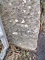 Benchmark on gatepost on the B5110, Llangefni - geograph.org.uk - 2233353.jpg 3,000 × 4,000; 1.41 MB
-
 Benchmark on old railway bridge, Llangefni - geograph.org.uk - 2699932.jpg 3,000 × 4,000; 5.59 MB
-
 Benchmark on Pont Clai, Llangefni - geograph.org.uk - 2233336.jpg 3,000 × 4,000; 1.42 MB
-

-

-
 Boardwalk and path in the Dingle - geograph.org.uk - 4936707.jpg 640 × 480; 219 KB
-
 Boardwalk on the Lon Las Cefni - geograph.org.uk - 4937163.jpg 640 × 480; 176 KB
-
 Boardwalk on the Lon Las Cefni - geograph.org.uk - 4937165.jpg 640 × 482; 131 KB
-
 Bodhyfryd House, Glanhwfa Road - geograph.org.uk - 1083227.jpg 640 × 480; 98 KB
-
 Bridge over the Afon Cefni - geograph.org.uk - 4936700.jpg 640 × 480; 161 KB
-
 Bridge Street, Llangefni - geograph.org.uk - 3394882.jpg 1,280 × 856; 219 KB
-
 Bridge Street, Llangefni - geograph.org.uk - 874385.jpg 640 × 480; 52 KB
-
 Bridge street, Llangefni NLW3363769.jpg 598 × 432; 57 KB
-
 Bull Hotel, Llangefni - geograph.org.uk - 2707321.jpg 4,000 × 3,000; 4.9 MB
-
 Bungalows at Pencraig - geograph.org.uk - 878817.jpg 640 × 408; 37 KB
-

-
 Bungalows west of the B 5114 - geograph.org.uk - 1083958.jpg 640 × 430; 43 KB
-
 Business premises on the High Street - geograph.org.uk - 897817.jpg 599 × 640; 122 KB
-

-
-
 Car park entrance near Rhosmeirch - geograph.org.uk - 3773681.jpg 1,600 × 1,067; 367 KB
-
 Car park off Lon y Felin - geograph.org.uk - 4937199.jpg 640 × 481; 111 KB
-
 Cattle near Pen-parc - geograph.org.uk - 963493.jpg 640 × 403; 39 KB
-
 Cefni Reservoir - geograph.org.uk - 152504.jpg 640 × 480; 126 KB
-
 Cefni Reservoir Bridge - geograph.org.uk - 2908235.jpg 640 × 427; 86 KB
-
 Cheese Factory, Llangefni - geograph.org.uk - 5636150.jpg 1,600 × 1,200; 216 KB
-

-
-
 County Court.jpg 3,096 × 4,128; 4.53 MB
-
 Covered reservoir at Rhostrehwfa - geograph.org.uk - 780974.jpg 640 × 480; 37 KB
-

-
 Disused railway - Llangefni - geograph.org.uk - 3395235.jpg 1,280 × 856; 387 KB
-
 Disused railway bridge in The Dingle - geograph.org.uk - 1738433.jpg 640 × 480; 135 KB
-

-
 Dolfeirig Residential Home, Llangefni - geograph.org.uk - 815972.jpg 640 × 333; 24 KB
-
 Dolfeirig residential nursing home - geograph.org.uk - 887461.jpg 640 × 389; 36 KB
-
 Dragonfly Sculpture, Llangefni - geograph.org.uk - 2707319.jpg 3,000 × 4,000; 5.92 MB
-
 EastLlynCefni.JPG 653 × 490; 43 KB
-
 Edwin, a Llangefni tinker NLW3362637.jpg 432 × 582; 40 KB
-
 Elias Hughes and his wife, Llangefni (8247021124).jpg 398 × 595; 47 KB
-
 Elim Garage, Glanhwfa Road - geograph.org.uk - 1083252.jpg 640 × 480; 71 KB
-

-

-
 Entry to the Cefni Reservoir Park - geograph.org.uk - 964053.jpg 640 × 480; 132 KB
-

-
 Farm road leading to Clegyrdy-bach - geograph.org.uk - 963400.jpg 640 × 480; 83 KB
-
 Farmhouse, Rhosmeirch - geograph.org.uk - 3773666.jpg 1,024 × 668; 83 KB
-
 Farmhouse, Rhosmeirch - geograph.org.uk - 3773673.jpg 1,600 × 924; 233 KB
-
-
 Farmland near Llangefni - geograph.org.uk - 5213173.jpg 4,896 × 3,672; 6.64 MB
-
 Ffordd Glandwr Road, Llangefni - geograph.org.uk - 419915.jpg 640 × 480; 76 KB
-
 Field near to Angora Farm - geograph.org.uk - 152505.jpg 640 × 480; 112 KB
-
 Field near to Frogwy Bach - geograph.org.uk - 152500.jpg 640 × 480; 154 KB
-
 Fields beside the B5110 - geograph.org.uk - 180227.jpg 640 × 480; 77 KB
-
 Footbridge below the Cefni Dam - geograph.org.uk - 4937172.jpg 640 × 481; 123 KB
-
 Footbridge over Afon Cefni - geograph.org.uk - 1084438.jpg 640 × 480; 98 KB
-
 Footbridge, Afon Cefni - geograph.org.uk - 5010882.jpg 1,600 × 1,200; 917 KB
-

-
 Forest track by Cefni Reservoir - geograph.org.uk - 3395771.jpg 1,280 × 856; 438 KB
-
 Former railway buildings, Llangefni - geograph.org.uk - 2720990.jpg 4,000 × 3,000; 6.62 MB
-

-
 Foundry Vaults, Llangefni - geograph.org.uk - 2709558.jpg 3,000 × 4,000; 4.84 MB
-
 Glanhwfa Road - geograph.org.uk - 904639.jpg 640 × 469; 50 KB
-

-
-
 Grazing sheep at Pen-y-bryn - geograph.org.uk - 963475.jpg 640 × 618; 68 KB
-

-
 Green Power - geograph.org.uk - 2135710.jpg 2,272 × 1,704; 858 KB
-
 Gwesty'r Bull Hotel, Llangefni - geograph.org.uk - 2707324.jpg 3,000 × 4,000; 5.17 MB
-

-
 High Street, Llangefni - geograph.org.uk - 3395167.jpg 1,280 × 855; 266 KB
-
 High Street, Llangefni - geograph.org.uk - 3773611.jpg 1,600 × 839; 316 KB
-
 High Street, Llangefni - geograph.org.uk - 3773617.jpg 1,024 × 665; 128 KB
-

-
 Houses at Corn Hir, Cildwrn Road - geograph.org.uk - 887422.jpg 640 × 429; 63 KB
-

-
 Industrial Estate Road, Llangefni - geograph.org.uk - 5344594.jpg 5,184 × 3,888; 6.29 MB
-

-

-
 Lane East From Rhosmeirch - geograph.org.uk - 1437529.jpg 640 × 480; 234 KB
-
 Llangefni town centre.jpg 640 × 480; 62 KB
-
 Llangefni.jpg 3,968 × 2,976; 2.53 MB
-
 Lleoliad Menter Môn- Neuadd y Dref (Llangefni, Ynys Môn).jpg 3,024 × 4,032; 2.71 MB
-
 Llun o rheilffordd yn Llangefni - Picture of abandoned railway in Llangefni.jpg 3,024 × 4,032; 3.58 MB
-
 LNWR 0-6-0 near Llangefni c1936.jpg 1,024 × 705; 191 KB
-
 Lon Las Cefni - geograph.org.uk - 4935561.jpg 640 × 480; 125 KB
-
 Lon Talwrn Road - geograph.org.uk - 963340.jpg 640 × 480; 53 KB
-

-
 Lon Tudur Lane - geograph.org.uk - 904239.jpg 640 × 480; 57 KB
-
 Lon Tudur, Llangefni, Anglesey. - geograph.org.uk - 183690.jpg 640 × 233; 67 KB
-

-
 Maes Derwydd Estate - geograph.org.uk - 887442.jpg 640 × 480; 54 KB
-
 Man at work gone for a swim - geograph.org.uk - 4936704.jpg 480 × 640; 166 KB
-

-
 Melin Wynt Y Graig - geograph.org.uk - 4176602.jpg 1,712 × 2,288; 773 KB
-
 Melin y Graig Corn Mill - geograph.org.uk - 904249.jpg 640 × 590; 102 KB
-
 Modern housing estate off Lon Talwrn - geograph.org.uk - 963347.jpg 640 × 480; 46 KB
-
 Morgan and Evans, Llangefni - geograph.org.uk - 3773654.jpg 1,024 × 607; 140 KB
-
 Mozzarella Cheese Factory, Llangefni. - geograph.org.uk - 107213.jpg 640 × 373; 68 KB
-

-
 New bungalows in Penmynydd Road - geograph.org.uk - 904236.jpg 640 × 480; 57 KB
-

-
 Old Milestone by Llangefni library - geograph.org.uk - 6102469.jpg 757 × 1,152; 261 KB
-

-
 Ordnance Survey Drawings - Llangefni (OSD 318).jpg 5,833 × 3,246; 2.48 MB
-
-

-

-
 Penmynydd Road - geograph.org.uk - 2473435.jpg 4,000 × 3,000; 5.06 MB
-
 Penuel Chapel, Llangefni - geograph.org.uk - 3773647.jpg 825 × 1,024; 110 KB
-

-
 Private road leading to Water Works - geograph.org.uk - 767745.jpg 640 × 469; 49 KB
-
 Protest-Llangefni-yn-erbyn-wylfa-b.jpg 1,000 × 618; 297 KB
-

-
 Railway bridge over Cefni river 2006.jpg 640 × 480; 162 KB
-

-
 Rhun ap Iorwerth's office.jpg 4,160 × 3,120; 3.32 MB
-

-
 Road bridge over Afon Cefni - geograph.org.uk - 1084448.jpg 640 × 480; 120 KB
-

-
-
 Rough grazing near Carrog Uchaf Farm - geograph.org.uk - 963458.jpg 640 × 439; 49 KB
-
 Semi-detached bungalows in Pencraig - geograph.org.uk - 879230.jpg 640 × 480; 38 KB
-
 Semis in Bridge Street - geograph.org.uk - 877726.jpg 640 × 480; 83 KB
-

-
 Sharp bend at Pont Carrog - geograph.org.uk - 963421.jpg 640 × 480; 61 KB
-
 Sheep at Lledwigan Farm - geograph.org.uk - 766290.jpg 640 × 241; 19 KB
-

-
 The A5114 near the cheese factory - geograph.org.uk - 5212798.jpg 4,896 × 3,672; 6.81 MB
-

-
 The B 4422 Rhostrehwfa road - geograph.org.uk - 887445.jpg 640 × 480; 51 KB
-
 The B5109 on the outskirts of Llangefni - geograph.org.uk - 5213169.jpg 1,600 × 1,200; 221 KB
-
 The B5110 - geograph.org.uk - 2523636.jpg 4,000 × 3,000; 5.11 MB
-

-
 The car park at Oriel Ynys Môn - geograph.org.uk - 5212792.jpg 4,896 × 3,672; 6.73 MB
-
 The Cefni Dam - geograph.org.uk - 4937168.jpg 640 × 480; 131 KB
-
 The Cefni Dam - geograph.org.uk - 5010892.jpg 1,600 × 1,200; 502 KB
-
 The Cefni Dam and the cycleway bridge - geograph.org.uk - 964203.jpg 640 × 351; 42 KB
-
 The Cefni Dam from the forest walk - geograph.org.uk - 964121.jpg 640 × 371; 50 KB
-
 The Cefni Reservoir Dam - geograph.org.uk - 962495.jpg 640 × 480; 48 KB
-
-

-
 The Dingle Dragonfly - geograph.org.uk - 1738508.jpg 480 × 640; 131 KB
-
 The Dingle, Llangefni - geograph.org.uk - 1735110.jpg 640 × 480; 74 KB
-
 The Dingle, Llangefni - geograph.org.uk - 38680.jpg 640 × 480; 139 KB
-
-

-
 The driveway to the Pencraig campus - geograph.org.uk - 904225.jpg 640 × 480; 75 KB
-

-
 The Glanbia cheese factory - geograph.org.uk - 5212800.jpg 4,896 × 3,672; 6.68 MB
-

-
 The Glanbia factory from the B 5114 - geograph.org.uk - 1083952.jpg 640 × 320; 55 KB
-

-
 The Home Bargain Store - geograph.org.uk - 2160689.jpg 800 × 600; 186 KB
-
-

-
 The Market, Llangefni - geograph.org.uk - 2715084.jpg 4,000 × 3,000; 5.7 MB
-
 The Market, Llangefni - geograph.org.uk - 2715085.jpg 3,000 × 4,000; 4.75 MB
-

-
 The new Asda Supermarket - geograph.org.uk - 766178.jpg 640 × 375; 55 KB
-

-

-
 The Old Foundry Vaults on the High Street, Llangefni - geograph.org.uk - 2709551.jpg 4,000 × 3,000; 5.8 MB
-

-
 The old Station Yard at Llangefni - geograph.org.uk - 816097.jpg 640 × 480; 67 KB
-
 The Old Station Yard at Llangefni - geograph.org.uk - 887340.jpg 640 × 480; 89 KB
-

-

-

-
 The Railway on the High Street, Llangefni - geograph.org.uk - 2702026.jpg 4,000 × 3,000; 6.62 MB
-
 The Railway, Llangefni - geograph.org.uk - 2702028.jpg 3,000 × 4,000; 5.08 MB
-

-

-

-
 The road from Menai Bridge - geograph.org.uk - 1564454.jpg 640 × 480; 88 KB
-

-
 TheDingleAnglesey.jpg 351 × 539; 67 KB
-

-

-
 Trees outside Park Mount - geograph.org.uk - 1083249.jpg 480 × 640; 146 KB
-
 Ty'n Coed Farm, Talwrn Road - geograph.org.uk - 963356.jpg 640 × 480; 77 KB
-

-
 Victorian villas in Lon Las - geograph.org.uk - 878529.jpg 640 × 526; 74 KB
-


_-_geograph.org.uk_-_994986.jpg)


.jpg)


.jpg)


.jpg)


_on_the_eastern_outskirts_of_Llangefni_-_geograph.org.uk_-_904230.jpg)


