Category:Llangyndeyrn
Jump to navigation
Jump to search
village and community in Carmarthenshire, Wales, UK   | |||||
| Upload media | |||||
| Instance of | |||||
|---|---|---|---|---|---|
| Location | Carmarthenshire, Wales | ||||
| Population |
| ||||
| Area |
| ||||
 | |||||
Cymraeg: Pentref a chymuned yn Sir Gaerfyrddin yw Llangyndeyrn. Saif ar y ffordd B4306 ar lan Afon Gwendraeth Fach, i'r de-ddwyrain o dref Caerfyrddin.
English: Llangyndeyrn is a village in the River Gwendraeth river valley, Carmarthenshire, in Dyfed region of West Wales, United Kingdom.
Subcategories
This category has the following 2 subcategories, out of 2 total.
S
T
- Torcoed quarry (2 F)
Media in category "Llangyndeyrn"
The following 200 files are in this category, out of 271 total.
(previous page) (next page)-

-
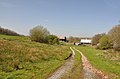
 Along the lane towards Torcoed Fawr - geograph.org.uk - 5435192.jpg 1,469 × 1,102; 732 KB
-
 Along the narrow lane towards Llangyndeyrn - geograph.org.uk - 5429951.jpg 1,632 × 1,224; 878 KB
-
 Another blocked Carmarthenshire footpath - geograph.org.uk - 3528813.jpg 640 × 480; 170 KB
-
 Approach from the west - Four Roads - geograph.org.uk - 1259558.jpg 640 × 425; 74 KB
-

-

-
 Arhosfan fysys - Bus Stop - geograph.org.uk - 4146887.jpg 640 × 480; 69 KB
-
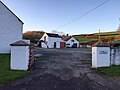
 At the cross roads, Four Roads, Llangyndeyrn - geograph.org.uk - 5196311.jpg 2,000 × 1,302; 566 KB
-
 B4309 at Pontantwn - geograph.org.uk - 6033103.jpg 3,264 × 2,448; 1.71 MB
-
 Barns at Coed Adam - geograph.org.uk - 5417006.jpg 1,469 × 1,102; 700 KB
-

-
 Bethel Baptist Chapel - geograph.org.uk - 6033100.jpg 3,264 × 2,448; 2.04 MB
-
 Bethyl Baptist Chapel Llangyndeyrn - geograph.org.uk - 1249581.jpg 640 × 425; 105 KB
-
 Block Bridge and Overgrowth - geograph.org.uk - 1291093.jpg 587 × 640; 261 KB
-
 Bragdy - geograph.org.uk - 5430016.jpg 2,448 × 1,836; 1.36 MB
-
 Bridge over a stream - geograph.org.uk - 1008250.jpg 640 × 480; 171 KB
-
 Broken Mile Stone - geograph.org.uk - 3876960.jpg 480 × 640; 87 KB
-
 Capel Bethel - geograph.org.uk - 3876967.jpg 640 × 480; 55 KB
-
 Capel Nebo - geograph.org.uk - 4145302.jpg 640 × 480; 69 KB
-
 Capel Nebo - geograph.org.uk - 4271795.jpg 480 × 640; 84 KB
-
 Capel Salem, Llangyndeyrn-geograph-5430023.jpg 2,448 × 1,836; 1.42 MB
-
 Carn Canol bus shelter - geograph.org.uk - 4156461.jpg 4,320 × 3,240; 2.94 MB
-
 Carway Farm - geograph.org.uk - 2083631.jpg 5,312 × 1,440; 1.37 MB
-

-
 Changing Seasons - geograph.org.uk - 6032724.jpg 3,264 × 2,448; 3.13 MB
-
 Chapel Remains, Pontyates - geograph.org.uk - 3972930.jpg 640 × 480; 97 KB
-
 Church Hall - geograph.org.uk - 6033101.jpg 3,264 × 2,448; 2.08 MB
-
 Church of St Cyndeyrn - geograph.org.uk - 5430003.jpg 1,836 × 2,448; 1.51 MB
-
 Cloigyn - geograph.org.uk - 421598.jpg 640 × 480; 92 KB
-
 Coed Adam farmhouse - geograph.org.uk - 5417000.jpg 1,632 × 1,224; 697 KB
-
 Coed Adam farmhouse - geograph.org.uk - 5417981.jpg 1,469 × 1,102; 545 KB
-
 Coed Gwempa - geograph.org.uk - 1291119.jpg 589 × 640; 196 KB
-
 Coed Gwempa - Gwempa Wood - geograph.org.uk - 6245436.jpg 1,024 × 768; 411 KB
-
 Coed Gwempa - Gwempa Wood - geograph.org.uk - 6245441.jpg 1,024 × 768; 397 KB
-
 Coed Wgan Fach - geograph.org.uk - 6032693.jpg 2,048 × 1,536; 1.16 MB
-

-
 Commemoration stone at Llangyndeyrn - geograph.org.uk - 3710773.jpg 1,330 × 950; 332 KB
-
 Country crossroads west of Pontyates - geograph.org.uk - 1259578.jpg 640 × 425; 135 KB
-
 Country lane north of Ty-llwyd - geograph.org.uk - 5418021.jpg 1,632 × 1,224; 877 KB
-

-
 Dedication stone on the bridge at Pontantwn - geograph.org.uk - 5432692.jpg 1,224 × 1,632; 1.11 MB
-
 Derelict barn or farm building - geograph.org.uk - 5435195.jpg 1,469 × 1,102; 893 KB
-
 Derelict building at Felindre, Llangyndeyrn - geograph.org.uk - 6171792.jpg 2,000 × 1,500; 989 KB
-
 Derelict cottage - Pontantwyn - geograph.org.uk - 1258265.jpg 640 × 425; 76 KB
-
 Derelict water wheel - Trysych Mill - geograph.org.uk - 1259744.jpg 640 × 425; 169 KB
-

-
 Derwen ar heol fach - Oak tree on minor road - geograph.org.uk - 6584034.jpg 1,024 × 768; 259 KB
-
 Electricity supply lines - geograph.org.uk - 6503693.jpg 1,536 × 2,048; 776 KB
-
 Entrance to Brynynyd Farm - geograph.org.uk - 5418027.jpg 1,632 × 1,224; 868 KB
-
 Entrance to Pencelli farm - geograph.org.uk - 5430044.jpg 1,958 × 1,469; 768 KB
-
 Evening sun over the Gwendraeth Fach valley - geograph.org.uk - 5434170.jpg 1,469 × 1,102; 661 KB
-
 Farm lane and daffodils - Pontyates - geograph.org.uk - 1243717.jpg 640 × 425; 151 KB
-
-
 Farm track across fields - geograph.org.uk - 5418032.jpg 1,306 × 979; 591 KB
-
 Farm track south of Cwmisfael - geograph.org.uk - 1258400.jpg 640 × 425; 134 KB
-
 Farmhouse ^ barns at Llwynpiod - geograph.org.uk - 5432993.jpg 1,632 × 1,224; 689 KB
-

-
 Farmland west of Cwmisfael - geograph.org.uk - 5418039.jpg 1,632 × 1,224; 682 KB
-
 Ffarm Capel Dyddgen Farm - geograph.org.uk - 4809640.jpg 640 × 480; 61 KB
-
 Ffarm Maes y Meillion - Maes y Meillion Farm - geograph.org.uk - 6584016.jpg 1,024 × 767; 190 KB
-
 Ffarm y Cwm Farm - geograph.org.uk - 4145314.jpg 640 × 480; 100 KB
-
 Fferm y Llandre - geograph.org.uk - 5592926.jpg 3,264 × 2,448; 1.76 MB
-
 Field near Coed-Wgan-fach - geograph.org.uk - 5429950.jpg 1,958 × 1,469; 1.07 MB
-
 Field near Tygwyn Farm - geograph.org.uk - 5418012.jpg 1,632 × 1,224; 824 KB
-
 Fields north of Gilfach Farm - geograph.org.uk - 5418034.jpg 1,632 × 1,224; 704 KB
-
 Footpath blacked by silage bale - geograph.org.uk - 6502425.jpg 1,536 × 2,048; 2.08 MB
-
 Four roads at Four Roads - geograph.org.uk - 580163.jpg 640 × 480; 84 KB
-
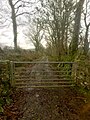 Gate and track - geograph.org.uk - 6032296.jpg 1,536 × 2,048; 1.25 MB
-
 Ger - Near Bancffosfelen - geograph.org.uk - 4145308.jpg 640 × 480; 84 KB
-
 Glanyrynys Farm - geograph.org.uk - 6032700.jpg 3,264 × 2,448; 2.59 MB
-
 Glyn Abbey west of Pontyates - geograph.org.uk - 1259642.jpg 640 × 425; 133 KB
-
 Glyn Abbey west of Pontyates - geograph.org.uk - 1259649.jpg 640 × 425; 140 KB
-
 Glynhir farm - geograph.org.uk - 6503696.jpg 1,536 × 2,048; 1.66 MB
-

-
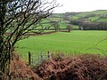
 Grazing land and fields east of Coed Adam farm - geograph.org.uk - 5419489.jpg 1,632 × 1,224; 606 KB
-
 Grazing land and Welsh Blacks above Llangyndeyrn - geograph.org.uk - 5429952.jpg 1,632 × 1,224; 813 KB
-
 Green lane - geograph.org.uk - 6503686.jpg 1,536 × 2,048; 1.74 MB
-
 Gwempa Standing Stone - geograph.org.uk - 2531085.jpg 1,024 × 768; 151 KB
-

-
 Gwendraeth Fawr - geograph.org.uk - 6503792.jpg 2,048 × 1,536; 1.49 MB
-
 Hayfield north of Ty-llwyd - geograph.org.uk - 5418024.jpg 1,632 × 1,224; 739 KB
-

-

-

-
 Heol dan ddwr - Road under water - geograph.org.uk - 4809427.jpg 640 × 480; 82 KB
-

-

-

-

-

-

-
 Heol fach i Grwbin - Minor road to Crwbin - geograph.org.uk - 6584051.jpg 1,024 × 768; 219 KB
-
 Heol fynediad i ffarm - Access road to farm - geograph.org.uk - 6597506.jpg 1,024 × 768; 167 KB
-
 Heol ger Gwyndy - A road near Gwyndy - geograph.org.uk - 6583365.jpg 1,024 × 768; 191 KB
-
 Heol i Gwmisfael - Road to Cwmisfael - geograph.org.uk - 6583361.jpg 1,024 × 768; 242 KB
-
 Hillside lane - geograph.org.uk - 5434136.jpg 1,469 × 1,102; 601 KB
-
 House at the lane junction - geograph.org.uk - 5435198.jpg 1,469 × 1,102; 703 KB
-
 In search of Bwrdd Arthur (1) - geograph.org.uk - 4157572.jpg 4,320 × 2,160; 1.68 MB
-
 In search of Bwrdd Arthur (2) - geograph.org.uk - 4157614.jpg 4,315 × 2,403; 2.1 MB
-
 Junction at Banc y Bettws - geograph.org.uk - 5432989.jpg 1,469 × 1,102; 710 KB
-
 Junction of lanes above Llangyndeyrn - geograph.org.uk - 5429954.jpg 1,795 × 1,346; 806 KB
-
 Junction of lanes near Llangyndeyrn - geograph.org.uk - 5419485.jpg 1,632 × 1,224; 707 KB
-

-
 Lane past Llwynpiod farm - geograph.org.uk - 5432991.jpg 1,469 × 1,102; 611 KB
-

-

-
 Lane south of Pontantwn - geograph.org.uk - 1258247.jpg 640 × 425; 112 KB
-
 Lane to Felindre and Trysych Mill - geograph.org.uk - 1259723.jpg 640 × 425; 77 KB
-
 Lane to Felindre and Trysych Mill - geograph.org.uk - 1259727.jpg 640 × 425; 87 KB
-
 Lane to Llangyndeyrn - geograph.org.uk - 5418041.jpg 1,632 × 1,224; 725 KB
-
 Lane to Plasbach near Llangyndeyrn - geograph.org.uk - 1248491.jpg 640 × 425; 169 KB
-
 Lane towards Bwlchymynydd - geograph.org.uk - 5418035.jpg 1,632 × 1,224; 719 KB
-
 Large grass triangle - geograph.org.uk - 5434154.jpg 1,469 × 1,102; 734 KB
-
 Lime kilns west of Four Roads - geograph.org.uk - 1259400.jpg 640 × 425; 148 KB
-
 Lime kilns west of Four Roads - geograph.org.uk - 1259411.jpg 640 × 425; 160 KB
-
 Lime kilns west of Four Roads - geograph.org.uk - 1259420.jpg 640 × 425; 178 KB
-
 Lime kilns west of Four Roads - geograph.org.uk - 1259444.jpg 640 × 425; 128 KB
-
 Llif ar yr heol - Flood on the road - geograph.org.uk - 6583388.jpg 1,024 × 768; 256 KB
-
 Llwybr Bwlchchwythaint - Bwlchchwythaint Path - geograph.org.uk - 6245454.jpg 1,024 × 768; 286 KB
-
 Llwybr Ceffyl Llangyndeyrn Bridleway - geograph.org.uk - 4809324.jpg 640 × 480; 93 KB
-
 Llwybr Clos Teg - Clos Teg path - geograph.org.uk - 4809346.jpg 640 × 480; 123 KB
-
 Llwybr Coed Adam - Coed Adam path - geograph.org.uk - 6583383.jpg 1,024 × 768; 249 KB
-
 Llwybr Coed Adam - Coed Adam path - geograph.org.uk - 6583385.jpg 1,024 × 767; 209 KB
-

-

-

-

-

-

-

-

-

-

-
 Llwybr ger Minyrafon - Path near Minyrafon - geograph.org.uk - 6583337.jpg 1,024 × 768; 243 KB
-
 Llwybr ger Pantycwarre - Path near Pantycwarre - geograph.org.uk - 6583341.jpg 1,024 × 768; 279 KB
-
 Llwybr ger Plasgwyn - Path near Plasgwyn - geograph.org.uk - 6583377.jpg 1,024 × 768; 223 KB
-
 Llwybr ger Rhydw Fach - Path near Rhydw Fach - geograph.org.uk - 6597501.jpg 1,024 × 768; 297 KB
-
 Llwybr ger Tygwyn - Path near Tygwyn - geograph.org.uk - 6583379.jpg 1,024 × 768; 328 KB
-
 Llwybr Greenhall - Greenhall Path - geograph.org.uk - 6243302.jpg 1,024 × 767; 171 KB
-
 Llwybr Greenhall - Greenhall Path - geograph.org.uk - 6243327.jpg 1,024 × 768; 331 KB
-
 Llwybr Greenhall - Greenhall Path - geograph.org.uk - 6243338.jpg 1,024 × 768; 279 KB
-
 Llwybr i Grwbin - Path to Crwbin - geograph.org.uk - 6591835.jpg 1,024 × 768; 358 KB
-
 Llwybr i Whitehall - Path to Whitehall - geograph.org.uk - 6245397.jpg 1,024 × 773; 208 KB
-
 Llwybr Penybanc Path - geograph.org.uk - 4081657.jpg 640 × 480; 148 KB
-

-

-

-
 Llwybr Waun-gwiail-fawr - Waun-gwiail-fawr path - geograph.org.uk - 6243181.jpg 1,024 × 768; 296 KB
-
 Llwybr y Wern - Wern Path - geograph.org.uk - 4809654.jpg 640 × 480; 110 KB
-

-

-
 Llwybr yn gadael yr heol - Path exiting the road - geograph.org.uk - 6583355.jpg 1,024 × 768; 253 KB
-
 Llwybr yn gadael yr heol - Path exiting the road - geograph.org.uk - 6584268.jpg 1,024 × 768; 207 KB
-
 Llwybr yn gadael yr heol - Path exiting the road - geograph.org.uk - 6584287.jpg 1,024 × 768; 301 KB
-
 Llwybr yn rhydio nant - Path fording a stream - geograph.org.uk - 6583382.jpg 1,024 × 767; 364 KB
-
 Llwybr Ynys Fawr - Ynys Fawr Footpath - geograph.org.uk - 5796667.jpg 640 × 480; 152 KB
-
 Llwynteg, Pontantwn - geograph.org.uk - 6033102.jpg 3,264 × 2,448; 2.07 MB
-
 Lone tree on lane to Felindre - geograph.org.uk - 1259718.jpg 640 × 425; 65 KB
-
 Maenhir - Standing Stone - geograph.org.uk - 4809375.jpg 640 × 480; 68 KB
-

-
 Mile Post, Pontantwn - geograph.org.uk - 3972899.jpg 480 × 640; 105 KB
-
 Milepost at Pontantwn - geograph.org.uk - 6033104.jpg 2,448 × 3,264; 3.3 MB
-
 Mill Wheel some restoration required - geograph.org.uk - 1291126.jpg 594 × 640; 211 KB
-
 Millstream - Trysych Mill - geograph.org.uk - 1259892.jpg 640 × 425; 163 KB
-

-
 Muddy road and tracks - geograph.org.uk - 6032298.jpg 2,048 × 1,536; 1.01 MB
-
 Mynedfa i Goed Gwempa - Access to Gwempa Wood - geograph.org.uk - 6245425.jpg 1,024 × 768; 331 KB
-
 Mynediad Danyrallt - Danyrallt Entrance - geograph.org.uk - 6245416.jpg 1,024 × 768; 221 KB
-
 Mynydd Llangyndeirn - geograph.org.uk - 4081933.jpg 640 × 480; 61 KB
-
 Mynydd Llangyndeyrn - geograph.org.uk - 3363440.jpg 2,592 × 1,944; 1.79 MB
-
 Nant Drysgyrch Stream - geograph.org.uk - 4081673.jpg 640 × 480; 123 KB
-
 Narrow lane down the hill - geograph.org.uk - 5432987.jpg 1,102 × 1,469; 650 KB
-
 New barn on the slopes of Mynydd Llangyndeyrn - geograph.org.uk - 5434116.jpg 1,469 × 1,102; 711 KB
-

-
 Obstruction on Carmarthenshire footpath 30-52-1 - geograph.org.uk - 4132182.jpg 1,000 × 750; 275 KB
-

-

-

-
 Old milk churn stand at Torcoed Fawr farm - geograph.org.uk - 5434167.jpg 1,469 × 1,102; 943 KB
-
 Old School at Meinciau - geograph.org.uk - 3972850.jpg 640 × 480; 55 KB
-
 On the lane near Gwyndy - geograph.org.uk - 5419478.jpg 1,632 × 1,224; 756 KB
-
 Ordnance Survey Cut Mark - geograph.org.uk - 3876911.jpg 480 × 640; 104 KB
-
 Ordnance Survey Cut Mark - geograph.org.uk - 3876919.jpg 480 × 640; 95 KB
-
 Ordnance Survey Cut Mark - geograph.org.uk - 3876927.jpg 480 × 640; 101 KB
-
 Ordnance Survey Cut Mark - geograph.org.uk - 3876937.jpg 480 × 640; 91 KB
-
 Ordnance Survey Cut Mark - geograph.org.uk - 3876946.jpg 480 × 640; 115 KB
-
 Ordnance Survey Cut Mark - geograph.org.uk - 3876956.jpg 480 × 640; 120 KB
-
 Ordnance Survey Cut Mark - geograph.org.uk - 3972808.jpg 480 × 640; 115 KB
-
 Ordnance Survey Cut Mark - geograph.org.uk - 3972822.jpg 480 × 640; 124 KB
-
 Ordnance Survey Cut Mark - geograph.org.uk - 3972837.jpg 480 × 640; 138 KB
-
 Ordnance Survey Cut Mark - geograph.org.uk - 3972920.jpg 480 × 640; 109 KB
-
 Ordnance Survey Cut Mark - geograph.org.uk - 3973066.jpg 480 × 640; 104 KB
-
 Ordnance Survey Cut Mark - geograph.org.uk - 4300119.jpg 480 × 640; 115 KB
-
 Ordnance Survey Cut Mark - geograph.org.uk - 4300125.jpg 480 × 640; 104 KB
-
 Ordnance Survey Cut Mark - geograph.org.uk - 4300129.jpg 480 × 640; 91 KB
-
 Ordnance Survey Cut Mark - geograph.org.uk - 4300134.jpg 480 × 640; 121 KB
-
 Ordnance Survey Cut Mark - geograph.org.uk - 4300144.jpg 480 × 640; 94 KB
-
 Ordnance Survey Cut Mark - geograph.org.uk - 4300148.jpg 480 × 640; 119 KB
-
 Ordnance Survey Cut Mark - geograph.org.uk - 4300151.jpg 480 × 640; 105 KB


_-_geograph.org.uk_-_4157572.jpg)
_-_geograph.org.uk_-_4157614.jpg)


