Category:Llangynog, Carmarthenshire
Jump to navigation
Jump to search
village and community in Carmarthenshire, Wales, United Kingdom  | |||||
| Upload media | |||||
| Pronunciation audio | |||||
|---|---|---|---|---|---|
| Instance of | |||||
| Named after | |||||
| Location | Carmarthenshire, Wales | ||||
| Population |
| ||||
| Area |
| ||||
 | |||||
Cymraeg: Pentref a chymuned yn Sir Gaerfyrddin yw Llangynog. Saif i'r dwyrain o Sanclêr ac i'r de o'r briffordd A40 rhwng Sanclêr a Chaerfyrddin.
Subcategories
This category has the following 4 subcategories, out of 4 total.
E
- Ebenezer Chapel, Llangynog (12 F)
L
Media in category "Llangynog, Carmarthenshire"
The following 111 files are in this category, out of 111 total.
-
 002osd000000014u00296000.jpg 4,798 × 4,188; 2.75 MB
-
 A sad sight... - geograph.org.uk - 3405836.jpg 1,024 × 680; 176 KB
-
 A40 westbound near Bancyfelin - geograph.org.uk - 3267632.jpg 640 × 480; 43 KB
-
 A40 westbound near Sarnau - geograph.org.uk - 3267628.jpg 640 × 481; 50 KB
-
 A40, eastbound - geograph.org.uk - 3708734.jpg 640 × 430; 32 KB
-

-
 Afon Cywyn - geograph.org.uk - 2922067.jpg 3,264 × 2,448; 5.37 MB
-
 Amaleco Farm - geograph.org.uk - 3405889.jpg 1,024 × 680; 209 KB
-
 Arable field and pylons - geograph.org.uk - 3405899.jpg 1,024 × 680; 136 KB
-
 Ardderfin - geograph.org.uk - 1091958.jpg 640 × 480; 85 KB
-

-
 Burial Chamber - geograph.org.uk - 153613.jpg 640 × 481; 594 KB
-
 Bus shelter in Llangynog - geograph.org.uk - 3406888.jpg 1,024 × 680; 201 KB
-
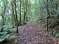
 Carmarthenshire Footpath - geograph.org.uk - 3036786.jpg 800 × 600; 670 KB
-
 Cattle pen on a wet day - geograph.org.uk - 1077741.jpg 640 × 480; 80 KB
-
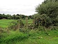
 Coed Wern Ddu Nature Reserve - geograph.org.uk - 1118108.jpg 640 × 480; 138 KB
-
 Coomb Cheshire Home - geograph.org.uk - 1054218.jpg 640 × 480; 76 KB
-
 Country road near Llangynog - geograph.org.uk - 3406842.jpg 1,024 × 680; 203 KB
-
 Country road, pylons and farmland - geograph.org.uk - 3406793.jpg 1,024 × 680; 246 KB
-
 Countryside - geograph.org.uk - 1074854.jpg 640 × 320; 36 KB
-

-
 Croes-y-ceilog Farm - geograph.org.uk - 1113053.jpg 640 × 480; 78 KB
-
 Crossroads near Wern Inn ruins - geograph.org.uk - 5063425.jpg 2,576 × 1,932; 1.24 MB
-
 Cywyn valley - geograph.org.uk - 3403587.jpg 1,024 × 680; 258 KB
-
 Derelict cottage - geograph.org.uk - 1076653.jpg 640 × 480; 119 KB
-
 Earthworks near Llangynog - geograph.org.uk - 3403548.jpg 1,024 × 680; 235 KB
-
 Ebenezer Baptist Chapel, Llangynog - geograph.org.uk - 4825395.jpg 2,576 × 1,932; 1.25 MB
-
 Electricity pylons - geograph.org.uk - 3405757.jpg 1,024 × 680; 184 KB
-
 Electricity pylons - geograph.org.uk - 3405864.jpg 680 × 1,024; 121 KB
-
 Farm building at Ty Canol - geograph.org.uk - 1113048.jpg 640 × 472; 76 KB
-
 Farmland and woodland near Llangynog - geograph.org.uk - 3405881.jpg 1,024 × 680; 185 KB
-
 Farmland near Llangynog - geograph.org.uk - 3403557.jpg 1,024 × 680; 205 KB
-
 Farmland track near Pentrenewydd - geograph.org.uk - 3405731.jpg 680 × 1,024; 183 KB
-
 Ffarm Amaleco - Amaleco Farm - geograph.org.uk - 5880494.jpg 1,024 × 768; 176 KB
-
 Ffarm Rhydychen - Rhydychen Farm - geograph.org.uk - 5898443.jpg 1,024 × 768; 243 KB
-
 Field above Penycoed - geograph.org.uk - 3405907.jpg 1,024 × 680; 203 KB
-
 Field near Llangynog - geograph.org.uk - 3406884.jpg 1,024 × 680; 199 KB
-
 Field view - geograph.org.uk - 1103501.jpg 640 × 320; 48 KB
-
 Footpath and track - geograph.org.uk - 3403608.jpg 1,024 × 680; 255 KB
-
 Footpath bridge - geograph.org.uk - 2574066.jpg 1,600 × 1,200; 671 KB
-
 Footpath bridge over stream - geograph.org.uk - 4886714.jpg 900 × 600; 306 KB
-
 Frosty track - geograph.org.uk - 1103473.jpg 480 × 640; 147 KB
-
 Grazing near Lan-y-gors - geograph.org.uk - 6308324.jpg 640 × 360; 56 KB
-
 Junction of country roads - geograph.org.uk - 3403629.jpg 1,024 × 680; 270 KB
-
 Lane and Pylons - geograph.org.uk - 1074762.jpg 640 × 480; 93 KB
-
 Lane between Llangynog and Llanybri - geograph.org.uk - 1040431.jpg 640 × 480; 121 KB
-
 Lane to Pengelli Uchaf Farm - geograph.org.uk - 517053.jpg 640 × 460; 65 KB
-
 Lane towards Coomb Mill - geograph.org.uk - 1075797.jpg 480 × 640; 135 KB
-
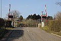 Level crossing near Sarnau - geograph.org.uk - 3403642.jpg 1,024 × 680; 176 KB
-
 Level crossing, Sarnau - geograph.org.uk - 2183903.jpg 640 × 480; 67 KB
-
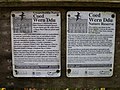
 Llangynog Information Board - geograph.org.uk - 4825366.jpg 2,576 × 1,932; 1.15 MB
-
 Llangynog Information Board - geograph.org.uk - 4825367.jpg 2,576 × 1,932; 1.16 MB
-
 Llangynog Village Hall - geograph.org.uk - 4825364.jpg 2,576 × 1,932; 1.22 MB
-
 Llwybr Ardderfin - Ardderfin Path - geograph.org.uk - 5885932.jpg 1,024 × 768; 218 KB
-
 Llwybr Ardderfin - Ardderfin Path - geograph.org.uk - 5885946.jpg 1,024 × 768; 218 KB
-
 Llwybr Ardderfin - Ardderfin Path - geograph.org.uk - 5885960.jpg 1,024 × 768; 225 KB
-
 Llwybr Ffarm Llangynog - Llangynog Farm Footpath - geograph.org.uk - 5885870.jpg 1,024 × 768; 368 KB
-
 Llwybr Ffarm Trehyrne - Trehyrne Farm Path - geograph.org.uk - 5885882.jpg 1,024 × 768; 359 KB
-
 Llwybr Ffarm y Gelli - Gelli Farm Path - geograph.org.uk - 5885896.jpg 1,024 × 768; 365 KB
-
 Llwybr ger Coed Moefre - Path near Moelfre Wood - geograph.org.uk - 5880482.jpg 1,024 × 768; 347 KB
-
 Llwybr ger Ty-rhos - A path near Ty-rhos - geograph.org.uk - 5885911.jpg 1,024 × 768; 257 KB
-
 Llwybr Lambstone - Lambstone Path - geograph.org.uk - 5880462.jpg 1,024 × 768; 368 KB
-
 Llwybr Llandeilo Abercywyn Path - geograph.org.uk - 4623164.jpg 640 × 480; 96 KB
-
 Llwybr y Gelli - Gelli Path - geograph.org.uk - 5885894.jpg 1,024 × 768; 324 KB
-
 Marshy farmland - geograph.org.uk - 3405771.jpg 1,024 × 680; 241 KB
-
 Meini Elwydion - geograph.org.uk - 917745.jpg 640 × 423; 83 KB
-
 Moelfre Woods - geograph.org.uk - 1091986.jpg 640 × 410; 56 KB
-
-
 Old A40 road Bancyfelin - geograph.org.uk - 2922078.jpg 3,264 × 2,448; 4.52 MB
-
 Old A40 road Bancyfelin - geograph.org.uk - 2922090.jpg 3,264 × 2,448; 4.3 MB
-
 Ordnance Survey Cut Mark - geograph.org.uk - 5371940.jpg 640 × 623; 74 KB
-
 Ordnance Survey Cut Mark - geograph.org.uk - 5371944.jpg 640 × 456; 132 KB
-
 Ordnance Survey Trig Pillar S2370 - geograph.org.uk - 3525326.jpg 4,000 × 3,000; 3.08 MB
-
 Plas Farm, near Bancyfelin - geograph.org.uk - 3403601.jpg 1,024 × 680; 218 KB
-
 Ploughed field above Penycoed - geograph.org.uk - 3406783.jpg 1,024 × 680; 265 KB
-
 Ploughed field near Llangynog - geograph.org.uk - 3406770.jpg 1,024 × 680; 281 KB
-
 Pompren yn Llangynog - Footbridge in Llangynog - geograph.org.uk - 5880468.jpg 1,024 × 768; 299 KB
-
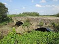 Pont-ddu - geograph.org.uk - 4655090.jpg 640 × 480; 107 KB
-
 Power lines over rough grazing - geograph.org.uk - 1103511.jpg 640 × 480; 70 KB
-
 Pretoria Buildings - geograph.org.uk - 6303902.jpg 800 × 457; 71 KB
-
 Pylons crossing farmland - geograph.org.uk - 3406812.jpg 1,024 × 680; 134 KB
-
 Pylons, a country road and farmland - geograph.org.uk - 3405854.jpg 1,024 × 680; 173 KB
-
 Road and rail - geograph.org.uk - 2930422.jpg 3,264 × 2,448; 3.37 MB
-
 Road Bridge and Sarnau Crossing, Bancyfelin - geograph.org.uk - 4825363.jpg 2,576 × 1,932; 1.25 MB
-
 Road junction in Coedcae - geograph.org.uk - 3403618.jpg 1,024 × 680; 275 KB
-
 Road Junction, Llangynog - geograph.org.uk - 4825423.jpg 2,576 × 1,932; 1.24 MB
-
 Road to Carmarthen - geograph.org.uk - 3406870.jpg 1,024 × 680; 169 KB
-
 Rough farmland near Castell-y-Garthen - geograph.org.uk - 3405800.jpg 1,024 × 680; 231 KB
-
 Rough grazing near Llangynog - geograph.org.uk - 3406876.jpg 1,024 × 680; 262 KB
-
 Signpost at Penplas - geograph.org.uk - 853641.jpg 640 × 480; 58 KB
-
 Sticil Anniogel - Unsafe Stile - geograph.org.uk - 4623174.jpg 640 × 480; 122 KB
-
 Stone Wall - geograph.org.uk - 1054260.jpg 640 × 480; 120 KB
-
 Tal-y-bont farm taken near Pont-ddu - geograph.org.uk - 1039932.jpg 640 × 480; 34 KB
-
 Tal-y-bont farm viewed from Pont-ddu - geograph.org.uk - 1042205.jpg 640 × 480; 40 KB
-
 The A40 westbound at the Llangynog turnoff - geograph.org.uk - 4335787.jpg 1,600 × 1,062; 314 KB
-

-
 The Wern Inn, Llangynog - geograph.org.uk - 1048637.jpg 640 × 480; 53 KB
-
 This Bridge is.... sign - geograph.org.uk - 2922110.jpg 3,264 × 2,448; 3.13 MB
-
 Trees in a hedgerow - geograph.org.uk - 3405783.jpg 1,024 × 680; 187 KB
-
 Trehyrne Farm - geograph.org.uk - 3405848.jpg 1,024 × 680; 133 KB
-
 View to Cowin Grove - geograph.org.uk - 3403578.jpg 1,024 × 680; 208 KB
-
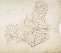
 Wales Carmarthenshire Community Llangynog map.svg 512 × 399; 1.12 MB
-
 Walking Carmarthenshire's "footpaths" - geograph.org.uk - 4413493.jpg 800 × 600; 248 KB
-
 Wern Inn Ruins - geograph.org.uk - 5063431.jpg 2,576 × 1,932; 1.25 MB
-
 Wern Inn Ruins - geograph.org.uk - 5063433.jpg 2,576 × 1,932; 1.25 MB
-
 Wern Inn Ruins - geograph.org.uk - 5063437.jpg 2,576 × 1,932; 1.25 MB
-
 Wern Inn Ruins - geograph.org.uk - 5063439.jpg 2,576 × 1,932; 1.24 MB
-

-
 Farmland near Pen-parciau - geograph.org.uk - 578113.jpg 640 × 480; 68 KB
-
 Parc-y-Rhos farm - geograph.org.uk - 578107.jpg 640 × 480; 77 KB
-
 Parce Bach - geograph.org.uk - 578118.jpg 640 × 480; 79 KB


