Category:Llanharry
Jump to navigation
Jump to search
village and community in Rhondda Cynon Taf, Wales, UK   | |||||
| Upload media | |||||
| Instance of | |||||
|---|---|---|---|---|---|
| Location | Rhondda Cynon Taf, Wales | ||||
| Population |
| ||||
 | |||||
Cymraeg: Mae Llanhari yn bentref bach a chymuned yn Rhondda Cynon Taf (Cyfeirnod OS: ST0080), i'r gogledd-orllewin o Gaerdydd ger Bontyclun. Cloddwyd haearn yn Llanharri cyn belled yn ôl ag adeg y Rhufeiniaid ac oes Elisabeth ac am gyfnod yn ystod y 20fed ganrif roedd y dref yn lleoliad i'r unig gloddfa haearn yng Nghymru. Mae'n bosibl mae'r un enw personol 'Harri' sydd yma a sydd yn y plwyf agos, Llanharan, sef, efallai, Aaron.
English: Llanharry is a small village and community in the county borough of Rhondda Cynon Taf, Wales.
Subcategories
This category has only the following subcategory.
S
Media in category "Llanharry"
The following 111 files are in this category, out of 111 total.
-
 'Mill' conversion, Pontyclun. - geograph.org.uk - 914800.jpg 640 × 480; 100 KB
-
 100 metre long A473 layby, Pontyclun - geograph.org.uk - 4028599.jpg 800 × 545; 107 KB
-
 2010 Wales Rhondda Cynon Taf Community Llanharry map.svg 512 × 737; 416 KB
-
 2024 Wales Rhondda Cynon Taf Community Llanharry map.svg 512 × 737; 369 KB
-

-
 A473 heads east towards Talbot Green - geograph.org.uk - 2305365.jpg 640 × 477; 66 KB
-

-
 Abandoned Mercedes - geograph.org.uk - 5951778.jpg 3,264 × 2,448; 1.78 MB
-
 Addison Avenue Bridge, M4 - geograph.org.uk - 3683095.jpg 640 × 430; 41 KB
-
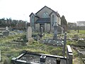
 Cemetery near Llanharry - geograph.org.uk - 2627854.jpg 4,000 × 3,000; 2.29 MB
-
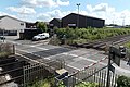 Coedcae Lane level crossing, Pontyclun - geograph.org.uk - 4014455.jpg 800 × 532; 154 KB
-

-
 DDS Discount Tyres in Pontyclun - geograph.org.uk - 4028591.jpg 800 × 605; 123 KB
-
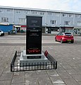 Dedications on Llanharry War Memorial - geograph.org.uk - 6821861.jpg 1,533 × 1,600; 540 KB
-
 Degar Farm, Llanharry - geograph.org.uk - 2627855.jpg 4,000 × 3,000; 2.1 MB
-
 Derelict building (disused mine), Llanharry - geograph.org.uk - 5657500.jpg 4,320 × 3,240; 3.17 MB
-

-

-
 Entering Llanharry on Llanharry Rd - geograph.org.uk - 5657502.jpg 4,320 × 3,240; 2.98 MB
-

-

-
 Fforest road bridge over M4 - geograph.org.uk - 3125798.jpg 640 × 391; 49 KB
-
 Fforest Road Bridge, M4 - geograph.org.uk - 3683094.jpg 640 × 379; 32 KB
-
 Floor-De-Lee in Pontyclun - geograph.org.uk - 4026429.jpg 800 × 535; 114 KB
-
 Fox and Hounds Inn, Llanharry Road - geograph.org.uk - 2750062.jpg 640 × 480; 55 KB
-

-
 Heol Y Twyn, Talbot Green - geograph.org.uk - 2305349.jpg 640 × 431; 58 KB
-
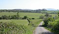
 Lane near Llanharry - geograph.org.uk - 5657497.jpg 4,320 × 3,240; 3.11 MB
-
 Lane north of Llanharry - geograph.org.uk - 406572 (cropped).jpg 448 × 256; 57 KB
-
 Level crossing on Coedcae Lane - geograph.org.uk - 2750080.jpg 640 × 480; 55 KB
-
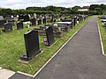 Llanharry Cemetery - geograph.org.uk - 5425788.jpg 3,264 × 2,448; 3.33 MB
-
 Llanharry Road - geograph.org.uk - 2750051.jpg 640 × 480; 68 KB
-
 Llanharry Road at Trecastell - geograph.org.uk - 2750090.jpg 640 × 480; 51 KB
-
 Llanharry SPAR - geograph.org.uk - 6821832.jpg 1,600 × 931; 289 KB
-
 Llanilid Former Opencast - geograph.org.uk - 305961.jpg 640 × 427; 172 KB
-
 Llanilid Former Opencast - geograph.org.uk - 406585.jpg 640 × 427; 127 KB
-
 Llechau Farm - geograph.org.uk - 5945302.jpg 2,999 × 2,250; 1.38 MB
-
 Llechau, Llanharry.jpg 2,592 × 1,936; 1.74 MB
-
 Llwybr i Heol y Fforest - Path to Fforest Road - geograph.org.uk - 6223369.jpg 1,024 × 768; 276 KB
-
 Llwybr yn Llanharri - Path in Llanharry - geograph.org.uk - 6223367.jpg 1,024 × 768; 242 KB
-
 Llwyn On, Pontyclun - geograph.org.uk - 4014394.jpg 800 × 441; 114 KB
-
 M4 eastbound towards junction 34 - geograph.org.uk - 4321399.jpg 1,600 × 1,218; 970 KB
-
 M4 near Llanharry - geograph.org.uk - 4144987.jpg 661 × 800; 58 KB
-

-
 Merch Asylum, Pontyclun - geograph.org.uk - 4026408.jpg 800 × 522; 98 KB
-

-

-
 Oak Furniture Factory, Pomtyclun - geograph.org.uk - 4028592.jpg 800 × 465; 83 KB
-
 Orchard in Pontyclun - geograph.org.uk - 4028587.jpg 800 × 605; 107 KB
-
 Ordnance Survey Cut Mark - geograph.org.uk - 5780657.jpg 640 × 448; 115 KB
-
 Ordnance Survey Flush Bracket (S9117) - geograph.org.uk - 5755150.jpg 518 × 640; 136 KB
-
 Packstat Ltd in Pontyclun - geograph.org.uk - 4026360.jpg 800 × 435; 74 KB
-
 Paper House Plus in Pontyclun - geograph.org.uk - 4028588.jpg 800 × 517; 109 KB
-
 Peniel Chapel and burial ground, Llanharry - geograph.org.uk - 5657559.jpg 4,320 × 3,240; 2.77 MB
-
 Peniel Chapel, Llanharry - geograph.org.uk - 5657554.jpg 4,095 × 3,108; 4.06 MB
-
 Peniel Chapel, Llanharry - geograph.org.uk - 5657562.jpg 3,832 × 2,306; 2.55 MB
-
 Playground and bus-shelter, Llanharry - geograph.org.uk - 5657507.jpg 4,320 × 3,240; 2.74 MB
-
 Pontyclun Grid Substation - geograph.org.uk - 4028593.jpg 800 × 472; 128 KB
-
 Quarry buildings viewed from Talygarn - geograph.org.uk - 4023937.jpg 641 × 800; 218 KB
-

-
 RAC at sunset - geograph.org.uk - 5951777.jpg 3,264 × 2,448; 1.83 MB
-
 Railway at Tylegarw - geograph.org.uk - 6097488.jpg 2,048 × 1,536; 819 KB
-
 Railway near Pontyclun - geograph.org.uk - 6408067.jpg 1,200 × 807; 1.35 MB
-

-
 Reliance offices, Talbot Green - geograph.org.uk - 2305343.jpg 640 × 480; 73 KB
-
 Rhondda Cynon Taf , M4 Motorway - geograph.org.uk - 3926571.jpg 4,288 × 2,848; 4.42 MB
-
 Rhondda Cynon Taf , M4 Motorway - geograph.org.uk - 3926574.jpg 4,288 × 2,848; 4.66 MB
-
 Rhondda Cynon Taf , M4 Motorway - geograph.org.uk - 3928372.jpg 4,288 × 2,848; 5.68 MB
-
 Rhondda Cynon Taf , M4 Motorway - geograph.org.uk - 3928374.jpg 4,288 × 2,848; 5.17 MB
-
 Rhondda Cynon Taf , M4 Motorway - geograph.org.uk - 3928381.jpg 4,288 × 2,848; 5.05 MB
-
 Road junction near M4, Llanharry - geograph.org.uk - 5657568.jpg 4,320 × 3,240; 2.87 MB
-
 Road to Bridgend, Talbot Green - geograph.org.uk - 2305358.jpg 640 × 519; 83 KB
-

-

-
 Southern boundary of Rhondda Cynon Taf - geograph.org.uk - 4023807.jpg 800 × 538; 160 KB
-
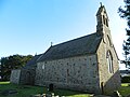
 St Illtyd's Church - geograph.org.uk - 5867656.jpg 3,000 × 2,178; 1.37 MB
-
 St Illtyd's Church, Llanharry - geograph.org.uk - 5657524.jpg 4,320 × 3,240; 2.96 MB
-
 St Illtyd's Church, Llanharry - geograph.org.uk - 5657536.jpg 3,240 × 4,320; 3.06 MB
-
 St Illtyd's Church, Llanharry - geograph.org.uk - 5657539.jpg 4,320 × 3,240; 2.76 MB
-
 Station Cafe, Pontyclun - geograph.org.uk - 4028586.jpg 800 × 605; 132 KB
-
 Stile and footpath - geograph.org.uk - 5867655.jpg 3,264 × 2,448; 3.71 MB
-
 Stile into churchyard, St Illtyd's Church, Llanharry - geograph.org.uk - 5657540.jpg 4,320 × 3,240; 2.93 MB
-
 Sycamore tree (2) - geograph.org.uk - 5951776.jpg 3,060 × 2,295; 1.95 MB
-
 Sycamore tree and tracks - geograph.org.uk - 5951775.jpg 2,448 × 3,264; 3.13 MB
-
 Sycamore, road and moonrise - geograph.org.uk - 5951779.jpg 3,264 × 2,448; 1.93 MB
-
 The Bear Inn, Llanharry - geograph.org.uk - 5657510.jpg 4,320 × 3,240; 2.92 MB
-
 The Bear Inn, Llanharry. - geograph.org.uk - 914766.jpg 640 × 480; 86 KB
-
 The Boar's Head name sign, Pontyclun - geograph.org.uk - 4026587.jpg 640 × 631; 124 KB
-
 The M4 at Llanharry - geograph.org.uk - 5657565.jpg 4,320 × 3,240; 2.78 MB
-
 TNT Llantrisant Depot in Pontyclun - geograph.org.uk - 4020911.jpg 800 × 471; 100 KB
-
 Towards Llanharan by rail from Pontyclun - geograph.org.uk - 4026527.jpg 800 × 732; 189 KB
-
 Towards Llanharan from Pontyclun by rail - geograph.org.uk - 4145279.jpg 800 × 570; 161 KB
-
 Trecastell Farm - geograph.org.uk - 5867650.jpg 2,957 × 2,170; 861 KB
-

-
 Tyre tracks into a field near Talygarn - geograph.org.uk - 4023875.jpg 800 × 516; 199 KB
-
-
 Vale of Glamorgan boundary - geograph.org.uk - 5657587.jpg 4,320 × 3,240; 2.7 MB
-

-

-
 War Memorial bench, Llanharry Road, Llanharry - geograph.org.uk - 6821876.jpg 1,600 × 1,266; 686 KB
-
 Woodland Terrace, Pontyclun - geograph.org.uk - 4026495.jpg 800 × 493; 120 KB
-
 Woody's Snack Bar, Pontyclun - geograph.org.uk - 4028598.jpg 800 × 504; 115 KB
-
 Ysgol Llanhari - geograph.org.uk - 5657545.jpg 4,320 × 3,240; 2.89 MB
-
 Argoed Isha Quarry Footpath - geograph.org.uk - 490862.jpg 640 × 480; 401 KB
-
 Fforest Road - geograph.org.uk - 490830.jpg 640 × 480; 284 KB
-
 Former Iron Ore Mine - geograph.org.uk - 406557.jpg 640 × 457; 155 KB
-
 Lane north of Llanharry - geograph.org.uk - 406572.jpg 640 × 427; 147 KB
-
 Lane nr Windmill Farm - geograph.org.uk - 490854.jpg 640 × 480; 311 KB
-
 Road leading up to Windmill Farm - geograph.org.uk - 490857.jpg 640 × 480; 307 KB
-
 Trecastell - geograph.org.uk - 406565.jpg 640 × 426; 143 KB
-
 Vale of Glamorgan Golf and Country Club - geograph.org.uk - 459891.jpg 640 × 318; 186 KB


,_Llanharry_-_geograph.org.uk_-_5657500.jpg)


,_Pontyclun_-_geograph.org.uk_-_4028590.jpg)


.jpg)


_-_geograph.org.uk_-_5755150.jpg)


_-_geograph.org.uk_-_5951776.jpg)


