Category:Llansawel
Jump to navigation
Jump to search
village and community in Carmarthenshire, Wales, UK  | |||||
| Upload media | |||||
| Instance of | |||||
|---|---|---|---|---|---|
| Location | Carmarthenshire, Wales | ||||
| Population |
| ||||
| Area |
| ||||
| Different from | |||||
 | |||||
Cymraeg: Pentref a chymuned yn Sir Gaerfyrddin yw Llansawel. Saif lle mae'r ffyrdd B4337 a B4310 yn cyfarfod, i'r gogledd o Dalyllychau ac i'r de-ddwyrain o Rydcymerau. Mae Afon Marlais yn llifo trwy'r pentref cyn ymuno ag Afon Cothi rhyw ddwy filltir i'r dwyrain.
Media in category "Llansawel"
The following 136 files are in this category, out of 136 total.
-
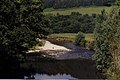 Afon Cothi - geograph.org.uk - 388973.jpg 640 × 426; 87 KB
-
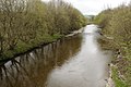 Afon Cothi-River Cothi - geograph.org.uk - 3528123.jpg 1,024 × 680; 237 KB
-
 Angel Inn - geograph.org.uk - 399304.jpg 640 × 480; 77 KB
-
 Angel Inn, Llansawel - geograph.org.uk - 3465521.jpg 1,024 × 680; 142 KB
-
 Banc Beili Tew - geograph.org.uk - 388799.jpg 640 × 480; 100 KB
-
 Banc Beili-Tew - geograph.org.uk - 3254858.jpg 1,600 × 1,200; 629 KB
-
 Banc Cwm Hywel - geograph.org.uk - 4075423.jpg 640 × 480; 61 KB
-
 Banc Cwm Hywel - geograph.org.uk - 4075435.jpg 640 × 480; 94 KB
-
 Banc Cwm-coed-ifor - geograph.org.uk - 3254839.jpg 1,600 × 1,200; 420 KB
-
 Banc Cwm-coed-ifor Walked to this Fence - geograph.org.uk - 3254845.jpg 1,600 × 1,200; 614 KB
-
 Banc Pistyll Gwyn - geograph.org.uk - 4619881.jpg 640 × 480; 88 KB
-
 Banc Pistyll Gwyn - geograph.org.uk - 4620032.jpg 640 × 480; 94 KB
-
 Banc Treglog - geograph.org.uk - 394518.jpg 640 × 423; 80 KB
-
 Bank of Trees above the Gorlech - geograph.org.uk - 4339515.jpg 1,024 × 768; 219 KB
-
 Black Lion Hotel, Llansawel - geograph.org.uk - 3465524.jpg 1,024 × 680; 139 KB
-
 Blaenresgair Farm - geograph.org.uk - 1042657.jpg 640 × 480; 60 KB
-
 Boarded up house - geograph.org.uk - 3528278.jpg 1,024 × 680; 167 KB
-
 Capel Bethel Chapel, Llansawel - geograph.org.uk - 4619930.jpg 640 × 480; 61 KB
-
 Cart ^ Horses - geograph.org.uk - 4075420.jpg 640 × 480; 129 KB
-
 Cattle grid on farm track - geograph.org.uk - 1529092.jpg 640 × 480; 85 KB
-
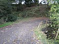
 Cilffordd Rhydcymerau Byway - geograph.org.uk - 4798504.jpg 640 × 480; 138 KB
-
 Clay Pigeon Shooting - geograph.org.uk - 394436.jpg 480 × 640; 125 KB
-
 Coed Bryn Abon - geograph.org.uk - 4075941.jpg 640 × 480; 88 KB
-
 Cwm Cottage - geograph.org.uk - 2133996.jpg 690 × 518; 235 KB
-
 Cwm Gorlech - geograph.org.uk - 1087628.jpg 640 × 480; 89 KB
-
 Drive to Tyncwm - geograph.org.uk - 3465458.jpg 1,024 × 680; 205 KB
-
 Edge of forestry - geograph.org.uk - 2030057.jpg 1,600 × 1,106; 747 KB
-
 Edwinsford (1131150).jpg 1,000 × 850; 141 KB
-
 Edwinsford Estate Bridge - geograph.org.uk - 388964.jpg 640 × 426; 126 KB
-
 Edwinsford Manor - geograph.org.uk - 563573 (cropped).jpg 361 × 361; 60 KB
-
 Edwinsford Manor - geograph.org.uk - 563573.jpg 412 × 640; 84 KB
-
 Edwinsford Mansion - geograph.org.uk - 399335.jpg 640 × 480; 110 KB
-
 Edwinsford picnic area - geograph.org.uk - 1448634.jpg 640 × 480; 83 KB
-
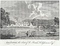
 Edwinsford, the seat of R. Banks Hodgkinson esq.jpeg 900 × 689; 172 KB
-
 Edwinsford, the Seat of R. Banks Hodgkinson Esq.jpeg 900 × 683; 395 KB
-
 Edwinsford.jpeg 900 × 675; 179 KB
-

-
 Farm fields - geograph.org.uk - 1529035.jpg 640 × 480; 84 KB
-
-
 Farmland in the Cothi valley - geograph.org.uk - 3465438.jpg 1,024 × 680; 167 KB
-
 Farmland in the Cothi valley - geograph.org.uk - 3528272.jpg 1,024 × 680; 202 KB
-
 Farmland near Llansawel - geograph.org.uk - 3528269.jpg 1,024 × 680; 179 KB
-
 Ffordd Ar Gau - Road Closed (20443436549).jpg 3,888 × 2,592; 4.45 MB
-
 Field boundary near Rhydcymerau - geograph.org.uk - 1724566.jpg 640 × 480; 100 KB
-
 Field east of Rhydcymerau - geograph.org.uk - 1067104.jpg 640 × 428; 91 KB
-
 Fields north of B4337, Llansawel - geograph.org.uk - 6281393.jpg 5,184 × 3,456; 5.06 MB
-
 Fields south of B4337 ^ B4310 - geograph.org.uk - 6281411.jpg 5,184 × 3,456; 5.86 MB
-
 Forest and natural trees. - geograph.org.uk - 1337684.jpg 640 × 480; 101 KB
-
 Forest Track - geograph.org.uk - 2030053.jpg 1,600 × 1,400; 977 KB
-
 Forestry tracks - geograph.org.uk - 1337679.jpg 640 × 480; 79 KB
-
 Garn Wen - geograph.org.uk - 4075456.jpg 596 × 418; 146 KB
-
 Georgian house in Llansawel (geograph 3465564).jpg 1,024 × 680; 147 KB
-
 Ger - Near Farm Cwm Howel Farm - geograph.org.uk - 4075480.jpg 640 × 480; 49 KB
-
-
 Hen Heol - Old Road - geograph.org.uk - 4798528.jpg 640 × 480; 118 KB
-
 Hen Heol Rhydodyn - Old Edwindsford Road - geograph.org.uk - 4079830.jpg 600 × 450; 152 KB
-
 Hen heol yr ucheldir - Old upland road - geograph.org.uk - 4798519.jpg 640 × 480; 158 KB
-
 Hen Stondin Laeth - Old Milk Stand - geograph.org.uk - 4619909.jpg 640 × 501; 108 KB
-
 Heol ar gau - Road closed. - geograph.org.uk - 4798534.jpg 640 × 480; 156 KB
-
 Heol Esgairdawe Road - geograph.org.uk - 4619861.jpg 640 × 480; 120 KB
-

-
 Heol Llansawel - Llansawel Road - geograph.org.uk - 4619842.jpg 640 × 480; 104 KB
-
 Horses in field at Bron-Yr-Haul - geograph.org.uk - 6281421.jpg 5,184 × 3,456; 6.1 MB
-
 Lan Ddu Cilwenau - geograph.org.uk - 3254820.jpg 1,600 × 1,200; 508 KB
-
 Lan Ddu Cilwenau Trig - geograph.org.uk - 3254828.jpg 1,600 × 1,200; 656 KB
-
 Llansawel - geograph.org.uk - 3465530.jpg 1,024 × 680; 157 KB
-
 Llansawel - geograph.org.uk - 4075445.jpg 640 × 480; 68 KB
-
 Llwybr Blaen Cwm Stile - geograph.org.uk - 4076173.jpg 640 × 480; 141 KB
-
-
 Llwybr ceffyl Groes - Groes bridleway - geograph.org.uk - 4619812.jpg 640 × 480; 128 KB
-
 Llwybr Ceffyl Groes Bridleway - geograph.org.uk - 4619822.jpg 640 × 480; 133 KB
-

-
 Llwybr Llansawel Path - geograph.org.uk - 4079395.jpg 640 × 480; 90 KB
-
 Llwybr Maestyle Path - geograph.org.uk - 4798484.jpg 640 × 480; 144 KB
-
 Llwybr yr Ucheldir - Upland Path - geograph.org.uk - 4798511.jpg 640 × 480; 66 KB
-
 Maes yr Haul - geograph.org.uk - 394413.jpg 640 × 430; 66 KB
-
 Minor road heading for Rhydcymerau - geograph.org.uk - 1067105.jpg 640 × 428; 108 KB
-
 Mountain Bike ^ Walking trails - geograph.org.uk - 2030049.jpg 1,600 × 1,353; 1.05 MB
-
 Mr Jones, Lord Mayor of Llansawel 1885 (cropped).jpg 364 × 534; 46 KB
-
 Neuadd Llansawel - geograph.org.uk - 3528277.jpg 1,024 × 680; 139 KB
-

-
 Ordnance Survey 1GL Bolt - geograph.org.uk - 5099439.jpg 640 × 574; 158 KB
-
 Ordnance Survey Cut Mark - geograph.org.uk - 5090756.jpg 414 × 640; 113 KB
-
 Ordnance Survey Cut Mark - geograph.org.uk - 5099444.jpg 403 × 640; 88 KB
-
 Ordnance Survey Cut Mark - geograph.org.uk - 5099449.jpg 602 × 640; 160 KB
-
 Ordnance Survey Cut Mark - geograph.org.uk - 5099458.jpg 576 × 640; 133 KB
-
 Ordnance Survey Cut Mark - geograph.org.uk - 5099517.jpg 640 × 633; 119 KB
-
 Ordnance Survey Cut Mark - geograph.org.uk - 5206885.jpg 640 × 451; 113 KB
-
 Ordnance Survey Cut Mark - geograph.org.uk - 5206889.jpg 640 × 359; 82 KB
-
 Ordnance Survey Cut Mark - geograph.org.uk - 5206892.jpg 640 × 336; 74 KB
-
 Ordnance Survey Cut Mark - geograph.org.uk - 5216321.jpg 640 × 384; 72 KB
-
 Ordnance Survey Cut Mark - geograph.org.uk - 5216376.jpg 640 × 432; 146 KB
-
 Ordnance Survey Pivot - geograph.org.uk - 5099453.jpg 640 × 446; 97 KB
-
 Ordnance Survey Rivet - geograph.org.uk - 5216379.jpg 459 × 640; 88 KB
-
 Pantiauau Farm - geograph.org.uk - 1069726.jpg 640 × 418; 59 KB
-
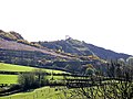
 Pen y Ddinas - geograph.org.uk - 3465462.jpg 1,024 × 680; 194 KB
-
 Pen y Ddinas - geograph.org.uk - 405747.jpg 640 × 480; 85 KB
-
 Pen y Ddinas quarry - geograph.org.uk - 4287066.jpg 800 × 533; 132 KB
-
 Pen y Ddinas quarry - geograph.org.uk - 4287075.jpg 640 × 426; 79 KB
-
 Pengelli - geograph.org.uk - 406776.jpg 640 × 480; 102 KB
-
 Penny Cottage - geograph.org.uk - 399281.jpg 640 × 480; 91 KB
-
 Queen Anne's lace - geograph.org.uk - 1306498.jpg 640 × 480; 87 KB
-
 Revd Alex Williams, Llansawel NLW3362210.jpg 414 × 583; 35 KB
-
 Road Closed - geograph.org.uk - 1067099.jpg 640 × 428; 120 KB
-
 Road through Llansawel - geograph.org.uk - 3528280.jpg 1,024 × 680; 189 KB
-
 Rough ground - geograph.org.uk - 1526316.jpg 640 × 480; 47 KB
-
 Sheep country - geograph.org.uk - 1306487.jpg 640 × 480; 110 KB
-
 Shiloh Welsh CM Chapel, Lampeter - geograph.org.uk - 3254869.jpg 1,600 × 1,200; 299 KB
-
 Small bridge on farm track - geograph.org.uk - 1529055.jpg 640 × 480; 109 KB
-
 St Sawyl's Church, Llansawel - geograph.org.uk - 6142873.jpg 1,600 × 1,200; 515 KB
-
 Sunrise - geograph.org.uk - 394419.jpg 640 × 481; 67 KB
-
 The B4337 to Llanswel - geograph.org.uk - 3465447.jpg 680 × 1,024; 312 KB
-

-
 The village of Llansawel - geograph.org.uk - 3465513.jpg 1,024 × 680; 156 KB
-
 Trefenty - geograph.org.uk - 4798489.jpg 640 × 480; 123 KB
-

-
 Valley of Nant yr Esgair - geograph.org.uk - 1069723.jpg 640 × 480; 65 KB
-
 View near Edwinsford, Carnarvonshire sic (1133999).jpg 1,000 × 844; 118 KB
-
 View near Edwinsford, Carnarvonshire sic.jpeg 900 × 699; 182 KB
-
 View to Llethr-llwyd - geograph.org.uk - 3465475.jpg 1,024 × 680; 215 KB
-
 Wales Carmarthenshire Community Llansawel map.svg 512 × 399; 1.12 MB
-
 Woodland down to River Cothi - geograph.org.uk - 1319614.jpg 640 × 480; 104 KB
-
 Woods above the road - geograph.org.uk - 1306182.jpg 640 × 480; 143 KB
-
 Blaengofiarth - geograph.org.uk - 406780.jpg 640 × 480; 132 KB
-
 Dolaugleision - geograph.org.uk - 404625.jpg 640 × 480; 100 KB
-
 Edwinsford Manor in winter - geograph.org.uk - 563578.jpg 640 × 424; 95 KB
-
 Pen y Ddinas - geograph.org.uk - 404621.jpg 640 × 480; 80 KB
-
 Pengelli - geograph.org.uk - 406773.jpg 640 × 480; 88 KB
-
 Pistyllgwyn - geograph.org.uk - 406777.jpg 640 × 480; 139 KB
-
 Shiloh Chapel - geograph.org.uk - 399296.jpg 640 × 480; 92 KB
-
 Sign, Edwinsford Picnic Site - geograph.org.uk - 399309.jpg 640 × 480; 160 KB
-
 Tan y Coed - geograph.org.uk - 406814.jpg 640 × 480; 163 KB
-
 The Angel Inn - geograph.org.uk - 525720.jpg 640 × 403; 57 KB
-
 Tyncwm - geograph.org.uk - 404629.jpg 640 × 480; 105 KB
-
 Ynys - geograph.org.uk - 404602.jpg 640 × 480; 113 KB
-
 Ynys - geograph.org.uk - 404605.jpg 640 × 480; 78 KB


.jpg)

.jpg)


.jpg)


.jpg)


.jpg)


.jpg)


