Category:Llanuwchllyn
Jump to navigation
Jump to search
village and community in Gwynedd, Wales, UK  | |||||
| Upload media | |||||
| Instance of | |||||
|---|---|---|---|---|---|
| Named after | |||||
| Location | Gwynedd, Wales | ||||
| Located in or next to body of water | |||||
| Connects with | |||||
| Population |
| ||||
| Area |
| ||||
 | |||||
Brezhoneg: Llanuwchllyn ( Lan-us-(al)lenn) zo ur gêriadenn e Gwynedd, en hanternoz Kembre, er c'hreisteiz d'al lenn anvet Llyn Tegid, hag er penn uhelañ anezhañ, nepell diouzh Y Bala, a zo er penn izelañ. E 2001 e oa 834 a dud enni, ha 81% anezho a gomze kembraeg .
Cymraeg: Mae Llanuwchllyn yn bentref tua dwy filltir i'r de o ben deheuol Llyn Tegid ym Meirionnydd, Gwynedd. Mae'n sefyll oddi ar yr A494, 5 milltir i'r de-orllewin o'r Bala. Mae'r pentref yn rhedeg ar hyd lôn y B4403; adnabyddir y pen gogleddol fel Y Llan a'r pen deheuol fel Y Pandy. Mae'r gofgolofn i O.M. Edwards a'i fab Ifan yn sefyll wrth y briffordd. Yr ysgol gymunedol leol yw Ysgol O. M. Edwards, a enwir ar ôl yr addysgwr enwog.
English: Llanuwchllyn is a village in Gwynedd, Wales, near the southern end of Bala Lake (Llyn Tegid). Its population according to the United Kingdom Census 2001 was 834., of which approximately 81% were Welsh-speaking.

Subcategories
This category has the following 8 subcategories, out of 8 total.
C
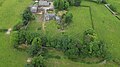
- Caer Gai (33 F)
- Candelas (2 F)
- Carndochan Castle (6 F)
G
H
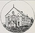
- Hen Gapel, Llanuwchllyn (7 F)
L
- Llanuwchllyn railway station (14 F)
Media in category "Llanuwchllyn"
The following 200 files are in this category, out of 816 total.
(previous page) (next page)-
 A bend in the fence - geograph.org.uk - 4617764.jpg 1,600 × 1,200; 422 KB
-
 A challenge for the fence builders - geograph.org.uk - 4617049.jpg 1,600 × 1,200; 426 KB
-
 A dramatic landscape of peat haggs and crags - geograph.org.uk - 4618176.jpg 1,600 × 1,200; 234 KB
-
 A history lesson in geology, geography and biology - geograph.org.uk - 4618192.jpg 1,600 × 1,200; 741 KB
-
 A line of exposed peat on Foel Rhudd - geograph.org.uk - 4618141.jpg 1,600 × 1,200; 428 KB
-
 A Moorland River - geograph.org.uk - 547687.jpg 640 × 480; 113 KB
-
 A possible forty shillings fine - geograph.org.uk - 5223180.jpg 640 × 427; 93 KB
-
 A rainbow over Llanuwchllyn - geograph.org.uk - 4816274.jpg 640 × 480; 129 KB
-
 A rainbow over the Dyfrdwy Valley - geograph.org.uk - 4816576.jpg 640 × 480; 109 KB
-
 A Remote Dwelling - geograph.org.uk - 557075.jpg 640 × 480; 128 KB
-
 A river of grass between the peat haggs - geograph.org.uk - 4618130.jpg 1,600 × 1,200; 423 KB
-
 A roadside rock, Blaen Lliw - geograph.org.uk - 5185189.jpg 800 × 533; 93 KB
-
 A solitary tree - geograph.org.uk - 547753.jpg 640 × 480; 90 KB
-

-
 A view towards Aran Fawddwy - geograph.org.uk - 4817126.jpg 640 × 480; 103 KB
-
 A view towards Llyn Tegid-Bala Lake - geograph.org.uk - 4816279.jpg 640 × 480; 195 KB
-
 A view towards Mynydd Bryn-llech - geograph.org.uk - 5261544.jpg 1,024 × 768; 410 KB
-
 A Viewpoint - geograph.org.uk - 547593.jpg 640 × 480; 98 KB
-
 A well defined footpath - geograph.org.uk - 547630.jpg 640 × 480; 120 KB
-
 A494 at Gareg- Lyncu - geograph.org.uk - 4622365.jpg 640 × 422; 71 KB
-
 A494 near Lôn - geograph.org.uk - 3393780.jpg 3,943 × 2,908; 2.26 MB
-
 A494 pull in near Ty'ny cefn - geograph.org.uk - 4622387.jpg 640 × 461; 62 KB
-
 Abandoned cars at Bryn Melyn - geograph.org.uk - 401303.jpg 640 × 480; 155 KB
-
 Above Afon Lliw - geograph.org.uk - 4489098.jpg 4,608 × 3,456; 3.56 MB
-
 Above Afon Lliw - geograph.org.uk - 4495705.jpg 4,608 × 3,456; 3.51 MB
-
 Above Braich y Twll - geograph.org.uk - 3041911.jpg 2,560 × 1,920; 2.1 MB
-
 Above Bwlch Sirddyn - geograph.org.uk - 3043322.jpg 2,560 × 1,920; 2.14 MB
-
 Access track through sheep pasture - geograph.org.uk - 4484584.jpg 640 × 480; 52 KB
-
 Across a wilderness - geograph.org.uk - 553357.jpg 640 × 480; 113 KB
-
 Across Cwm Cynllwydd - geograph.org.uk - 5420711.jpg 3,240 × 4,320; 3.46 MB
-
 Afon Erwent - geograph.org.uk - 4111501.jpg 3,600 × 2,400; 4.24 MB
-
 Afon Fechan - geograph.org.uk - 401286.jpg 640 × 480; 143 KB
-
 Afon Fechan Ford - geograph.org.uk - 401277.jpg 640 × 480; 153 KB
-
 Afon Fwy - geograph.org.uk - 1331091.jpg 640 × 533; 188 KB
-
 Afon Fwy - geograph.org.uk - 1572694.jpg 640 × 480; 158 KB
-
 Afon Groes - geograph.org.uk - 401773.jpg 640 × 480; 147 KB
-
 Afon Llafar - geograph.org.uk - 5794181.jpg 640 × 480; 172 KB
-
 Afon Llafar - geograph.org.uk - 5794185.jpg 640 × 480; 114 KB
-
 Afon Lliw - geograph.org.uk - 4111606.jpg 2,400 × 3,600; 4.1 MB
-
 Afon Lliw - geograph.org.uk - 4495691.jpg 4,608 × 3,456; 3.62 MB
-
 Afon Lliw - geograph.org.uk - 4804587.jpg 1,600 × 1,200; 540 KB
-
 Afon Lliw - geograph.org.uk - 5261541.jpg 640 × 480; 165 KB
-
 Afon Lliw - geograph.org.uk - 5795993.jpg 640 × 480; 114 KB
-
 Afon Lliw, near Llanuwchllyn - geograph.org.uk - 168032.jpg 640 × 480; 152 KB
-
 Afon Twrch - geograph.org.uk - 3041881.jpg 2,560 × 1,920; 2.14 MB
-
 Afon Twrch at Llanuwchllyn - geograph.org.uk - 4814965.jpg 640 × 480; 202 KB
-
 Afon Twrch at Llanuwchllyn - geograph.org.uk - 4814967.jpg 640 × 480; 201 KB
-
 Afon Twrch flows down to Llanuwchllyn - geograph.org.uk - 4815371.jpg 640 × 480; 251 KB
-
 Afon Twrch looking downstream - geograph.org.uk - 4815385.jpg 640 × 480; 175 KB
-
 Afon Twrch near Llanuwchllyn - geograph.org.uk - 2885273.jpg 4,272 × 2,848; 2.62 MB
-
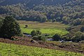
 Agricultural land beside river in Llanuwchllyn - geograph.org.uk - 3670150.jpg 1,500 × 789; 1.22 MB
-
 Allt-y-gwine entrance from A494 - geograph.org.uk - 4622402.jpg 640 × 448; 65 KB
-
 An Interesting Problem - geograph.org.uk - 547741.jpg 640 × 480; 145 KB
-
 Another Balloon Down - geograph.org.uk - 4495666.jpg 4,608 × 3,456; 3.82 MB
-
-
 Approaching Aran Benllyn from the south - geograph.org.uk - 5752197.jpg 1,200 × 795; 560 KB
-

-
 Approaching junction with B4403 - geograph.org.uk - 4622350.jpg 640 × 486; 96 KB
-
 Approaching Moel Llyfnant - geograph.org.uk - 4495241.jpg 4,608 × 3,456; 3.74 MB
-
 Approaching Pont Afon Fechan - geograph.org.uk - 4622343.jpg 640 × 494; 129 KB
-
 Approaching Pont Rhyd-sarn - geograph.org.uk - 4622370.jpg 640 × 461; 46 KB
-

-
 Approaching the moorland edge - geograph.org.uk - 477873.jpg 640 × 480; 62 KB
-

-

-
 Ar Waun y Griafolen - On Waun y Griafolen - geograph.org.uk - 4104055.jpg 3,600 × 2,400; 4.05 MB
-
 Aran Benllyn - geograph.org.uk - 2202541.jpg 690 × 518; 147 KB
-
 Aran Benllyn - geograph.org.uk - 2871626.jpg 640 × 480; 75 KB
-
 Aran Benllyn - geograph.org.uk - 3876114.jpg 3,600 × 2,400; 4.02 MB
-
 Aran Benllyn - geograph.org.uk - 4922638.jpg 640 × 480; 94 KB
-
 Aran Benllyn from near Caergai - geograph.org.uk - 5795978.jpg 640 × 480; 89 KB
-

-
 Aran Benllyn Summit - geograph.org.uk - 2884434.jpg 2,560 × 1,920; 949 KB
-
 Aran Benllyn summit area - geograph.org.uk - 4486829.jpg 640 × 480; 68 KB
-

-
 Aran Fawddwy - almost at the summit cairn - geograph.org.uk - 5752149.jpg 1,200 × 697; 476 KB
-
 Aran Fawddwy - geograph.org.uk - 3876168.jpg 3,600 × 2,400; 3.86 MB
-
 Aran Fawddwy and Creiglyn Dyfi - geograph.org.uk - 5752072.jpg 1,200 × 689; 521 KB
-
 Aran Fawddwy, Eryri - Snowdonia - geograph.org.uk - 3292694.jpg 690 × 518; 174 KB
-
 Aran ridge south to Erw y Ddafad-ddu - geograph.org.uk - 5752037.jpg 1,200 × 732; 599 KB
-
 Arenig Fawr - geograph.org.uk - 372194.jpg 640 × 480; 89 KB
-
 Ascending Aran Benllyn - geograph.org.uk - 2884425.jpg 2,560 × 1,920; 789 KB
-
 Ascending Moel Llyfnant - geograph.org.uk - 4495237.jpg 4,608 × 3,456; 3.45 MB
-
 B4403 through Llanuwchllyn - geograph.org.uk - 2557552.jpg 640 × 464; 64 KB
-

-
 Bala Lake Railway train - geograph.org.uk - 4187001.jpg 1,717 × 1,130; 1.15 MB
-
 Bala Lake, Glan-Llyn Outdoor Activity Centre - geograph.org.uk - 6136503.jpg 6,809 × 4,539; 4.1 MB
-
 Balancing stone near Parc - geograph.org.uk - 5794187.jpg 640 × 480; 116 KB
-
 Balloon under Foel Rhudd - geograph.org.uk - 3041892.jpg 1,920 × 2,560; 1.96 MB
-
 Banc Du - geograph.org.uk - 4111511.jpg 3,600 × 2,400; 3.99 MB
-
 Banc y Merddwr - geograph.org.uk - 4163700.jpg 3,600 × 2,400; 4.16 MB
-
 Barns at Buarthmeini farm - geograph.org.uk - 4526139.jpg 640 × 360; 64 KB
-
 Bench beside the path - geograph.org.uk - 4484599.jpg 640 × 480; 85 KB
-

-
 Bend near Pen y Cefn - geograph.org.uk - 4622243.jpg 640 × 391; 76 KB
-
 Beudy Uchaf - geograph.org.uk - 383949.jpg 640 × 480; 121 KB
-
 Big Bog - geograph.org.uk - 485412.jpg 640 × 427; 58 KB
-

-
 Blaen Lliw - geograph.org.uk - 5185187.jpg 800 × 529; 82 KB
-
 Blaen Lliw uchaf - geograph.org.uk - 4495678.jpg 4,608 × 3,456; 3.84 MB
-
 Blaen-y-Cwm - geograph.org.uk - 2574672.jpg 2,288 × 1,712; 815 KB
-
 Blaen-y-cwm - geograph.org.uk - 3022627.jpg 2,540 × 1,720; 1.95 MB
-
 Blaen-y-cwm - geograph.org.uk - 3023521.jpg 3,264 × 2,448; 3.88 MB
-
 Blaen-y-cwm farm - geograph.org.uk - 1277302.jpg 640 × 480; 57 KB
-
 Blaenlliw Isaf farm - geograph.org.uk - 5261533.jpg 640 × 480; 220 KB
-
 Blue water pump - geograph.org.uk - 139635.jpg 480 × 640; 144 KB
-
 Boggy track - geograph.org.uk - 4619636.jpg 640 × 427; 423 KB
-

-

-
 Braich y Dduallt - geograph.org.uk - 4919648.jpg 640 × 480; 62 KB
-
 Bridge over Afon Llafar - geograph.org.uk - 5795999.jpg 640 × 445; 111 KB
-
 Bridge over Afon Llafar stream - geograph.org.uk - 2362202.jpg 3,787 × 2,548; 1.62 MB
-
 Bridge over afon Lliw, near Llanuwchllyn - geograph.org.uk - 5795990.jpg 640 × 480; 121 KB
-
 Bridge over the Afon Lliw - geograph.org.uk - 2108694.jpg 1,200 × 803; 657 KB
-
 Bridle Path - geograph.org.uk - 547607.jpg 640 × 480; 101 KB
-
 Brynllech trig looking SE - geograph.org.uk - 1165985.jpg 640 × 480; 66 KB
-
 Brynllech trig looking west - geograph.org.uk - 1165987.jpg 640 × 480; 69 KB
-
 Buildings at Coed-ladyr - geograph.org.uk - 4622333.jpg 640 × 470; 125 KB
-
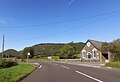 Bus stop and chapel at Rhyd Sarn - geograph.org.uk - 4622377.jpg 640 × 440; 59 KB
-
 Bus stop at Llanuwchllyn - geograph.org.uk - 5795995.jpg 640 × 480; 84 KB
-
 Bwch yn Uchaf - geograph.org.uk - 1877113.jpg 1,024 × 768; 143 KB
-
 Bwch Yn Uchaf campsite - geograph.org.uk - 2469275.jpg 2,977 × 2,074; 3.09 MB
-
-
 Bwlch Sirddyn - geograph.org.uk - 3043309.jpg 1,920 × 2,560; 2.15 MB
-
 Bwlch y Bi - geograph.org.uk - 4111183.jpg 3,600 × 2,400; 3.98 MB
-
 Bwlch y Bi - geograph.org.uk - 4111193.jpg 3,600 × 2,400; 4.26 MB
-
 Bwlch y Bi - geograph.org.uk - 4111214.jpg 3,600 × 2,400; 3.86 MB
-
 Bwlch y Groes - geograph.org.uk - 3026637.jpg 4,000 × 3,000; 2.48 MB
-
 By Llyn Pen Aran - geograph.org.uk - 5752257.jpg 1,200 × 795; 526 KB
-

-
-
-
-

-
-

-

-

-

-

-

-

-

-

-
-

-

-

-

-

-

-

-

-

-

-

-

-

-

-
-

-

-
-
 Caergai - geograph.org.uk - 5795976.jpg 640 × 480; 82 KB
-
 Cairn above Nant Ddu - geograph.org.uk - 767649.jpg 640 × 439; 164 KB
-
 Cairn on Aran Benllyn summit - geograph.org.uk - 4486827.jpg 640 × 480; 80 KB
-
 Cairn On Erw Y Ddafad-ddu - geograph.org.uk - 4725946.jpg 1,600 × 1,200; 475 KB
-

-
 Camp site at Bala - geograph.org.uk - 1200758.jpg 640 × 550; 394 KB
-
 Capel Glanaber (MC) Llanuwchllyn.jpg 2,488 × 2,356; 1.48 MB
-
 Capel Peniel - geograph.org.uk - 4954812.jpg 515 × 640; 89 KB
-
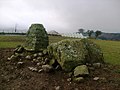
 Carreg Diddos.jpeg 900 × 779; 436 KB
-
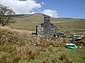
 Castell Carndochan - geograph.org.uk - 1331083.jpg 640 × 264; 40 KB
-
 Castell Carndochan - geograph.org.uk - 1572875.jpg 640 × 480; 77 KB
-
 Castell Carndochan - geograph.org.uk - 4101535.jpg 3,600 × 2,400; 4.12 MB
-
 Castell Coch - geograph.org.uk - 383993.jpg 640 × 480; 91 KB
-
 Cattle grid at Bwlch y Groes - geograph.org.uk - 3695080.jpg 1,024 × 680; 159 KB
-
 Cattle grid on the mountain road - geograph.org.uk - 2107101.jpg 1,200 × 803; 851 KB
-
 Cefn Glas - geograph.org.uk - 4106141.jpg 3,600 × 2,400; 3.82 MB
-
 Cefn Glas Bach - geograph.org.uk - 4106154.jpg 3,600 × 2,400; 4 MB
-
 Cerrig Chwibanog - geograph.org.uk - 4102096.jpg 3,600 × 2,400; 4.01 MB
-
 Cerrig yr Iwrch - geograph.org.uk - 4102132.jpg 3,600 × 2,400; 3.94 MB
-
 Cerrig yr Iwrch - geograph.org.uk - 4103975.jpg 3,600 × 2,400; 4.18 MB
-
 Chapel at Rhyd-Sarn - geograph.org.uk - 3393791.jpg 2,508 × 2,108; 1.18 MB
-
 Chapel beside the lane - geograph.org.uk - 4498245.jpg 640 × 480; 89 KB
-
 Chapel in Coed Wenallt - geograph.org.uk - 169644.jpg 640 × 480; 91 KB
-
 Chapel, Coed Wenallt - geograph.org.uk - 4804605.jpg 1,600 × 1,200; 519 KB
-
 Chapel, Pont Rhyd-Sarn - geograph.org.uk - 449291.jpg 640 × 480; 121 KB
-
 Churn stand at Llechweddystrad - geograph.org.uk - 139650.jpg 640 × 480; 110 KB
-
 Cleavage, Craig yr Ogof - geograph.org.uk - 4556225.jpg 640 × 480; 90 KB
-
 Clipiau Duon, looking towards Aran Benllyn - geograph.org.uk - 4617774.jpg 1,600 × 1,200; 463 KB
-
 Coal trucks at the end of the line - geograph.org.uk - 5226656.jpg 640 × 427; 89 KB
-
 Coed Bryn Bras - geograph.org.uk - 4101547.jpg 3,600 × 2,400; 4.28 MB
-
 Coed Bryn Bras - geograph.org.uk - 4101560.jpg 3,600 × 2,400; 3.89 MB
-
 Coed-ladyr farm - geograph.org.uk - 2107016.jpg 1,200 × 803; 711 KB
-
 Col below Aran Fawddwy and view to Cader Idris - geograph.org.uk - 5752093.jpg 1,200 × 795; 549 KB
-
 Contrasting rocks near summit of Aran Benllyn - geograph.org.uk - 5751951.jpg 1,200 × 902; 836 KB
-

-
 Copa Dduallt Summit - geograph.org.uk - 2200999.jpg 690 × 517; 60 KB
-
 Copa Foel Boeth - Summit of Foel Boeth - geograph.org.uk - 4110827.jpg 3,600 × 2,400; 3.82 MB


;_Eryri_National_Park_01.jpg)
;_Eryri_National_Park_02.jpg)
;_Eryri_National_Park_03.jpg)
;_Eryri_National_Park_04.jpg)
;_Eryri_National_Park_05.jpg)
;_Eryri_National_Park_06.jpg)
;_Eryri_National_Park_07.jpg)
;_Eryri_National_Park_08.jpg)
;_Eryri_National_Park_09.jpg)
;_Eryri_National_Park_10.jpg)
;_Eryri_National_Park_11.jpg)
;_Eryri_National_Park_12.jpg)
;_Eryri_National_Park_13.jpg)
;_Eryri_National_Park_14.jpg)
;_Eryri_National_Park_15.jpg)
;_Eryri_National_Park_16.jpg)
;_Eryri_National_Park_17.jpg)
;_Eryri_National_Park_18.jpg)
;_Eryri_National_Park_19.jpg)
;_Eryri_National_Park_20.jpg)
;_Eryri_National_Park_21.jpg)
;_Eryri_National_Park_22.jpg)
;_Eryri_National_Park_23.jpg)
;_Eryri_National_Park_24.jpg)
;_Eryri_National_Park_25.jpg)
;_Eryri_National_Park_26.jpg)
;_Eryri_National_Park_27.jpg)
;_Eryri_National_Park_28.jpg)
;_Eryri_National_Park_29.jpg)
;_Eryri_National_Park_30.jpg)
;_Eryri_National_Park_31.jpg)
;_Eryri_National_Park_32.jpg)
;_Eryri_National_Park_33.jpg)
;_Eryri_National_Park_34.jpg)


_Llanuwchllyn.jpg)


