Category:Llithfaen
Jump to navigation
Jump to search
village in Wales  | |||||
| Upload media | |||||
| Instance of | |||||
|---|---|---|---|---|---|
| Location | Gwynedd, Wales | ||||
 | |||||
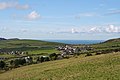
English: Llithfaen is a small village on the Llyn Peninsula in Gwynedd, Wales. It is located around 4 miles north-east of Nefyn and lies just south-west of Yr Eifl mountain. There used to be three quarries close to the village, the last of which (Chwarel Carreg y Llam) closed in 1963. There is a shop again in the village that re-opened in August 2009.
Subcategories
This category has the following 6 subcategories, out of 6 total.
Media in category "Llithfaen"
The following 200 files are in this category, out of 225 total.
(previous page) (next page)-

-

-

-
 A ruined cottage in the forest - geograph.org.uk - 717699.jpg 480 × 640; 83 KB
-
 A ruined sheepfold below Caergribin - geograph.org.uk - 706789.jpg 640 × 480; 126 KB
-

-
 Afon Nant Gwrtheyrn crossing the beach - geograph.org.uk - 630951.jpg 640 × 480; 105 KB
-
 Afon Nant Gwrtheyrn in its middle course - geograph.org.uk - 717681.jpg 640 × 451; 139 KB
-
 Berms exposed at low tide - geograph.org.uk - 720461.jpg 640 × 336; 66 KB
-
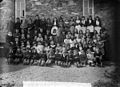 Big boys and girls, Llithfaen school NLW3362809.jpg 597 × 432; 71 KB
-
-
 Calvinistic Methodist chapel, Llithfaen NLW3361935.jpg 595 × 449; 59 KB
-
 Capel Isaf, Llithfaen - geograph.org.uk - 2117049.jpg 1,024 × 735; 154 KB
-
 Capel Llithfaen - geograph.org.uk - 348326.jpg 640 × 480; 67 KB
-
 Capel Tabor - geograph.org.uk - 348388.jpg 640 × 480; 72 KB
-

-
 Côr Meibion Llithfaen, 1925.jpg 3,232 × 2,346; 3.4 MB
-

-
 Farm buildings and field system - geograph.org.uk - 59993.jpg 640 × 384; 56 KB
-

-
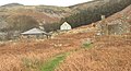
 Gwyniasa Farm - geograph.org.uk - 299029.jpg 640 × 475; 69 KB
-
 Hanging valley - geograph.org.uk - 715576.jpg 640 × 480; 120 KB
-
 Hen eglwys Llithfaen Old church - geograph.org.uk - 415850.jpg 640 × 428; 146 KB
-
 Houses and Bus - geograph.org.uk - 228573.jpg 640 × 480; 59 KB
-
 Housing at Nefyn - geograph.org.uk - 228534.jpg 640 × 480; 69 KB
-
 Infants, Llithfaen school (1887) NLW3363304.jpg 598 × 426; 81 KB
-
 Llithfaen bus conductor (13376016473).jpg 474 × 621; 40 KB
-
 Llithfaen chapel - geograph.org.uk - 3105360.jpg 640 × 480; 54 KB
-
 Llithfaen NLW3363336.jpg 591 × 423; 60 KB
-
 Low tide at Porth Howel - geograph.org.uk - 630803.jpg 640 × 481; 58 KB
-
 Meheryn - Rams - geograph.org.uk - 569872.jpg 640 × 428; 167 KB
-
 Melin Carnguwch Mill - geograph.org.uk - 415856.jpg 640 × 428; 163 KB
-
 Melin Carnguwch Mill - geograph.org.uk - 415860.jpg 640 × 428; 160 KB
-
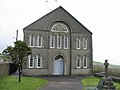
 Methodist Chapel, Llithfaen - geograph.org.uk - 1311075.jpg 640 × 480; 65 KB
-
 Moriah chapel (Cong), Llithfaen NLW3361934.jpg 593 × 447; 58 KB
-
 Nant Ciliau - a hanging valley - geograph.org.uk - 630678.jpg 640 × 480; 125 KB
-
 Old Church, Llithfaen - geograph.org.uk - 1311068.jpg 640 × 480; 109 KB
-
 Porth y Nant Bay from Carreg y Llam - geograph.org.uk - 635986.jpg 640 × 382; 35 KB
-
 Porth y Nant cottages - geograph.org.uk - 245628.jpg 576 × 432; 54 KB
-
 Quarry building at Porth y Nant - geograph.org.uk - 468179.jpg 640 × 480; 141 KB
-

-

-
 Restored cottages at Nant Gwrtheyrn - geograph.org.uk - 468175.jpg 640 × 480; 145 KB
-
 Road to Nant Gwrtheyrn - geograph.org.uk - 468168.jpg 640 × 480; 132 KB
-
 Sea cliff at Penrhyn Glas - geograph.org.uk - 715629.jpg 640 × 480; 70 KB
-
 Stone crusher in use at Nant Gwrtheyrn - geograph.org.uk - 681749.jpg 640 × 480; 107 KB
-
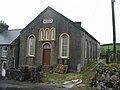
 Tabor chapel (Bapt), Llithfaen which opened in 1885 NLW3362815.jpg 598 × 434; 50 KB
-
 Tafarn y Fic - geograph.org.uk - 415847.jpg 640 × 428; 145 KB
-
 The back of Sea View Terrace - geograph.org.uk - 717704.jpg 640 × 332; 45 KB
-

-
 The church, Llithfaen NLW3363151.jpg 595 × 427; 55 KB
-

-

-

-
 The incised Nant Gwrtheyrn valley - geograph.org.uk - 681706.jpg 640 × 480; 117 KB
-
 The new road to Porth y Nant - geograph.org.uk - 631360.jpg 640 × 337; 57 KB
-
 The old track to Porth-y-Nant - geograph.org.uk - 681994.jpg 640 × 480; 109 KB
-

-

-

-

-
-

-
 Where the Eifl Drops Down to the Sea. - geograph.org.uk - 242245.jpg 480 × 640; 58 KB
-

-
 Woodland at Gallt y Bwlch - geograph.org.uk - 721396.jpg 640 × 372; 34 KB
-
 Workers at Cae'r Nant quarry, Llithfaen NLW3363992.jpg 581 × 416; 74 KB
-
 Yr Eifl a Llithfaen - geograph.org.uk - 394888.jpg 640 × 394; 96 KB
-

-

-

-

-
 A sphinx or a nesting hen^ - geograph.org.uk - 675251.jpg 640 × 480; 68 KB
-
 A surviving footpath gate - geograph.org.uk - 675133.jpg 640 × 480; 172 KB
-
 A victim of a fox or a rogue dog. - geograph.org.uk - 681349.jpg 640 × 480; 127 KB
-
 A wasteland of brushwood and bracken - geograph.org.uk - 676779.jpg 640 × 480; 87 KB
-

-

-

-

-

-

-

-

-

-

-
 Bend in the Carnguwch road - geograph.org.uk - 695241.jpg 640 × 480; 88 KB
-
 Bends in the Llithfaen road - geograph.org.uk - 676571.jpg 640 × 376; 45 KB
-

-
 Berms on Porth y Nant beach - geograph.org.uk - 720394.jpg 640 × 480; 101 KB
-

-
 Bins and tips at Nant Quarry - geograph.org.uk - 720390.jpg 640 × 480; 89 KB
-
 Bogland and drumlin - geograph.org.uk - 676331.jpg 640 × 386; 86 KB
-
 Bogland north of Bryn Farm - geograph.org.uk - 676325.jpg 640 × 405; 61 KB
-

-

-

-
 Breaking waves at Penrhyn Glas - geograph.org.uk - 630911.jpg 640 × 360; 32 KB
-

-

-
 Caergribin rocks - geograph.org.uk - 704495.jpg 640 × 480; 81 KB
-
 Carnguwch Bach - geograph.org.uk - 415897.jpg 640 × 428; 143 KB
-

-

-
 Castell - an ancient earthworks - geograph.org.uk - 718790.jpg 640 × 480; 52 KB
-
 Cefn Gwynus - geograph.org.uk - 394876.jpg 640 × 480; 94 KB
-
 Cefnydd - geograph.org.uk - 394857.jpg 640 × 480; 127 KB
-
 Chwarel Nant Quarry - geograph.org.uk - 719197.jpg 640 × 409; 76 KB
-

-
 Cliffs east of Carreg-y-Llam Quarry - geograph.org.uk - 714650.jpg 640 × 480; 96 KB
-
 Coast South of Porth y Nant - geograph.org.uk - 437434.jpg 640 × 480; 148 KB
-

-
 Coastal wood and Penrhyn Glas - geograph.org.uk - 437439.jpg 640 × 480; 142 KB
-

-
 Craig Ddu - geograph.org.uk - 245622.jpg 576 × 432; 41 KB
-
 Cultivated grass above Afon Erch - geograph.org.uk - 675207.jpg 640 × 480; 75 KB
-
 Disused quarry building at Porth y Nant - geograph.org.uk - 468185.jpg 640 × 480; 142 KB
-

-

-
 Farm track near Ciliau - geograph.org.uk - 437446.jpg 640 × 480; 156 KB
-

-
 Farmland at Tyddyn Felin Farm - geograph.org.uk - 694292.jpg 640 × 403; 68 KB
-
 Farmland near Pen-rhos - geograph.org.uk - 231097.jpg 640 × 480; 97 KB
-

-

-

-

-
 Feral goats near the Castell earthworks - geograph.org.uk - 718795.jpg 640 × 480; 115 KB
-
 Fferm Carnguwch Bach Farm - geograph.org.uk - 415891.jpg 640 × 428; 143 KB
-
 Fferm Carnguwch Bach Farm - geograph.org.uk - 415893.jpg 640 × 428; 138 KB
-
 Foel Gwynus - geograph.org.uk - 228566.jpg 640 × 480; 44 KB
-
 Footbridge over Afon Erch - geograph.org.uk - 675080.jpg 640 × 356; 80 KB
-
 Forest-moorland boundary - geograph.org.uk - 682306.jpg 640 × 480; 73 KB
-
 Fron - geograph.org.uk - 231093.jpg 640 × 480; 67 KB
-

-

-

-

-
 Hilltop farmhouse above Porth y Nant bay - geograph.org.uk - 437444.jpg 640 × 480; 142 KB
-
 Improved grasslands at Carnguwch Bach - geograph.org.uk - 706814.jpg 640 × 480; 79 KB
-

-
 Infertile wetland south of Bryn Farm - geograph.org.uk - 676558.jpg 640 × 394; 85 KB
-

-
 Llithfaen Village - geograph.org.uk - 59919.jpg 640 × 456; 79 KB
-
 Maharen - Ram - geograph.org.uk - 569873.jpg 640 × 428; 145 KB
-
 Meander in Afon Erch - geograph.org.uk - 707959.jpg 640 × 480; 67 KB
-
 Melin Carnguwch Mill - geograph.org.uk - 415862.jpg 640 × 428; 168 KB
-
 Nant Gwrtheyrn from the new road - geograph.org.uk - 468170.jpg 640 × 480; 153 KB
-
 Nant Gwrtheyrn in 1972 - geograph.org.uk - 87433.jpg 640 × 440; 102 KB
-
 Path at Porth y Nant - geograph.org.uk - 468183.jpg 640 × 480; 138 KB
-
 Penfras-isaf - geograph.org.uk - 675940.jpg 640 × 480; 67 KB
-
 Penfras-uchaf Farm - geograph.org.uk - 674861.jpg 640 × 480; 98 KB
-

-
-
 Plas Isaf Farm - geograph.org.uk - 678710.jpg 640 × 307; 53 KB
-
 Plas y Nant - geograph.org.uk - 632903.jpg 640 × 382; 74 KB
-
 Porth y Nant - geograph.org.uk - 245625.jpg 576 × 432; 66 KB
-
 Porth Y Nant - geograph.org.uk - 245626.jpg 576 × 432; 74 KB
-
 Porth-y-Nant before restoration - geograph.org.uk - 322932.jpg 640 × 429; 88 KB
-

-
 Pwll hwyaid Fferm Tynrhos Duckpond - geograph.org.uk - 415837.jpg 640 × 428; 195 KB
-
 Rapids on Afon Nant Gwrtheyrn - geograph.org.uk - 681717.jpg 640 × 480; 150 KB
-

-
 Remains of the pier at Porth y Nant - geograph.org.uk - 468190.jpg 640 × 480; 141 KB
-
 Returning to base - geograph.org.uk - 695228.jpg 640 × 325; 24 KB
-

-
 Road west towards Battin - geograph.org.uk - 676301.jpg 640 × 414; 52 KB
-

-
 Rock outcrops above Porth y Nant - geograph.org.uk - 632524.jpg 640 × 386; 67 KB
-
 Rough grazing in the Erch valley - geograph.org.uk - 674724.jpg 640 × 480; 111 KB
-

-

-
 Sheep grazing on Yr Eifl - geograph.org.uk - 682294.jpg 640 × 324; 45 KB
-

-

-

-

-

-

-

-
 The abandoned Ty Uchaf Farm - geograph.org.uk - 632889.jpg 640 × 480; 101 KB
-

-
 The bay at Porth y Nant - geograph.org.uk - 468176.jpg 640 × 480; 134 KB
-

-

-
 The boggy flood plain of the Erch - geograph.org.uk - 675093.jpg 640 × 323; 57 KB
-

-
 The creation of another passing point - geograph.org.uk - 681985.jpg 640 × 480; 101 KB
-

-
 The Erch gorge - geograph.org.uk - 675754.jpg 640 × 325; 42 KB
-

-

-

-
 The flood plain of Afon Erch - geograph.org.uk - 675223.jpg 640 × 480; 104 KB
-

-

-

-

-
-


_NLW3363304.jpg)
.jpg)


,_Llithfaen_NLW3361934.jpg)


,_Llithfaen_which_opened_in_1885_NLW3362815.jpg)


