Category:Llwyndyrys
Jump to navigation
Jump to search
Media in category "Llwyndyrys"
The following 40 files are in this category, out of 40 total.
-
 'Elbow of Capture' on the upper Erch - geograph.org.uk - 708237.jpg 640 × 480; 113 KB
-
-
 Afon Erch above Llwyndyrys bridge - geograph.org.uk - 675942.jpg 640 × 480; 122 KB
-
-
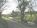
 Bend in the Llwyndyrys road - geograph.org.uk - 694268.jpg 640 × 368; 59 KB
-
-
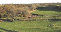
 Farmland at Llwyndyrys - geograph.org.uk - 230870.jpg 640 × 480; 103 KB
-
 Farmland at Llwyndyrys - geograph.org.uk - 230877.jpg 640 × 480; 74 KB
-
 Farmland north of the Llwyndyrys road - geograph.org.uk - 694270.jpg 640 × 317; 32 KB
-
-

-

-
 Llwyndyrus farm - geograph.org.uk - 230867.jpg 640 × 480; 83 KB
-

-
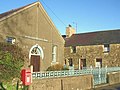
 Llwyndyrys Chapel - geograph.org.uk - 1311092.jpg 640 × 480; 79 KB
-

-

-

-
 Pont Llwyndyrys - geograph.org.uk - 676012.jpg 640 × 480; 101 KB
-
-
 The A499 at the Llwyndyrys turnoff - geograph.org.uk - 692477.jpg 640 × 320; 35 KB
-
-
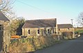
 The farmhouse at Llwyndyrys - geograph.org.uk - 693151.jpg 640 × 302; 49 KB
-
 The former corn mill at Llwyndyrys - geograph.org.uk - 675935.jpg 640 × 480; 86 KB
-

-
 The Llwyndyrys road near Bryn Marchog - geograph.org.uk - 676280.jpg 640 × 480; 121 KB
-

-

-

-
-
 Ty Fferm Llwyndyrys - geograph.org.uk - 693198.jpg 640 × 321; 39 KB
-
 Tyddyn Cestyll, Llwyndyrys - geograph.org.uk - 676075.jpg 640 × 480; 97 KB
-
 Tyddyn Felin Farm, Llwyndyrys - geograph.org.uk - 676053.jpg 640 × 480; 79 KB
-
-

-

-
 Yr Hen Felin, Llwyndyrys - geograph.org.uk - 694290.jpg 640 × 480; 83 KB
-

-

-
 Parc Glasfryn - geograph.org.uk - 364010.jpg 640 × 428; 151 KB


