Category:Location maps of California
Jump to navigation
Jump to search
 |
This category should only contain blank "Location maps" created for geo-location purposes which follow a same uniform standard, and have been created with a Geographic information system (GIS) software program using a compatible equirectangular or conical projection and for which the geographic coordinate system is known. For more information or questions see the wikiproject: German Wikipedia:Kartenwerkstatt/Positionskarten and this discussion page. |
Media in category "Location maps of California"
The following 13 files are in this category, out of 13 total.
-
 California Locator Map with US.PNG 532 × 603; 80 KB
-
 California Locator Map.PNG 596 × 676; 24 KB
-
 Map of California Counties in 1850.svg 512 × 591; 14 KB
-
 Relief map of California.png 681 × 780; 647 KB
-
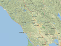
 Relief map of Northern California.png 654 × 489; 454 KB
-
 Relief map of Santa Clara Valley.png 681 × 780; 685 KB
-
 Sacramento metropolitan area.jpg 1,217 × 2,163; 132 KB
-
 SF location map.png 724 × 619; 59 KB
-
 Sonoma County California Location Map.png 1,003 × 760; 1.1 MB
-
 United States San Francisco Bay Area location map.svg 100 × 120; 1.29 MB
-
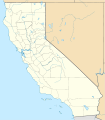 USA California location map.svg 1,022 × 1,171; 480 KB
-
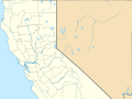 USA California Northern location map.svg 978 × 733; 430 KB
-
 USA California Southern location map.svg 685 × 387; 430 KB


