Category:Location maps of local government areas in South Australia
Jump to navigation
Jump to search
Media in category "Location maps of local government areas in South Australia"
The following 8 files are in this category, out of 8 total.
-
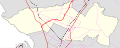
 Australia South Australia City of Adelaide location map.svg 709 × 709; 1.22 MB
-
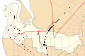
 Australia South Australia Town of Gawler location map.svg 709 × 709; 1.42 MB
-
 Australia South Australia Wattle Range Council location map blank.svg 1,027 × 609; 84 KB
-
 Australia South Australia Wattle Range Council location map.svg 1,027 × 609; 4.84 MB
-
 Australia South Australia Yorke Peninsula Council location map.svg 709 × 709; 8.72 MB
-
 Australia South Australia City of Playford location map.svg 1,027 × 407; 5.32 MB
-
 Australia South Australia City of Port Adelaide Enfield location map.svg 1,063 × 709; 4.92 MB
-
 Australia South Australia Wudinna District Council location map.svg 1,027 × 609; 2.54 MB


