Category:Location maps of the Channel Islands
Jump to navigation
Jump to search
 |
This category should only contain blank "Location maps" created for geo-location purposes which follow a same uniform standard, and have been created with a Geographic information system (GIS) software program using a compatible equirectangular or conical projection and for which the geographic coordinate system is known. For more information or questions see the wikiproject: German Wikipedia:Kartenwerkstatt/Positionskarten and this discussion page. |
Media in category "Location maps of the Channel Islands"
The following 9 files are in this category, out of 9 total.
-
 Bailiwick of Guernsey location map.svg 770 × 496; 281 KB
-
 Bailiwick of Jersey location map.svg 770 × 496; 281 KB
-
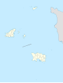 Channel Islands location map (+parishes).svg 1,325 × 1,728; 298 KB
-
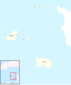
 Channel Islands location map.svg 1,325 × 1,728; 166 KB
-
 Channel Islands location.svg 770 × 496; 281 KB
-
 Channel Islands locator skeleton map.svg 1,237 × 1,462; 488 KB
-
 Channel Islands.png 1,059 × 1,448; 4 KB
-
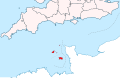
 Guernsey location map.svg 1,325 × 1,426; 178 KB
-
 Jersey location map.svg 1,325 × 1,728; 169 KB


.svg)


