Category:Locator maps of Folketing constituencies
Jump to navigation
Jump to search
Media in category "Locator maps of Folketing constituencies"
The following 20 files are in this category, out of 20 total.
-
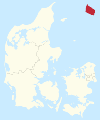 Bornholm (Folketing constituency).svg 2,500 × 3,000; 128 KB
-
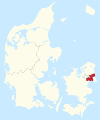
 Bornholms Storkreds.svg 510 × 412; 541 KB
-
 Copenhagen (Folketing constituency).svg 2,500 × 3,000; 128 KB
-
 East Jutland (Folketing constituency).svg 2,500 × 3,000; 129 KB
-
 Funen (Folketing constituency).svg 2,500 × 3,000; 128 KB
-
 Fyns Storkreds.svg 510 × 412; 541 KB
-
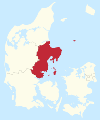
 Greater Copenhagen (Folketing constituency).svg 2,500 × 3,000; 129 KB
-
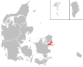 København Omegns Storkreds.svg 510 × 412; 541 KB
-
 Københavns Storkreds.svg 510 × 412; 541 KB
-
 Nordjyllands Storkreds.svg 510 × 412; 541 KB
-
 Nordsjællands Storkreds.svg 510 × 412; 541 KB
-
 North Jutland (Folketing constituency).svg 2,500 × 3,000; 128 KB
-
 North Zealand (Folketing constituency).svg 2,500 × 3,000; 128 KB
-
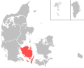
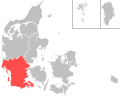
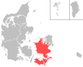 Sjællands Storkreds.svg 510 × 412; 541 KB
-
 South Jutland (Folketing constituency).svg 2,500 × 3,000; 129 KB
-
 Sydjyllands Storkreds.svg 510 × 412; 541 KB
-
 Vestjyllands Storkreds.svg 510 × 412; 541 KB
-
 West Jutland (Folketing constituency).svg 2,500 × 3,000; 129 KB
-
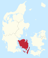
 Zealand (Folketing constituency).svg 2,500 × 3,000; 129 KB
-
 Østjyllands Storkreds.svg 510 × 412; 541 KB
.svg)

.svg)
.svg)
.svg)

.svg)


.svg)
.svg)

.svg)


.svg)
.svg)
