Category:Locator maps of Kiribati
Jump to navigation
Jump to search
Subcategories
This category has the following 3 subcategories, out of 3 total.
Media in category "Locator maps of Kiribati"
The following 9 files are in this category, out of 9 total.
-
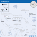
Kiribati - Location Map (2013) - KIR - UNOCHA.svg 250 × 251; 3.45 MB
-
Kiribati CIA WFB map (2004).png 330 × 354; 10 KB
-
Kiribati-locator.png 800 × 746; 38 KB
-
Kiribati-Pos.png 330 × 228; 16 KB
-
LocationKiribati.png 248 × 156; 7 KB
-
Mapa de Kiribati.png 625 × 623; 120 KB
-
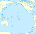
Territorial waters - Kiribati.svg 800 × 400; 694 KB
-
World Factbook (1982) Kiribati.jpg 759 × 586; 81 KB
-
キリスィマスィ島-位置地図.jpg 330 × 228; 53 KB


