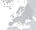
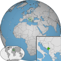
Category:Locator maps of Montenegro
Jump to navigation
Jump to search
Subcategories
This category has the following 2 subcategories, out of 2 total.
B
- Bilateral maps of Montenegro (74 F)
S
Media in category "Locator maps of Montenegro"
The following 23 files are in this category, out of 23 total.
-
Europe location MNE.png 1,600 × 1,200; 458 KB
-
Europe me.svg 680 × 520; 795 KB
-
Europe-Montenegro.svg 2,182 × 1,834; 2.12 MB
-
European Union Montenegro Locator 2013.png 679 × 519; 93 KB
-
Kingdom of Montenegro (1914).svg 450 × 456; 441 KB
-
Location Montenegro Europe.png 2,056 × 1,800; 366 KB
-
Location Montenegro.PNG 250 × 115; 7 KB
-
LocationMontenegro.png 250 × 115; 5 KB
-
LocationMontenegro.PNG 250 × 115; 6 KB
-
LocationMontenegro.svg 1,000 × 500; 2.76 MB
-
LocationMontenegroInEurope.png 415 × 422; 14 KB
-
Montenegro (orthographic projection).svg 553 × 553; 299 KB
-
Montenegro - Location Map (2013) - MNE - UNOCHA.svg 251 × 251; 878 KB
-
Montenegro location 2012.svg 1,052 × 744; 132 KB
-
Montenegro w1 locator.svg 1,000 × 1,000; 129 KB
-
Montenegro w2 locator.svg 1,000 × 1,000; 232 KB
-
Montenegro Žabljak BG.png 1,092 × 1,333; 25 KB
-
Montenegrorachelrocket72.jpg 500 × 388; 53 KB
-
Podgorica Municipality Montenegro (1).png 491 × 599; 80 KB
-
Principality of Montenegro (1890).svg 450 × 456; 437 KB
-
Republic of Montenegro (2006).svg 680 × 520; 597 KB
-
SettlementsUL.png 600 × 745; 136 KB
-
Tuzi Me.png 1,920 × 1,440; 662 KB


