Category:Locator maps of Regionalverbände in Bavaria (gray scheme)
Jump to navigation
Jump to search
Media in category "Locator maps of Regionalverbände in Bavaria (gray scheme)"
The following 19 files are in this category, out of 19 total.
-
 Bayern Regionenplanung Region1.svg 4,944 × 4,924; 710 KB
-
 Bayern Regionenplanung Region10.svg 4,944 × 4,924; 720 KB
-
 Bayern Regionenplanung Region11.svg 4,944 × 4,924; 720 KB
-
 Bayern Regionenplanung Region12.svg 4,944 × 4,924; 737 KB
-
 Bayern Regionenplanung Region13.svg 4,944 × 4,924; 728 KB
-
 Bayern Regionenplanung Region14.svg 4,944 × 4,924; 750 KB
-
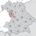
 Bayern Regionenplanung Region15.svg 4,944 × 4,924; 719 KB
-
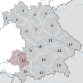
 Bayern Regionenplanung Region16.svg 4,944 × 4,924; 718 KB
-
 Bayern Regionenplanung Region17.svg 4,944 × 4,924; 724 KB
-
 Bayern Regionenplanung Region18.svg 4,944 × 4,924; 734 KB
-
 Bayern Regionenplanung Region2.svg 4,944 × 4,924; 715 KB
-
 Bayern Regionenplanung Region3.svg 4,944 × 4,924; 728 KB
-
 Bayern Regionenplanung Region4.svg 4,944 × 4,924; 724 KB
-
 Bayern Regionenplanung Region5.svg 4,944 × 4,924; 729 KB
-
 Bayern Regionenplanung Region6.svg 4,944 × 4,924; 727 KB
-
 Bayern Regionenplanung Region7.svg 4,944 × 4,924; 727 KB
-
 Bayern Regionenplanung Region8.svg 4,944 × 4,924; 718 KB
-
 Bayern Regionenplanung Region9.svg 4,944 × 4,924; 726 KB
-
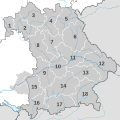 Bayern Regionenplanung Uebersicht.svg 4,944 × 4,924; 702 KB


