Category:Locator maps of Silesian Voivodeship
Jump to navigation
Jump to search
Subcategories
This category has the following 3 subcategories, out of 3 total.
Media in category "Locator maps of Silesian Voivodeship"
The following 24 files are in this category, out of 24 total.
-
 Bielsko County and Bielsko-Biała location map.png 1,000 × 905; 104 KB
-
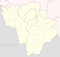 Bielsko, Cieszyn and Żywiec County location map.png 1,635 × 1,550; 282 KB
-
 Cieszynskie w wojewodztwie.png 446 × 599; 95 KB
-
 Czestochowskie w wojewodztwie.png 442 × 599; 93 KB
-
 Gliwickie w wojewodztwie.png 442 × 599; 95 KB
-
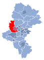
 GZM location map.svg 512 × 378; 194 KB
-
 GZM metropolitan public shared bike system coverage map, 30.07.2024.svg 512 × 378; 196 KB
-
 GZM metropolitan public shared bike system coverage map.svg 512 × 378; 196 KB
-
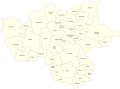
 Górnośląsko-Zagłebiowska Metropolia - gminy.png 1,635 × 2,232; 762 KB
-
 Locator map GZM in Silesian Voivodeship.svg 2,359 × 3,249; 2.47 MB
-
 Locator map GZM.svg 1,229 × 904; 2.15 MB
-
 Map of the planned and implemented GMZ velostrade network in 2023.svg 512 × 350; 185 KB
-
 Mikolowskie w wojewodztwie.png 442 × 599; 96 KB
-
 Myszkowskie w wojewodztwie.png 442 × 599; 96 KB
-
 Polska podział admin slaskie.svg 461 × 425; 127 KB
-
 Rower Metropolitalny Zasieg.png 1,024 × 753; 278 KB
-
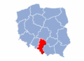
 Silesian Voivodeship location map.png 1,223 × 1,650; 253 KB
-
 Slaskie (EE,E NN,N).png 491 × 454; 347 KB
-
 Slaskie location map.PNG 580 × 425; 16 KB
-
 Slaskie.png 96 × 136; 18 KB
-
 Woj. Śląskie.png 480 × 680; 752 KB
-
 Woj. Śląskie1.png 480 × 680; 204 KB
-
 Woj. Śląskie2.png 693 × 996; 294 KB
-
 Wojewodztwo slaskie.png 580 × 425; 11 KB


.png)


