Category:Locator maps of Tamaulipas
Jump to navigation
Jump to search
This category is for maps indicating the position of Tamaulipas in Mexico, not Tamaulipas' cities or municipalities.
Subcategories
This category has only the following subcategory.
Media in category "Locator maps of Tamaulipas"
The following 8 files are in this category, out of 8 total.
-
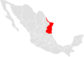 Mapatamaulipas.PNG 467 × 315; 10 KB
-
 Mexico map, MX-TAM.svg 1,000 × 680; 267 KB
-
 Mexico states tamaulipas.png 1,000 × 682; 33 KB
-
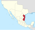
 Tamaulipas en México.svg 974 × 653; 218 KB
-
 Tamaulipas in Mexico (1824).svg 1,509 × 1,288; 901 KB
-
 Tamaulipas in Mexico (location map scheme).svg 2,029 × 1,326; 1.43 MB
-
 Tamaulipas in Mexico.png 278 × 183; 20 KB
-
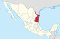
 Tamaulipas in Mexico.svg 1,000 × 680; 127 KB


.svg)
.svg)

