Category:Locator maps of cantons of Aude to 2018
Jump to navigation
Jump to search
Media in category "Locator maps of cantons of Aude to 2018"
The following 19 files are in this category, out of 19 total.
-
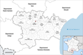 Locator map of Kanton Carcassonne-1.png 2,500 × 1,662; 789 KB
-
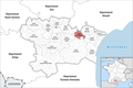
 Locator map of Kanton Carcassonne-2.png 2,500 × 1,662; 793 KB
-
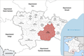
 Locator map of Kanton Carcassonne-3.png 2,500 × 1,662; 792 KB
-
 Locator map of Kanton La Haute-Vallée de l’Aude.png 2,500 × 1,662; 815 KB
-
 Locator map of Kanton La Malpère à la Montagne Noire.png 2,500 × 1,662; 801 KB
-
 Locator map of Kanton La Montagne d’Alaric.png 2,500 × 1,662; 801 KB
-
 Locator map of Kanton La Piège au Razès.png 2,500 × 1,662; 813 KB
-
 Locator map of Kanton La Région Limouxine.png 2,500 × 1,662; 800 KB
-
 Locator map of Kanton La Vallée de l’Orbiel.png 2,500 × 1,662; 797 KB
-
 Locator map of Kanton Le Bassin Chaurien.png 2,500 × 1,662; 796 KB
-
 Locator map of Kanton Le Haut-Minervois.png 2,500 × 1,662; 799 KB
-
 Locator map of Kanton Le Lézignanais.png 2,500 × 1,662; 794 KB
-
 Locator map of Kanton Le Sud-Minervois.png 2,500 × 1,662; 797 KB
-
 Locator map of Kanton Les Basses Plaines de l’Aude.png 2,500 × 1,662; 794 KB
-
 Locator map of Kanton Les Corbières Maritimes.png 2,500 × 1,662; 796 KB
-
 Locator map of Kanton Les Corbières.png 2,500 × 1,662; 811 KB
-
 Locator map of Kanton Narbonne-1.png 2,500 × 1,662; 793 KB
-
 Locator map of Kanton Narbonne-2.png 2,500 × 1,662; 791 KB
-
 Locator map of Kanton Narbonne-3.png 2,500 × 1,662; 790 KB


