Category:Locator maps of census divisions of Canada
Jump to navigation
Jump to search
Subcategories
This category has the following 3 subcategories, out of 3 total.
Media in category "Locator maps of census divisions of Canada"
The following 35 files are in this category, out of 35 total.
-
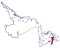
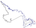
 Cendiv5cb-hum-whitbayPNGA.PNG 622 × 493; 42 KB
-
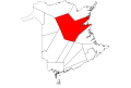
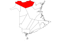
 Division 1, Newfoundland and Labrador.svg 622 × 493; 79 KB
-
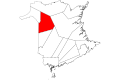
 Division 10, Newfoundland and Labrador.svg 622 × 493; 78 KB
-
 Division 11, Newfoundland and Labrador.svg 622 × 493; 78 KB
-
 Division 2, Newfoundland and Labrador.svg 622 × 493; 79 KB
-
 Division 3, Newfoundland and Labrador.svg 622 × 493; 79 KB
-
 Division 4, Newfoundland and Labrador.svg 622 × 493; 79 KB
-
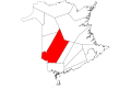
 Division 5, Newfoundland and Labrador.svg 622 × 493; 79 KB
-
 Division 6, Newfoundland and Labrador.svg 622 × 493; 79 KB
-
 Division 7, Newfoundland and Labrador.svg 622 × 493; 79 KB
-
 Division 8, Newfoundland and Labrador.svg 622 × 493; 79 KB
-
 Division 9, Newfoundland and Labrador.svg 622 × 493; 79 KB
-
 Map of New Brunswick highlighting Albert County.svg 4,096 × 2,731; 5.81 MB
-
 Map of New Brunswick highlighting Carleton County.svg 4,096 × 2,731; 5.81 MB
-
 Map of New Brunswick highlighting Charlotte County.svg 4,096 × 2,731; 5.81 MB
-
 Map of New Brunswick highlighting Gloucester County.svg 4,096 × 2,731; 5.81 MB
-
 Map of New Brunswick highlighting Kent County.svg 4,096 × 2,731; 5.81 MB
-
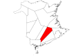
 Map of New Brunswick highlighting Kings County.svg 4,096 × 2,731; 5.81 MB
-
 Map of New Brunswick highlighting Madawaska County.svg 4,096 × 2,731; 5.81 MB
-
 Map of New Brunswick highlighting Northumberland County.svg 4,096 × 2,731; 5.81 MB
-
 Map of New Brunswick highlighting Queens County.svg 4,096 × 2,731; 5.81 MB
-
 Map of New Brunswick highlighting Restigouche County.svg 4,096 × 2,731; 5.81 MB
-
 Map of New Brunswick highlighting Saint John County.svg 4,096 × 2,731; 5.81 MB
-
 Map of New Brunswick highlighting Sunbury County.svg 4,096 × 2,731; 5.81 MB
-
 Map of New Brunswick highlighting Victoria County.svg 4,096 × 2,731; 5.81 MB
-
 Map of New Brunswick highlighting Westmorland County.svg 4,096 × 2,731; 5.81 MB
-
 Map of New Brunswick highlighting York County.svg 4,096 × 2,731; 5.81 MB
-
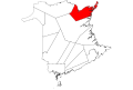
 NL-CD-Div-01.png 3,562 × 2,510; 204 KB
-
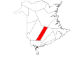
 Nl-stjohns.PNG 622 × 493; 40 KB
-
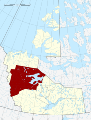
 Region 1, Northwest Territories.svg 2,000 × 2,637; 1.99 MB
-
 Region 2, Northwest Territories.svg 2,000 × 2,637; 2.03 MB
-
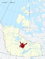 Region 3, Northwest Territories.svg 2,000 × 2,637; 2.06 MB
-
 Region 4, Northwest Territories.svg 2,000 × 2,637; 2.04 MB
-
 Region 5, Northwest Territories.svg 2,000 × 2,637; 2.04 MB
-
 Region 6, Northwest Territories.svg 2,000 × 2,637; 2.04 MB


