Category:Locator maps of communities in Newport, Wales
Jump to navigation
Jump to search
Media in category "Locator maps of communities in Newport, Wales"
The following 29 files are in this category, out of 29 total.
-
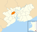 Wales Newport Community Allt-yr-Yn map.svg 512 × 443; 416 KB
-
 Wales Newport Community Alway map.svg 512 × 443; 416 KB
-
 Wales Newport Community Beechwood map.svg 512 × 443; 416 KB
-
 Wales Newport Community Bettws map.svg 512 × 443; 416 KB
-
 Wales Newport Community Bishton map.svg 512 × 443; 416 KB
-
 Wales Newport Community Caerleon map.svg 512 × 443; 416 KB
-
 Wales Newport Community Coedkernew map.svg 512 × 443; 416 KB
-
 Wales Newport Community Gaer map.svg 512 × 443; 416 KB
-
 Wales Newport Community Goldcliff map.svg 512 × 443; 416 KB
-
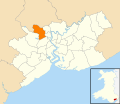
 Wales Newport Community Graig map.svg 512 × 443; 416 KB
-
 Wales Newport Community Langstone map.svg 512 × 443; 416 KB
-
 Wales Newport Community Liswerry map.svg 512 × 443; 416 KB
-
 Wales Newport Community Llanvaches map.svg 512 × 443; 416 KB
-
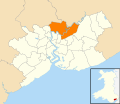
 Wales Newport Community Llanwern map.svg 512 × 443; 416 KB
-
 Wales Newport Community Malpas map.svg 512 × 443; 416 KB
-
 Wales Newport Community Marshfield map.svg 512 × 443; 416 KB
-
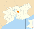
 Wales Newport Community Michaelstone-y-Fedw map.svg 512 × 443; 416 KB
-
 Wales Newport Community Nash map.svg 512 × 443; 416 KB
-
 Wales Newport Community Penhow map.svg 512 × 443; 416 KB
-
 Wales Newport Community Pillgwenlly map.svg 512 × 443; 416 KB
-
 Wales Newport Community Redwick map.svg 512 × 443; 416 KB
-
 Wales Newport Community Ringland map.svg 512 × 443; 416 KB
-
 Wales Newport Community Rogerstone map.svg 512 × 443; 416 KB
-
 Wales Newport Community Shaftesbury map.svg 512 × 443; 416 KB
-
 Wales Newport Community St Julians map.svg 512 × 443; 416 KB
-
 Wales Newport Community Stow Hill map.svg 512 × 443; 416 KB
-
 Wales Newport Community Tredegar Park map.svg 512 × 443; 416 KB
-
 Wales Newport Community Victoria map.svg 512 × 443; 416 KB
-
 Wales Newport Community Wentlooge map.svg 512 × 443; 416 KB


