Category:Locator maps of departements of Nouvelle-Aquitaine to 2017
Jump to navigation
Jump to search
Media in category "Locator maps of departements of Nouvelle-Aquitaine to 2017"
The following 12 files are in this category, out of 12 total.
-
 Locator map of Departement Charente.png 2,500 × 2,871; 1.72 MB
-
 Locator map of Departement Charente-Maritime.png 2,500 × 2,871; 1.73 MB
-
 Locator map of Departement Corrèze.png 2,500 × 2,871; 1.71 MB
-
 Locator map of Departement Creuse.png 2,500 × 2,871; 1.7 MB
-
 Locator map of Departement Deux-Sèvres.png 2,500 × 2,871; 1.7 MB
-
 Locator map of Departement Dordogne.png 2,500 × 2,871; 1.73 MB
-
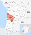 Locator map of Departement Gironde.png 2,500 × 2,871; 1.73 MB
-
 Locator map of Departement Haute-Vienne.png 2,500 × 2,871; 1.7 MB
-
 Locator map of Departement Landes.png 2,500 × 2,871; 1.7 MB
-
 Locator map of Departement Lot-et-Garonne.png 2,500 × 2,871; 1.69 MB
-
 Locator map of Departement Pyrénées-Atlantiques.png 2,500 × 2,871; 1.71 MB
-
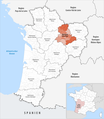
 Locator map of Departement Vienne.png 2,500 × 2,871; 1.7 MB


