Category:Locator maps of districts of Bahamas
Jump to navigation
Jump to search
Subcategories
This category has only the following subcategory.
Media in category "Locator maps of districts of Bahamas"
The following 15 files are in this category, out of 15 total.
-
 Central Abaco District Location.png 427 × 415; 33 KB
-
 Central Abaco District.png 431 × 363; 28 KB
-
 District of Acklins.png 434 × 341; 19 KB
-
 District of the City of Freeport.png 371 × 419; 31 KB
-
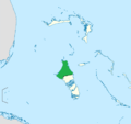
 East Grand Bahama.png 432 × 360; 28 KB
-
 Grand Cay District.png 432 × 355; 28 KB
-
 Hope Town District.png 432 × 357; 28 KB
-
 Inagua District Location.png 443 × 348; 19 KB
-
 Mayaguana District.png 456 × 359; 20 KB
-
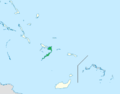
 Moore's Island.png 432 × 356; 28 KB
-
 North Abaco District.png 431 × 355; 28 KB
-
 North Andros District Location.png 427 × 403; 32 KB
-
 Northern Bahamas.png 800 × 577; 64 KB
-
 South Abaco District.png 430 × 359; 28 KB
-
 South Andros District Location.png 430 × 413; 33 KB


