Category:Locator maps of districts of Vojvodina
Jump to navigation
Jump to search
Media in category "Locator maps of districts of Vojvodina"
The following 44 files are in this category, out of 44 total.
-
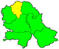
 Map of Central Banat.PNG 816 × 681; 27 KB
-
 Central Banat in Serbia (Kosovo independent).svg 727 × 1,041; 650 KB
-
 Central Banat in Serbia (Kosovo semi-independent) (UNMIK).svg 727 × 1,041; 987 KB
-
 Central Banat in Serbia (Kosovo semi-independent).svg 727 × 1,041; 1,002 KB
-
 Central Banat in Serbia.svg 727 × 1,041; 657 KB
-
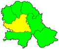
 Juzna Backa.png 2,089 × 2,538; 144 KB
-
 Map of North Backa.PNG 816 × 681; 17 KB
-
 Map of North Backa1.PNG 816 × 681; 26 KB
-
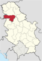
 North Backa in Serbia (Kosovo independent).svg 727 × 1,041; 650 KB
-
 North Backa in Serbia (Kosovo semi-independent) (UNMIK).svg 727 × 1,041; 987 KB
-
 North Backa in Serbia (Kosovo semi-independent).svg 727 × 1,041; 1,002 KB
-
 North Backa in Serbia.svg 727 × 1,041; 657 KB
-
 Map of North Banat.PNG 816 × 681; 26 KB
-
 North Banat in Serbia (Kosovo independent).svg 727 × 1,041; 650 KB
-
 North Banat in Serbia (Kosovo semi-independent) (UNMIK).svg 727 × 1,041; 987 KB
-
 North Banat in Serbia (Kosovo semi-independent).svg 727 × 1,041; 1,002 KB
-
 North Banat in Serbia.svg 727 × 1,041; 657 KB
-
 Map of South Backa.PNG 816 × 681; 27 KB
-
 South Backa in Serbia (Kosovo independent).svg 727 × 1,041; 650 KB
-
 South Backa in Serbia (Kosovo semi-independent) (UNMIK).svg 727 × 1,041; 987 KB
-
 South Backa in Serbia (Kosovo semi-independent).svg 727 × 1,041; 1,002 KB
-
 South Backa in Serbia.svg 727 × 1,041; 657 KB
-
 Map of South Banat.PNG 816 × 681; 26 KB
-
 South Banat in Serbia (Kosovo independent).svg 727 × 1,041; 650 KB
-
 South Banat in Serbia (Kosovo semi-independent) (UNMIK).svg 727 × 1,041; 987 KB
-
 South Banat in Serbia (Kosovo semi-independent).svg 727 × 1,041; 1,002 KB
-
 South Banat in Serbia.svg 727 × 1,041; 657 KB
-
 Srem in Serbia (Kosovo independent).svg 727 × 1,041; 650 KB
-
 Srem in Serbia (Kosovo semi-independent) (UNMIK).svg 727 × 1,041; 987 KB
-
 Srem in Serbia (Kosovo semi-independent).svg 727 × 1,041; 1,002 KB
-
 Srem in Serbia.svg 727 × 1,041; 657 KB
-
 Map of Srem.PNG 816 × 681; 26 KB
-
 Map of West Backa.PNG 816 × 681; 26 KB
-
 West Backa in Serbia (Kosovo independent).svg 727 × 1,041; 650 KB
-
 West Backa in Serbia (Kosovo semi-independent) (UNMIK).svg 727 × 1,041; 987 KB
-
 West Backa in Serbia (Kosovo semi-independent).svg 727 × 1,041; 1,002 KB
-
 West Backa in Serbia.svg 727 × 1,041; 657 KB
-
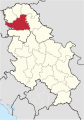
 Сербия Западная Бачка округ.png 400 × 565; 18 KB
-
 Сербия Северная Бачка округ.png 400 × 565; 18 KB
-
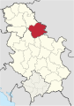
 Сербия Северно-Банатский округ.png 400 × 565; 18 KB
-
 Сербия Средне-Банатский округ.png 400 × 565; 18 KB
-
 Сербия Сремский округ.png 400 × 565; 18 KB
-
 Сербия Южная Бачка округ.png 400 × 565; 18 KB
-
 Сербия Южно-Банатский округ.png 400 × 565; 18 KB

.svg)
_(UNMIK).svg)
.svg)


.svg)
_(UNMIK).svg)
.svg)


.svg)
_(UNMIK).svg)
.svg)


.svg)
_(UNMIK).svg)
.svg)


.svg)
_(UNMIK).svg)
.svg)

.svg)
_(UNMIK).svg)
.svg)


.svg)
_(UNMIK).svg)
.svg)


