Category:Locator maps of districts of the Republic of Karelia
Jump to navigation
Jump to search
Federal subjects of the Russian Federation:
Republics: Adygea · Altai · Altai · Bashkortostan · Buryatia · Chechnya · Chuvashia · Dagestan · Ingushetia · Kabardino-Balkaria · Kalmykia · Karachay–Cherkessia · Karelia · Khakassia · Komi · Mordovia · North Ossetia — Alania · Tatarstan · UdmurtiaKrais: Altai · Krasnodar · Krasnoyarsk · Perm · Primorsky · Stavropol · Zabaykalsky
Oblasts: Amur · Arkhangelsk · Astrakhan · Belgorod · Bryansk · Chelyabinsk · Irkutsk · Ivanovo · Kaliningrad · Kaluga · Kemerovo · Kirov · Kostroma · Kursk · Leningrad · Lipetsk · Moscow · Murmansk · Nizhny Novgorod · Novgorod · Novosibirsk · Omsk · Oryol · Pskov · Rostov · Ryazan · Sakhalin · Samara · Saratov · Smolensk · Sverdlovsk · Tambov · Tomsk · Tula · Tver · Tyumen · Ulyanovsk · Vladimir · Volgograd · Vologda · Voronezh ·
Federal cities: Saint Petersburg ·
Autonomous oblast: Jewish
Autonomous okrugs: Chukotka ·
English: Locator maps of districts of the Republic of Karelia, in northwestern Russia.
Subcategories
This category has only the following subcategory.
Media in category "Locator maps of districts of the Republic of Karelia"
The following 20 files are in this category, out of 20 total.
-
 Kondopoga.PNG 80 × 120; 11 KB
-
 Ru-kr full.svg 920 × 1,006; 75 KB
-
 Ru-kr-belomorsky loc.svg 920 × 1,006; 76 KB
-
 Ru-kr-kalevalsky loc.svg 744 × 1,052; 79 KB
-
 Ru-kr-kemsky loc.svg 744 × 1,052; 79 KB
-
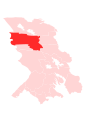
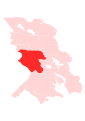
 Ru-kr-kondopozhsky loc.svg 744 × 1,052; 79 KB
-
 Ru-kr-kostomuksha loc.svg 744 × 1,052; 79 KB
-
 Ru-kr-lakhdenpokhsky loc.svg 744 × 1,052; 79 KB
-
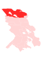 Ru-kr-loukhsky loc.svg 744 × 1,052; 79 KB
-
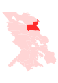
 Ru-kr-medvezhyegorsky loc.svg 744 × 1,052; 79 KB
-
 Ru-kr-muyezersky loc.svg 744 × 1,052; 79 KB
-
 Ru-kr-olonetsky loc.svg 744 × 1,052; 79 KB
-
 Ru-kr-pitkyaransky loc.svg 744 × 1,052; 79 KB
-
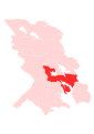
 Ru-kr-prionezhsky loc.svg 744 × 1,052; 79 KB
-
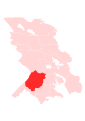
 Ru-kr-pryazhinsky loc.svg 744 × 1,052; 79 KB
-
 Ru-kr-pudozhsky loc.svg 744 × 1,052; 79 KB
-
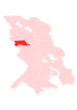
 Ru-kr-segezhsky loc.svg 744 × 1,052; 79 KB
-
 Ru-kr-sortavala loc.svg 744 × 1,052; 79 KB
-
 Ru-kr-suoyarvsky loc.svg 744 × 1,052; 79 KB
-
 Sortavala.png 80 × 120; 11 KB


