Category:Locator maps of former municipalities in Landkreis Goslar
Jump to navigation
Jump to search

Media in category "Locator maps of former municipalities in Landkreis Goslar"
The following 10 files are in this category, out of 10 total.
-
 Altenau in GS.svg 1,460 × 1,470; 655 KB
-
 Hahausen in GS.svg 1,460 × 1,470; 613 KB
-
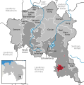
 Lutter am Barenberge in GS.svg 1,460 × 1,470; 613 KB
-
 Samtgemeinde Lutter am Barenberge in GS.svg 1,460 × 1,470; 613 KB
-
 Samtgemeinde Oberharz in GS.svg 1,460 × 1,470; 655 KB
-
 Sankt Andreasberg in GS.svg 1,460 × 1,470; 653 KB
-
 Schulenberg im Oberharz in GS.svg 1,460 × 1,470; 655 KB
-
 Vienenburg in GS.svg 1,460 × 1,470; 645 KB
-
 Wallmoden in GS.svg 1,460 × 1,470; 613 KB
-
 Wildemann in GS.svg 1,460 × 1,470; 655 KB


