Category:Locator maps of former municipalities in the Landkreis Weimarer Land
Jump to navigation
Jump to search
Media in category "Locator maps of former municipalities in the Landkreis Weimarer Land"
The following 40 files are in this category, out of 40 total.
-
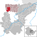
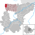
 Auerstedt in AP.png 299 × 299; 9 KB
-
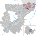
 Bechstedtstraß in AP.png 299 × 299; 6 KB
-
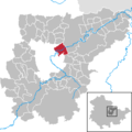
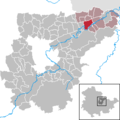
 Berlstedt in AP.png 299 × 299; 8 KB
-
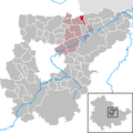
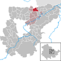
 Buttelstedt in AP.png 299 × 299; 8 KB
-
 Daasdorf a. Berge in AP.png 299 × 299; 6 KB
-
 Flurstedt in AP.png 299 × 299; 9 KB
-
 Gebstedt in AP.png 299 × 299; 9 KB
-
 Großobringen in AP.png 299 × 299; 8 KB
-
 Heichelheim in AP.png 299 × 299; 8 KB
-
 Hopfgarten in AP.png 299 × 299; 6 KB
-
 Isseroda in AP.png 299 × 299; 6 KB
-
 Kleinobringen in AP.png 299 × 299; 8 KB
-
 Krautheim in AP.png 299 × 299; 8 KB
-
 Kromsdorf in AP.png 299 × 299; 8 KB
-
 Ködderitzsch in AP.png 299 × 299; 8 KB
-
 Leutenthal in AP.png 299 × 299; 8 KB
-
 Liebstedt in AP.png 299 × 299; 7 KB
-
 Mattstedt in AP.png 299 × 299; 7 KB
-
 Mönchenholzhausen in AP.png 299 × 299; 6 KB
-
 Niederreißen in AP.png 299 × 299; 7 KB
-
 Niederroßla in AP.png 299 × 299; 7 KB
-
 Niederzimmern in AP.png 299 × 299; 6 KB
-
 Nirmsdorf in AP.png 299 × 299; 7 KB
-
 Nohra in AP.png 299 × 299; 6 KB
-
 Oberreißen in AP.png 299 × 299; 7 KB
-
 Ottstedt a. Berge in AP.png 299 × 299; 6 KB
-
 Oßmannstedt in AP.png 299 × 299; 7 KB
-
 Pfiffelbach in AP.png 299 × 299; 7 KB
-
 Ramsla in AP.png 299 × 299; 8 KB
-
 Rannstedt in AP.png 299 × 299; 6 KB
-
 Reisdorf in AP.png 299 × 299; 9 KB
-
 Rohrbach in AP.png 299 × 299; 8 KB
-
 Saaleplatte in AP.png 299 × 299; 6 KB
-
 Sachsenhausen in AP.png 299 × 299; 8 KB
-
 Schwerstedt in AP.png 299 × 299; 8 KB
-
 Troistedt in AP.png 299 × 299; 6 KB
-
 Vippachedelhausen in AP.png 299 × 299; 8 KB
-
 Wickerstedt in AP.png 299 × 299; 9 KB
-
 Willerstedt in AP.png 299 × 299; 7 KB
-
 Wohlsborn in AP.png 299 × 299; 8 KB


