Category:Locator maps of islands of New Zealand
Jump to navigation
Jump to search
Media in category "Locator maps of islands of New Zealand"
The following 26 files are in this category, out of 26 total.
-
 LocationCheesemanCurtisIsland.PNG 250 × 158; 5 KB
-
 LocationKermadecIslands.PNG 250 × 158; 6 KB
-
 LocationMacauleyIsland.PNG 250 × 158; 5 KB
-
 NZ-Motutapu.png 589 × 701; 96 KB
-
 New Zealand North Island.png 405 × 590; 10 KB
-
 North Island on the globe.png 1,125 × 1,125; 477 KB
-
 NZ-Arapawa I.png 440 × 497; 32 KB
-
 NZ-Auckland Rangitoto map.png 378 × 423; 28 KB
-
 NZ-D'Urville I.png 440 × 497; 33 KB
-
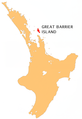 NZ-Gt Barrier I.png 405 × 590; 112 KB
-
 NZ-Kapiti I.png 405 × 590; 114 KB
-
 NZ-L Chalky Island.PNG 617 × 697; 85 KB
-
 NZ-L Cuvier island.PNG 501 × 728; 155 KB
-
 NZ-Matakana I.png 405 × 590; 114 KB
-
 NZ-Rabbit I.png 440 × 497; 32 KB
-
 NZ-Resolution I.png 440 × 497; 33 KB
-
 NZ-Secretary I.png 440 × 497; 33 KB
-
 NZ-ThreeKings.png 449 × 622; 116 KB
-
 NZ-Waiheke I.png 405 × 590; 114 KB
-
 NZ-Whakaari White.png 405 × 590; 104 KB
-
 LocationRaoulIsland.PNG 250 × 158; 5 KB
-
 South Island on the globe.png 1,125 × 1,125; 477 KB
-
 Stewart Island-Rakiura.png 405 × 590; 13 KB
-
 Vanua levu.PNG 844 × 492; 10 KB
-
 Viti levu.PNG 844 × 492; 11 KB
-
 ZhsubaIslandsMap.png 555 × 356; 73 KB


