Category:Locator maps of municipalities in Landkreis Wittmund
Jump to navigation
Jump to search

Media in category "Locator maps of municipalities in Landkreis Wittmund"
The following 22 files are in this category, out of 22 total.
-
 Blomberg in WTM.svg 1,047 × 1,240; 375 KB
-
 Dunum in WTM.svg 1,047 × 1,240; 375 KB
-
 Esens in WTM.svg 1,047 × 1,240; 375 KB
-
 Eversmeer in WTM.svg 1,047 × 1,240; 375 KB
-
 Friedeburg in WTM.svg 1,047 × 1,240; 375 KB
-
 Holtgast in WTM.svg 1,047 × 1,240; 375 KB
-
 Langeoog in WTM.svg 1,047 × 1,240; 375 KB
-
 Moorweg in WTM.svg 1,047 × 1,240; 375 KB
-
 Municipalities in WTM.svg 1,047 × 1,240; 788 KB
-
 Nenndorf in WTM.svg 1,047 × 1,240; 375 KB
-
 Neuharlingersiel in WTM.svg 1,047 × 1,240; 375 KB
-
 Neuschoo in WTM.svg 1,047 × 1,240; 375 KB
-
 Ochtersum in WTM.svg 1,047 × 1,240; 375 KB
-
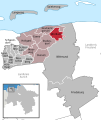
 Samtgemeinde Esens in WTM.svg 1,047 × 1,240; 375 KB
-
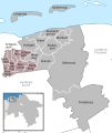 Samtgemeinde Holtriem in WTM.svg 1,047 × 1,240; 375 KB
-
 Schweindorf in WTM.svg 1,047 × 1,240; 375 KB
-
 Spiekeroog in WTM.svg 1,047 × 1,240; 375 KB
-
 Stedesdorf in WTM.svg 1,047 × 1,240; 375 KB
-
 Utarp in WTM.svg 1,047 × 1,240; 375 KB
-
 Werdum in WTM.svg 1,047 × 1,240; 375 KB
-
 Westerholt in WTM.svg 1,047 × 1,240; 375 KB
-
 Wittmund in WTM.svg 1,047 × 1,240; 375 KB


