Category:Locator maps of municipalities of Liège (province)
Jump to navigation
Jump to search
Media in category "Locator maps of municipalities of Liège (province)"
The following 185 files are in this category, out of 185 total.
-
 Amay Liège Belgium Map.png 290 × 220; 5 KB
-
 Amay Liège Belgium Map.svg 977 × 721; 3.11 MB
-
 Amel Liège Belgium Map.png 290 × 220; 5 KB
-
 Amel Liège Belgium Map.svg 977 × 721; 3.11 MB
-
 AmelLocatie.png 290 × 220; 7 KB
-
 Ans Liège Belgium Map.png 290 × 220; 5 KB
-
 Ans Liège Belgium Map.svg 977 × 721; 3.11 MB
-
 Anthisnes Liège Belgium Map.png 290 × 220; 5 KB
-
 Anthisnes Liège Belgium Map.svg 977 × 721; 3.11 MB
-
 Aubel Liège Belgium Map.png 290 × 220; 5 KB
-
 Aubel Liège Belgium Map.svg 977 × 721; 3.11 MB
-
 AubelLocatie.png 290 × 220; 7 KB
-
 Awans Liège Belgium Map.png 290 × 220; 5 KB
-
 Awans Liège Belgium Map.svg 977 × 721; 3.11 MB
-
 Aywaille Liège Belgium Map.png 290 × 220; 5 KB
-
 Aywaille Liège Belgium Map.svg 977 × 721; 3.11 MB
-
 AywailleLocatie.png 290 × 220; 7 KB
-
 Baelen Liège Belgium Map.png 290 × 220; 5 KB
-
 Baelen Liège Belgium Map.svg 977 × 721; 3.11 MB
-
 Bassenge Liège Belgium Map.png 290 × 220; 5 KB
-
 Bassenge Liège Belgium Map.svg 977 × 721; 3.11 MB
-
 BassengeLocatie.png 290 × 220; 7 KB
-
 Berloz Liège Belgium Map.png 290 × 220; 7 KB
-
 Berloz Liège Belgium Map.svg 977 × 721; 3.11 MB
-
 Beyne-Heusay Liège Belgium Map.png 290 × 220; 5 KB
-
 Beyne-Heusay Liège Belgium Map.svg 977 × 721; 3.11 MB
-
 Blegny Liège Belgium Map.svg 977 × 721; 3.11 MB
-
 Blégny Liège Belgium Map.png 290 × 220; 5 KB
-
 Braives Liège Belgium Map.png 290 × 220; 7 KB
-
 Braives Liège Belgium Map.svg 977 × 721; 3.11 MB
-
 Burdinne Liège Belgium Map.png 290 × 220; 7 KB
-
 Burdinne Liège Belgium Map.svg 977 × 721; 3.11 MB
-
 Burg-Reuland Liège Belgium Map.png 290 × 220; 7 KB
-
 Burg-Reuland Liège Belgium Map.svg 977 × 721; 3.11 MB
-
 Büllingen Liège Belgium Map.png 290 × 220; 7 KB
-
 Büllingen Liège Belgium Map.svg 977 × 721; 3.11 MB
-
 Bütgenbach Liège Belgium Map.png 290 × 220; 7 KB
-
 Bütgenbach Liège Belgium Map.svg 977 × 721; 3.11 MB
-
 Chaudfontaine Liège Belgium Map.png 290 × 220; 5 KB
-
 Chaudfontaine Liège Belgium Map.svg 977 × 721; 3.11 MB
-
 Clavier Liège Belgium Map.png 290 × 220; 7 KB
-
 Clavier Liège Belgium Map.svg 977 × 721; 3.11 MB
-
 Comblain-au-Pont Liège Belgium Map.png 290 × 220; 5 KB
-
 Comblain-au-Pont Liège Belgium Map.svg 977 × 721; 3.11 MB
-
 Communauté germanophone province de Liège.png 290 × 220; 5 KB
-
 Communauté germanophone province de Liège.svg 977 × 721; 3.11 MB
-
 Complexe résidentiel urbain de Liège en 2017.png 3,507 × 2,480; 815 KB
-
 Crisnée Liège Belgium Map.png 290 × 220; 7 KB
-
 Crisnée Liège Belgium Map.svg 977 × 721; 3.11 MB
-
 Dalhem Liège Belgium Map.png 290 × 220; 5 KB
-
 Dalhem Liège Belgium Map.svg 977 × 721; 3.11 MB
-
 Dison Liège Belgium Map.png 290 × 220; 7 KB
-
 Dison Liège Belgium Map.svg 977 × 721; 3.11 MB
-
 Donceel Liège Belgium Map.png 290 × 220; 7 KB
-
 Donceel Liège Belgium Map.svg 977 × 721; 3.11 MB
-
 Engis Liège Belgium Map.png 290 × 220; 5 KB
-
 Engis Liège Belgium Map.svg 977 × 721; 3.11 MB
-
 Esneux Liège Belgium Map.png 290 × 220; 5 KB
-
 Esneux Liège Belgium Map.svg 977 × 721; 3.11 MB
-
 Eupen Liège Belgium Map.png 290 × 220; 7 KB
-
 Eupen Liège Belgium Map.svg 977 × 721; 3.11 MB
-
 Faimes Liège Belgium Map.png 290 × 220; 7 KB
-
 Faimes Liège Belgium Map.svg 977 × 721; 3.11 MB
-
 Ferrières Liège Belgium Map.png 290 × 220; 5 KB
-
 Ferrières Liège Belgium Map.svg 977 × 721; 3.11 MB
-
 Fexhe-le-Haut-Clocher Liège Belgium Map.png 290 × 220; 7 KB
-
 Fexhe-le-Haut-Clocher Liège Belgium Map.svg 977 × 721; 3.11 MB
-
 Flémalle Liège Belgium Map.png 290 × 220; 5 KB
-
 Flémalle Liège Belgium Map.svg 977 × 721; 3.11 MB
-
 FlémalleLocatie.png 290 × 220; 7 KB
-
 Fléron Liège Belgium Map.png 290 × 220; 5 KB
-
 Fléron Liège Belgium Map.svg 977 × 721; 3.11 MB
-
 Geer Liège Belgium Map.png 290 × 220; 5 KB
-
 Geer Liège Belgium Map.svg 977 × 721; 3.11 MB
-
 GeerLocatie.png 290 × 220; 7 KB
-
 Grâce-Hollogne Liège Belgium Map.png 290 × 220; 5 KB
-
 Grâce-Hollogne Liège Belgium Map.svg 977 × 721; 3.11 MB
-
 Hamoir Liège Belgium Map.png 290 × 220; 7 KB
-
 Hamoir Liège Belgium Map.svg 977 × 721; 3.11 MB
-
 Hannut Liège Belgium Map.png 290 × 220; 7 KB
-
 Hannut Liège Belgium Map.svg 977 × 721; 3.11 MB
-
 Herstal Liège Belgium Map.png 290 × 220; 5 KB
-
 Herstal Liège Belgium Map.svg 977 × 721; 3.11 MB
-
 Herve Liège Belgium Map.png 290 × 220; 7 KB
-
 Herve Liège Belgium Map.svg 977 × 721; 3.11 MB
-
 Huy Liège Belgium Map.png 290 × 220; 5 KB
-
 Huy Liège Belgium Map.svg 977 × 721; 3.11 MB
-
 Héron Liège Belgium Map.png 290 × 220; 7 KB
-
 Héron Liège Belgium Map.svg 977 × 721; 3.11 MB
-
 Jalhay Liège Belgium Map.png 290 × 220; 7 KB
-
 Jalhay Liège Belgium Map.svg 977 × 721; 3.11 MB
-
 Juprelle Liège Belgium Map.png 290 × 220; 5 KB
-
 Juprelle Liège Belgium Map.svg 977 × 721; 3.11 MB
-
 Kelmis Liège Belgium Map.png 290 × 220; 7 KB
-
 Kelmis Liège Belgium Map.svg 977 × 721; 3.11 MB
-
 Lierneux Liège Belgium Map.png 290 × 220; 7 KB
-
 Lierneux Liège Belgium Map.svg 977 × 721; 3.11 MB
-
 Limbourg Liège Belgium Map.png 290 × 220; 7 KB
-
 Limbourg Liège Belgium Map.svg 977 × 721; 3.11 MB
-
 Lincent Liège Belgium Map.png 290 × 220; 7 KB
-
 Lincent Liège Belgium Map.svg 977 × 721; 3.11 MB
-
 Liège agglomération Liège Belgium Map.PNG 800 × 590; 76 KB
-
 Liège agglomération Liège Belgium Map.svg 977 × 721; 3.11 MB
-
 Liège Liège Belgium Map.svg 977 × 721; 3.11 MB
-
 LiègeGemeenten2.png 290 × 220; 13 KB
-
 Lontzen Liège Belgium Map.png 290 × 220; 7 KB
-
 Lontzen Liège Belgium Map.svg 977 × 721; 3.11 MB
-
 Malmedy Liège Belgium Map.png 290 × 220; 7 KB
-
 Malmedy Liège Belgium Map.svg 977 × 721; 3.11 MB
-
 Marchin Liège Belgium Map.png 290 × 220; 5 KB
-
 Marchin Liège Belgium Map.svg 977 × 721; 3.11 MB
-
 Modave Liège Belgium Map.png 290 × 220; 7 KB
-
 Modave Liège Belgium Map.svg 977 × 721; 3.11 MB
-
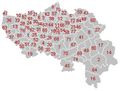
 Municipalities Liège Belgium Map - Number.svg 977 × 721; 3.46 MB
-
 Municipalities Liège Belgium Map.svg 977 × 721; 3.11 MB
-
 Nandrin Liège Belgium Map.png 290 × 220; 5 KB
-
 Nandrin Liège Belgium Map.svg 977 × 721; 3.11 MB
-
 Neupré Liège Belgium Map.png 290 × 220; 5 KB
-
 Neupré Liège Belgium Map.svg 977 × 721; 3.11 MB
-
 Olne Liège Belgium Map.png 290 × 220; 5 KB
-
 Olne Liège Belgium Map.svg 977 × 721; 3.11 MB
-
 OlneLocatie.png 290 × 220; 7 KB
-
 Oreye Liège Belgium Map.png 290 × 220; 5 KB
-
 Oreye Liège Belgium Map.svg 977 × 721; 3.11 MB
-
 Ouffet Liège Belgium Map.png 290 × 220; 7 KB
-
 Ouffet Liège Belgium Map.svg 977 × 721; 3.11 MB
-
 Oupeye Liège Belgium Map.png 290 × 220; 5 KB
-
 Oupeye Liège Belgium Map.svg 977 × 721; 3.11 MB
-
 Pepinster Liège Belgium Map.png 290 × 220; 7 KB
-
 Pepinster Liège Belgium Map.svg 977 × 721; 3.11 MB
-
 Platdietse streek.PNG 290 × 220; 7 KB
-
 Plombières Liège Belgium Map.png 290 × 220; 7 KB
-
 Plombières Liège Belgium Map.svg 977 × 721; 3.11 MB
-
 Raeren Liège Belgium Map.png 290 × 220; 7 KB
-
 Raeren Liège Belgium Map.svg 977 × 721; 3.11 MB
-
 Remicourt Liège Belgium Map.png 290 × 220; 7 KB
-
 Remicourt Liège Belgium Map.svg 977 × 721; 3.11 MB
-
 Région urbaine de Liège en 2017.png 800 × 590; 79 KB
-
 Saint-Georges-sur-Meuse Liège Belgium Map.png 290 × 220; 7 KB
-
 Saint-Georges-sur-Meuse Liège Belgium Map.svg 977 × 721; 3.11 MB
-
 Saint-Nicolas Liège Belgium Map.png 290 × 220; 5 KB
-
 Saint-Nicolas Liège Belgium Map.svg 977 × 721; 3.11 MB
-
 Sankt-Vith Liège Belgium Map.png 290 × 220; 7 KB
-
 Sankt-Vith Liège Belgium Map.svg 977 × 721; 3.11 MB
-
 Seraing Liège Belgium Map.png 290 × 220; 5 KB
-
 Seraing Liège Belgium Map.svg 977 × 721; 3.11 MB
-
 Soumagne Liège Belgium Map.png 290 × 220; 5 KB
-
 Soumagne Liège Belgium Map.svg 977 × 721; 3.11 MB
-
 Spa Liège Belgium Map.png 290 × 220; 7 KB
-
 Spa Liège Belgium Map.svg 977 × 721; 3.11 MB
-
 Sprimont Liège Belgium Map.png 290 × 220; 5 KB
-
 Sprimont Liège Belgium Map.svg 977 × 721; 3.11 MB
-
 Stavelot Liège Belgium Map.png 290 × 220; 7 KB
-
 Stavelot Liège Belgium Map.svg 977 × 721; 3.11 MB
-
 Stoumont Liège Belgium Map.png 290 × 220; 7 KB
-
 Stoumont Liège Belgium Map.svg 977 × 721; 3.11 MB
-
 Theux Liège Belgium Map.png 290 × 220; 7 KB
-
 Theux Liège Belgium Map.svg 977 × 721; 3.11 MB
-
 Thimister-Clermont Liège Belgium Map.png 290 × 220; 7 KB
-
 Thimister-Clermont Liège Belgium Map.svg 977 × 721; 3.11 MB
-
 Tinlot Liège Belgium Map.png 290 × 220; 7 KB
-
 Tinlot Liège Belgium Map.svg 977 × 721; 3.11 MB
-
 Trois-Ponts Liège Belgium Map.png 290 × 220; 7 KB
-
 Trois-Ponts Liège Belgium Map.svg 977 × 721; 3.11 MB
-
 Trooz Liège Belgium Map.png 290 × 220; 5 KB
-
 Trooz Liège Belgium Map.svg 977 × 721; 3.11 MB
-
 Verlaine Liège Belgium Map.png 290 × 220; 7 KB
-
 Verlaine Liège Belgium Map.svg 977 × 721; 3.11 MB
-
 Verviers Liège Belgium Map.png 290 × 220; 7 KB
-
 Verviers Liège Belgium Map.svg 977 × 721; 3.11 MB
-
 Villers-le-Bouillet Liège Belgium Map.png 290 × 220; 7 KB
-
 Villers-le-Bouillet Liège Belgium Map.svg 977 × 721; 3.11 MB
-
 ViseLocatie.png 290 × 220; 7 KB
-
 Visé Liège Belgium Map.png 290 × 220; 5 KB
-
 Visé Liège Belgium Map.svg 977 × 721; 3.11 MB
-
 Waimes Liège Belgium Map.png 290 × 220; 7 KB
-
 Waimes Liège Belgium Map.svg 977 × 721; 3.11 MB
-
 Wanze Liège Belgium Map.png 290 × 220; 7 KB
-
 Wanze Liège Belgium Map.svg 977 × 721; 3.11 MB
-
 Waremme Liège Belgium Map.png 290 × 220; 7 KB
-
 Waremme Liège Belgium Map.svg 977 × 721; 3.11 MB
-
 Wasseiges Liège Belgium Map.png 290 × 220; 7 KB
-
 Wasseiges Liège Belgium Map.svg 977 × 721; 3.11 MB
-
 Welkenraedt Liège Belgium Map.png 290 × 220; 7 KB
-
 Welkenraedt Liège Belgium Map.svg 977 × 721; 3.11 MB


