Category:Locator maps of neighborhoods in Loon op Zand
Jump to navigation
Jump to search
Media in category "Locator maps of neighborhoods in Loon op Zand"
The following 16 files are in this category, out of 16 total.
-

-

-
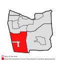
 Map - NL - Loon op Zand - Wijk 00 Loon op Zand.svg 625 × 575; 7 KB
-

-

-

-

-

-

-

-
 Map - NL - Loon op Zand - Wijk 01 Kaatsheuvel.svg 625 × 575; 7 KB
-
 Map - NL - Loon op Zand - Wijk 02 De Moer - Buurt 00 De Moer.svg 375 × 375; 16 KB
-
-
 Map - NL - Loon op Zand - Wijk 02 De Moer.svg 625 × 575; 7 KB
-

-
 Map - NL - Loon op Zand - Wijk 09.svg 625 × 575; 7 KB


.svg)


