Category:Locator maps of neighborhoods in Montferland
Jump to navigation
Jump to search
Media in category "Locator maps of neighborhoods in Montferland"
The following 30 files are in this category, out of 30 total.
-

-

-
 Map - NL - Montferland - Wijk 00 's-Heerenberg - Buurt 02 Zeddam.svg 375 × 375; 29 KB
-

-
 Map - NL - Montferland - Wijk 00 's-Heerenberg - Buurt 04 Braamt.svg 375 × 375; 29 KB
-

-

-
-

-

-
-
 Map - NL - Montferland - Wijk 00 's-Heerenberg.svg 625 × 575; 11 KB
-
 Map - NL - Montferland - Wijk 01 Brakel - Buurt 00 Beek.svg 375 × 375; 29 KB
-
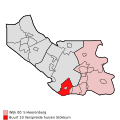
 Map - NL - Montferland - Wijk 01 Brakel - Buurt 01 Kilder.svg 375 × 375; 29 KB
-
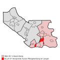
 Map - NL - Montferland - Wijk 01 Brakel - Buurt 02 Loerbeek.svg 375 × 375; 29 KB
-
-

-

-

-
 Map - NL - Montferland - Wijk 01 Brakel.svg 625 × 575; 11 KB
-
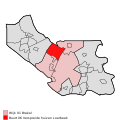
 Map - NL - Montferland - Wijk 02 Didam - Buurt 00 Didam-Zuid.svg 375 × 375; 29 KB
-
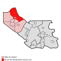
 Map - NL - Montferland - Wijk 02 Didam - Buurt 01 Didam-Noord.svg 375 × 375; 29 KB
-
 Map - NL - Montferland - Wijk 02 Didam - Buurt 02 Loil.svg 375 × 375; 29 KB
-
 Map - NL - Montferland - Wijk 02 Didam - Buurt 03 Nieuw-Dijk.svg 375 × 375; 29 KB
-

-

-

-

-
-
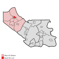
 Map - NL - Montferland - Wijk 02 Didam.svg 625 × 575; 11 KB


