Category:Locator maps of neighborhoods in Noord (Rotterdam)
Jump to navigation
Jump to search
Media in category "Locator maps of neighborhoods in Noord (Rotterdam)"
The following 16 files are in this category, out of 16 total.
-
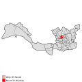
 Map - NL - Rotterdam - Wijk 05 Noord - Buurt 15 Agniesebuurt.svg 375 × 375; 78 KB
-
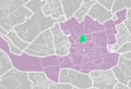
 Map - NL - Rotterdam - Wijk 05 Noord - Buurt 16 Provenierswijk.svg 375 × 375; 78 KB
-
 Map - NL - Rotterdam - Wijk 05 Noord - Buurt 31 Bergpolder.svg 375 × 375; 78 KB
-
 Map - NL - Rotterdam - Wijk 05 Noord - Buurt 32 Blijdorp.svg 375 × 375; 78 KB
-
 Map - NL - Rotterdam - Wijk 05 Noord - Buurt 34 Liskwartier.svg 375 × 375; 78 KB
-
 Map - NL - Rotterdam - Wijk 05 Noord - Buurt 35 Oude Noorden.svg 375 × 375; 78 KB
-

-
 Rotterdamse wijk-blijdorp.PNG 890 × 606; 43 KB
-
 Rotterdamse wijk-blijdorpse polder.PNG 890 × 606; 43 KB
-
 Rotterdamse wijken-agniesebuurt.PNG 890 × 606; 37 KB
-
 Rotterdamse wijken-bergpolder.PNG 890 × 606; 33 KB
-
 Rotterdamse wijken-blijdorp.PNG 890 × 606; 33 KB
-
 Rotterdamse wijken-blijdorpse polder.PNG 890 × 606; 33 KB
-
 Rotterdamse wijken-liskwartier.PNG 890 × 606; 33 KB
-
 Rotterdamse wijken-oude noorden.PNG 890 × 606; 33 KB
-
 Rotterdamse wijken-provenierswijk.PNG 890 × 606; 33 KB


