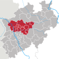
Category:Locator maps of regions in North Rhine-Westphalia
Jump to navigation
Jump to search
Federal states of Germany:
Subcategories
This category has only the following subcategory.
Media in category "Locator maps of regions in North Rhine-Westphalia"
The following 14 files are in this category, out of 14 total.
-
Karte-Wiehengebirge.PNG 188 × 235; 5 KB
-
Lage und Ausdehnung der Eifel.png 188 × 235; 6 KB
-
Locator map Region Aachen in Germany cropped.png 770 × 734; 68 KB
-
Nordrhein Westfalen Teile.gif 342 × 318; 11 KB
-
North rhine w bergisches land.png 263 × 245; 41 KB
-
North rhine w eifel (part).png 263 × 245; 42 KB
-
North rhine w niederrhein.png 263 × 245; 25 KB
-
North rhine w ruhr area.png 263 × 245; 41 KB
-
North rhine w RVR.svg 660 × 660; 223 KB
-
Satellitenbild Niederrheinische Bucht.png 1,625 × 1,359; 3.71 MB
-
Satellitenbild Niederrheinisches Tiefland.png 1,619 × 1,356; 3.7 MB
-
Sauerland (Lage und Ausdehnung).png 188 × 235; 7 KB
-
Westfaelische bucht landsat.gif 816 × 543; 426 KB
-
Westfaelische bucht landsat.png 804 × 586; 884 KB


