Category:Locator maps of territories of the Holy Roman Empire (1680)
Jump to navigation
Jump to search
Media in category "Locator maps of territories of the Holy Roman Empire (1680)"
The following 16 files are in this category, out of 16 total.
-
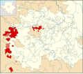
 Locator Counties ruled by Reuss Elder Line (1680).svg 1,329 × 1,164; 394 KB
-
 Locator Counties ruled by Reuss Younger Line (1680).svg 1,329 × 1,164; 394 KB
-
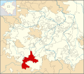
 Locator County of Schwarzburg-Rudolstadt (1680).svg 1,329 × 1,164; 394 KB
-
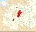
 Locator County of Schwarzburg-Sondershausen (1680).svg 1,329 × 1,164; 394 KB
-
 Locator Duchy of Saxe-Coburg (1680).svg 1,329 × 1,164; 394 KB
-
 Locator Duchy of Saxe-Eisenach (1680).svg 1,329 × 1,164; 393 KB
-
 Locator Duchy of Saxe-Eisenberg (1680).svg 1,329 × 1,164; 394 KB
-
 Locator Duchy of Saxe-Gotha-Altenburg (1680).svg 1,329 × 1,164; 394 KB
-
 Locator Duchy of Saxe-Hildburghausen (1680).svg 1,329 × 1,164; 394 KB
-
 Locator Duchy of Saxe-Jena (1680).svg 1,329 × 1,164; 394 KB
-
 Locator Duchy of Saxe-Meiningen (1680).svg 1,329 × 1,164; 394 KB
-
 Locator Duchy of Saxe-Römhild (1680).svg 1,329 × 1,164; 394 KB
-
 Locator Duchy of Saxe-Saalfeld (1680).svg 1,329 × 1,164; 394 KB
-
 Locator Duchy of Saxe-Weimar (1680).svg 1,329 × 1,164; 394 KB
-
 Locator Duchy of Saxe-Zeitz (1680).svg 1,329 × 1,164; 394 KB
-
 Locator Erfurter Staat (1680).svg 1,329 × 1,164; 394 KB
.svg)
.svg)
.svg)
.svg)
.svg)
.svg)
.svg)
.svg)
.svg)
.svg)
.svg)
.svg)
.svg)
.svg)
.svg)
.svg)