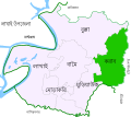
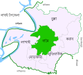
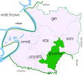
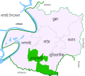
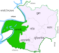
Category:Locator maps of unions of Bangladesh
Jump to navigation
Jump to search
| Locator maps of divisions (=8) | |||||||||||||||||||
| Locator maps of districts ("zilas") (=64) | |||||||||||||||||||
| Locator maps of sub-districts ("upazilas") (=495) | Locator maps of city corporations (metropolis) (=12) | ||||||||||||||||||
| Locator maps of unions (rural areas) (=4,578) | Locator maps of municipalities (towns) (=330) | ||||||||||||||||||
Media in category "Locator maps of unions of Bangladesh"
The following 14 files are in this category, out of 14 total.
-
Location of Asharkandi Union in Jagannathpur Upazila.png 1,190 × 1,080; 56 KB
-
Location of Chilaura-Haldipur Union in Jagannathpur Upazila.png 1,190 × 1,080; 55 KB
-
Location of Kolkolia Union in Jagannathpur Upazila.png 1,190 × 1,080; 55 KB
-
Location of Mirpur Union in Jagannathpur Upazila.png 1,190 × 1,080; 55 KB
-
Location of Pailgaon Union in Jagannathpur Upazila.png 1,190 × 1,080; 55 KB
-
Location of Patli Union in Jagannathpur Upazila.png 1,190 × 1,080; 55 KB
-
Location of Raniganj Union in Jagannathpur Upazila.png 1,190 × 1,080; 55 KB
-
Location of Syedpur-Shaharpara Union in Jagannathpur Upazila.png 1,190 × 1,080; 55 KB
-
লাখাই উপজেলার করাব ইউনিয়ন.svg 512 × 457; 232 KB
-
লাখাই উপজেলার বামৈ ইউনিয়ন.svg 512 × 457; 232 KB
-
লাখাই উপজেলার বুল্লা ইউনিয়ন.svg 512 × 457; 236 KB
-
লাখাই উপজেলার মুড়িয়াউক ইউনিয়ন.svg 512 × 457; 232 KB
-
লাখাই উপজেলার মোড়াকরি ইউনিয়ন.svg 512 × 457; 232 KB
-
লাখাই উপজেলার লাখাই ইউনিয়ন.svg 512 × 457; 232 KB


