Category:Locator maps of villages in Miaoli
Jump to navigation
Jump to search
English: Locator maps of villages in Miaoli. Note: "Village" is an administrative division, and not to be confused with the definition of a "village" in a clustered human settlement or community.
中文(臺灣):苗栗縣各村里位置圖
Media in category "Locator maps of villages in Miaoli"
The following 7 files are in this category, out of 7 total.
-
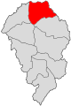 Hudong village.svg 2,000 × 3,000; 19 KB
-
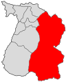 NZ Donghe village.svg 2,000 × 2,500; 52 KB
-
 NZ East village.svg 2,000 × 2,500; 16 KB
-
 NZ West village.svg 2,000 × 2,500; 15 KB
-
 Sihu village.svg 2,000 × 3,000; 19 KB
-
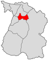
 ZN DaPu village.svg 1,800 × 2,050; 21 KB
-
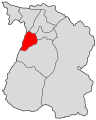
 ZN Qiding village.svg 1,800 × 2,050; 21 KB


