Category:Logie Coldstone (civil parish)
Jump to navigation
Jump to search
Scottish parish in Aberdeenshire, Scotland, UK | |||||
| Upload media | |||||
| Instance of | |||||
|---|---|---|---|---|---|
| Location |
| ||||
| Population |
| ||||
| Area |
| ||||
 | |||||
Media in category "Logie Coldstone (civil parish)"
The following 200 files are in this category, out of 378 total.
(previous page) (next page)-
 'Tom Dubh' wood - geograph.org.uk - 5501771.jpg 4,896 × 3,672; 6.57 MB
-
 (New) Mains of Coynach - geograph.org.uk - 5504942.jpg 4,896 × 3,672; 5.06 MB
-
 A bridge over the Burn of Blackmill - geograph.org.uk - 5497424.jpg 4,896 × 3,672; 6.93 MB
-
 A Christmas scene during Lent - geograph.org.uk - 1752360.jpg 640 × 480; 65 KB
-
 A drain from Tillypronie Estate - geograph.org.uk - 1752431.jpg 640 × 480; 98 KB
-
 A fruiting rowan - geograph.org.uk - 5508407.jpg 4,674 × 3,368; 3.29 MB
-
 A group of Greylag on Coynach Hill, week 3 August - geograph.org.uk - 5507282.jpg 4,896 × 3,672; 6.44 MB
-
 A Hare, hare-ing it^ - geograph.org.uk - 861831.jpg 640 × 480; 88 KB
-
 A Multiplicity of Signs - geograph.org.uk - 5110050.jpg 429 × 640; 88 KB
-
 A plaque on a low wall around an old grave slab, Migvie - geograph.org.uk - 1943422.jpg 1,600 × 1,200; 506 KB
-
 A Praetorian Guard at the entrance to Braefoot - geograph.org.uk - 5498969.jpg 3,981 × 3,122; 3.5 MB
-
 A steading at The Glack, Migvie - geograph.org.uk - 1943153.jpg 1,600 × 1,200; 467 KB
-

-
 A track to Cairnmore - geograph.org.uk - 4288085.jpg 1,024 × 683; 252 KB
-
 A view towards Davoch Plantation - geograph.org.uk - 5501795.jpg 4,896 × 3,672; 6.93 MB
-
 A97 approach to Carrue - geograph.org.uk - 5502693.jpg 4,692 × 3,519; 3.14 MB
-
 A97 near Honeycombe House - geograph.org.uk - 5502728.jpg 4,896 × 2,752; 5.33 MB
-
 Access gate to Knockargety Forest - geograph.org.uk - 861880.jpg 640 × 480; 109 KB
-
 Access lane to Broadford - geograph.org.uk - 5504905.jpg 4,686 × 3,541; 3.09 MB
-
 Access lane to Upper Broadford Croft - geograph.org.uk - 5505973.jpg 4,896 × 3,672; 6.5 MB
-
 Access to Blelack House estate - geograph.org.uk - 5502688.jpg 4,896 × 3,672; 3.25 MB
-
 Access to Braefoot - geograph.org.uk - 1752967.jpg 640 × 480; 91 KB
-
 Access to Broadford - geograph.org.uk - 4568170.jpg 2,848 × 2,136; 3.14 MB
-
 Access to Honeycombe House, Balnastraid - geograph.org.uk - 5502710.jpg 4,896 × 2,752; 5.44 MB
-
 Access to Hopewell Lodge - geograph.org.uk - 5497254.jpg 4,896 × 3,672; 6.43 MB
-
 Access to Milton of Migvie - geograph.org.uk - 5497389.jpg 4,896 × 3,672; 6.83 MB
-
 Access to Navity Cottage, Ordie - geograph.org.uk - 3016776.jpg 3,648 × 2,736; 1.68 MB
-
 Access to Parks farm - geograph.org.uk - 1337659.jpg 640 × 480; 127 KB
-
 Access to Picts Howe, Logie Coldstone - geograph.org.uk - 5504008.jpg 4,896 × 3,672; 4.95 MB
-
 Access to Sunnybrae from A97 - geograph.org.uk - 1752406.jpg 640 × 480; 113 KB
-
 Access to Tillykerrie - geograph.org.uk - 1752914.jpg 640 × 480; 62 KB
-
 Across the fields to Gallows Hill - geograph.org.uk - 4288218.jpg 1,024 × 683; 209 KB
-
 Across the fields to Morven - geograph.org.uk - 4133008.jpg 1,000 × 667; 225 KB
-
 An interfield dyke at Coynach - geograph.org.uk - 5506180.jpg 4,641 × 3,481; 4.36 MB
-
 Approach to a Y-junction on the minor road to Migvie - geograph.org.uk - 5505990.jpg 4,896 × 3,672; 6.92 MB
-
 Approach to Easter Migvie crossroads - geograph.org.uk - 5509252.jpg 4,289 × 2,882; 2.63 MB
-
 Approach to Ordie (Jun,2012) - geograph.org.uk - 3016770.jpg 1,451 × 931; 338 KB
-
 Approaching Ordie crossroads from Dinnet - geograph.org.uk - 5502627.jpg 4,526 × 3,395; 3.08 MB
-
 Approaching the summit of Morven - geograph.org.uk - 854165.jpg 640 × 425; 93 KB
-
 Ardan Breac and Hill of Allamuc - geograph.org.uk - 1377658.jpg 640 × 480; 70 KB
-
 Ardan Breac track - geograph.org.uk - 1377624.jpg 640 × 480; 76 KB
-
 Autumn colours at Migvie kirkyard - geograph.org.uk - 5942708.jpg 4,896 × 3,672; 6.48 MB
-
 Balnastraid farm - geograph.org.uk - 1352413.jpg 573 × 409; 78 KB
-
 Balronald Wood - geograph.org.uk - 1378309.jpg 640 × 480; 65 KB
-
 Balronald Wood - geograph.org.uk - 1378350.jpg 640 × 480; 79 KB
-
 Balronald Wood boundary wall - geograph.org.uk - 1398430.jpg 640 × 480; 69 KB
-
 Balronald Wood junction - geograph.org.uk - 1378330.jpg 640 × 480; 116 KB
-
 Balronald Wood shrinking - geograph.org.uk - 1378327.jpg 640 × 480; 88 KB
-
 Balronald Wood track - geograph.org.uk - 1378314.jpg 640 × 480; 101 KB
-
 Balronald Wood track - geograph.org.uk - 1378336.jpg 640 × 480; 86 KB
-

-
 Barehillock Steading - geograph.org.uk - 5357844.jpg 4,272 × 2,848; 4.28 MB
-
 Bend in track to Knockargety Hill - geograph.org.uk - 861888.jpg 480 × 640; 101 KB
-
 Blackmill - geograph.org.uk - 2439247.jpg 640 × 427; 416 KB
-
 Blackmill farm - geograph.org.uk - 1753429.jpg 640 × 414; 51 KB
-
 Blackmill farm - geograph.org.uk - 1753455.jpg 640 × 511; 96 KB
-
 Blackmill Farm - geograph.org.uk - 1753473.jpg 640 × 480; 72 KB
-
 Blackmill Farm - geograph.org.uk - 5497240.jpg 4,896 × 3,672; 6.55 MB
-
 Blue Cairn of Ladieswell (1) - geograph.org.uk - 4951116.jpg 640 × 427; 551 KB
-
 Blue Cairn of Ladieswell (2) - geograph.org.uk - 4951262.jpg 640 × 427; 568 KB
-
 Blue Cairn of Ladieswell (3) - geograph.org.uk - 4951349.jpg 427 × 640; 546 KB
-
 Blue Cairn of Ladieswell (4) - geograph.org.uk - 4951355.jpg 640 × 427; 543 KB
-
 Blue Cairn of Ladieswell (5) - geograph.org.uk - 4951453.jpg 640 × 427; 553 KB
-
 Blue Cairn of Ladieswell (6) - geograph.org.uk - 4951457.jpg 640 × 427; 550 KB
-
 Bonlee Hill - geograph.org.uk - 1378281.jpg 640 × 480; 80 KB
-
 Bonlee Hill - geograph.org.uk - 1398439.jpg 640 × 480; 59 KB
-
 Bonlee Hill track - geograph.org.uk - 1398325.jpg 640 × 480; 59 KB
-
 Bonlee Hill track - geograph.org.uk - 1398467.jpg 640 × 480; 62 KB
-
 Braefoot - geograph.org.uk - 2439255.jpg 640 × 427; 375 KB
-
 Braehead Farm - geograph.org.uk - 861999.jpg 640 × 480; 79 KB
-
 Braes of Fintock near Strathdon - geograph.org.uk - 4314846.jpg 4,608 × 3,456; 7.09 MB
-
 Bridge on track to Watererne - geograph.org.uk - 1752813.jpg 640 × 480; 112 KB
-
 Bridge over the Burn of Blackmill - geograph.org.uk - 5357859.jpg 4,272 × 2,848; 3.17 MB
-
 Bridge over the Logie Burn - geograph.org.uk - 1352354.jpg 640 × 480; 75 KB
-
 Bridge over the Logie Burn in Logie Coldstone - geograph.org.uk - 5502749.jpg 4,380 × 3,285; 2.65 MB
-
 Broadford farm - geograph.org.uk - 5504928.jpg 4,896 × 3,672; 6.89 MB
-
 Broadford farm - geograph.org.uk - 5505980.jpg 4,896 × 3,672; 6.92 MB
-
 Broadford farmstead - geograph.org.uk - 5504829.jpg 4,666 × 2,835; 1.59 MB
-
 Burn coming out of Braes of Fintock near Strathdon - geograph.org.uk - 4314844.jpg 4,608 × 3,456; 6.71 MB
-
 Burn of Badanseaneach - geograph.org.uk - 1378299.jpg 640 × 480; 65 KB
-
 Burn of Blackmill - geograph.org.uk - 5357885.jpg 4,272 × 2,848; 3.32 MB
-
 Burnside cottage in sun - geograph.org.uk - 862114.jpg 640 × 480; 113 KB
-
 Bus depot at Sunnybrae - geograph.org.uk - 1752401.jpg 640 × 480; 69 KB
-
 Carlene Cottage - geograph.org.uk - 861996.jpg 640 × 480; 106 KB
-
 Carved Stone Fragment - geograph.org.uk - 3122655.jpg 427 × 640; 99 KB
-
 Cilroena Cottage - geograph.org.uk - 862106.jpg 640 × 480; 111 KB
-
 Clearing with Logs - geograph.org.uk - 5357817.jpg 4,272 × 2,848; 2.37 MB
-
 Coldhome farm - geograph.org.uk - 1398272.jpg 640 × 480; 60 KB
-
 Coldstone Kirkyard - geograph.org.uk - 4952331.jpg 640 × 409; 448 KB
-
 Coldstone Kirkyard - geograph.org.uk - 4952334.jpg 640 × 427; 515 KB
-
 Conical cairn on Baderonach Hill - geograph.org.uk - 2467757.jpg 1,500 × 876; 982 KB
-
 Copse near Braehead - geograph.org.uk - 862077.jpg 640 × 480; 91 KB
-
 Corbies' Nest - geograph.org.uk - 1377611.jpg 640 × 480; 76 KB
-
 Cottage, west of Woodend - geograph.org.uk - 878131.jpg 640 × 480; 62 KB
-
 Coynach Cottage - geograph.org.uk - 5504915.jpg 4,896 × 3,672; 7.04 MB
-
 Cragielea farm - geograph.org.uk - 2020484.jpg 1,296 × 972; 354 KB
-
 Craig Walgan - geograph.org.uk - 1378271.jpg 640 × 480; 53 KB
-

-
 Deep Muddy Ruts - geograph.org.uk - 4952227.jpg 427 × 640; 457 KB
-
 Departing Logie Coldstone on a minor road northwards - geograph.org.uk - 5502760.jpg 4,896 × 3,672; 6.65 MB
-
 Derelict Cottage - geograph.org.uk - 4952260.jpg 640 × 427; 532 KB
-
 Deskry Water - geograph.org.uk - 1374942.jpg 640 × 480; 69 KB
-
 Deskry Water track North - geograph.org.uk - 1377507.jpg 640 × 480; 63 KB
-
 Deskry Water track South - geograph.org.uk - 1377521.jpg 640 × 480; 55 KB
-
 Deskryshiel - geograph.org.uk - 1337734.jpg 640 × 480; 85 KB
-
 Disused Quarry near Migvie - geograph.org.uk - 5501466.jpg 4,895 × 3,237; 6.89 MB
-
 Downhill from Little Corrie - geograph.org.uk - 5498978.jpg 4,279 × 3,671; 2.5 MB
-
 East side of Hill of Corrachree - geograph.org.uk - 4133028.jpg 1,000 × 664; 283 KB
-
 East to Tarland - geograph.org.uk - 5358095.jpg 2,848 × 4,272; 4.09 MB
-
 Easter Migvie - geograph.org.uk - 5358032.jpg 4,272 × 2,848; 5.13 MB
-
 Easter Migvie crossroads - geograph.org.uk - 5497308.jpg 4,896 × 3,672; 6.64 MB
-
 Eastern access to Tillypronie - geograph.org.uk - 1752933.jpg 480 × 640; 78 KB
-
 Eastern approach to hillfort - geograph.org.uk - 861848.jpg 640 × 480; 72 KB
-
 Eastern slope of Morven looking towards Little Cairn - geograph.org.uk - 6468759.jpg 1,799 × 1,199; 229 KB
-
 Electricity pylon on wooded Kirk Hill, Migvie - geograph.org.uk - 5942566.jpg 4,896 × 3,672; 7.1 MB
-

-
 End of the Run - geograph.org.uk - 5357748.jpg 4,272 × 2,848; 2.7 MB
-
 Entrance to Corrachree House - geograph.org.uk - 3918656.jpg 1,024 × 768; 283 KB
-
 Entrance to Kirkhill graveyard - geograph.org.uk - 4567860.jpg 2,848 × 2,136; 1.72 MB
-
 Entrance to Mains of Coynach - geograph.org.uk - 4568075.jpg 2,848 × 2,136; 3.04 MB
-
 Exit from Knockargety Wood. - geograph.org.uk - 861922.jpg 640 × 480; 125 KB
-
 Farm bridge over the Howe Burn - geograph.org.uk - 1753508.jpg 640 × 480; 161 KB
-
 Farm track by the Howe Burn - geograph.org.uk - 2020451.jpg 1,944 × 2,592; 1.66 MB
-
 Farmhouse at Meadowlea - geograph.org.uk - 1753385.jpg 640 × 489; 59 KB
-
 Fernyhowe - geograph.org.uk - 861818.jpg 640 × 480; 87 KB
-
 Field and woods by Millhead - geograph.org.uk - 878108.jpg 640 × 480; 66 KB
-
 Field Boundary - geograph.org.uk - 2439252.jpg 427 × 640; 448 KB
-
 Field Dyke - geograph.org.uk - 5112209.jpg 480 × 640; 133 KB
-
 Field near Braehead - geograph.org.uk - 5112200.jpg 640 × 428; 95 KB
-
 Field Stripes - geograph.org.uk - 4952273.jpg 640 × 427; 348 KB
-
 Field with sheep - geograph.org.uk - 1753520.jpg 640 × 480; 53 KB
-
 Fields at Nether Ruthven - geograph.org.uk - 5112159.jpg 640 × 408; 92 KB
-
 Fields near Davan - geograph.org.uk - 5110038.jpg 640 × 385; 114 KB
-
 Fields with trees south-west of A97 - geograph.org.uk - 2472495.jpg 1,500 × 843; 1.15 MB
-
 Flowers in a quarry - geograph.org.uk - 861827.jpg 640 × 480; 153 KB
-
 Forest boundary climbing Mullachdubh near Braes of Fintock - geograph.org.uk - 4314865.jpg 4,608 × 3,456; 7.24 MB
-
 Forest Track - geograph.org.uk - 5112171.jpg 640 × 480; 118 KB
-
 Former cottage shop, Easter Migvie - geograph.org.uk - 5501507.jpg 4,896 × 3,672; 6.88 MB
-
 Fruiting Roddens (Mountain Ash) - geograph.org.uk - 5507263.jpg 4,896 × 3,672; 7.06 MB
-
 Gallows Hill Field - geograph.org.uk - 5356738.jpg 4,272 × 2,848; 3.01 MB
-
 Gardener's Cottage on Gallows Hill - geograph.org.uk - 877240.jpg 640 × 480; 45 KB
-
 Gated egress from the moor at Lazy Well - geograph.org.uk - 2024064.jpg 1,296 × 972; 447 KB
-
 Gated entrance to Migvie kirkyard - geograph.org.uk - 1943409.jpg 1,600 × 1,200; 534 KB
-
 Gated track to Heugh - geograph.org.uk - 1352436.jpg 640 × 480; 184 KB
-
 Gateway to Hopewell - geograph.org.uk - 1753467.jpg 640 × 496; 100 KB
-
 Glengarry Cottage, Logie Coldstone - geograph.org.uk - 5502767.jpg 640 × 480; 73 KB
-
 Granite block - geograph.org.uk - 861915.jpg 640 × 480; 145 KB
-
 Grassy Field by Knockie - geograph.org.uk - 5358022.jpg 4,272 × 2,848; 3.42 MB
-

-
 Gravestones in Coldstone Graveyard - geograph.org.uk - 4567866.jpg 2,848 × 2,136; 3.11 MB
-
 Greystone - geograph.org.uk - 5112220.jpg 473 × 640; 81 KB
-
 Ground Ivy (Glechoma hederacea) - geograph.org.uk - 4952268.jpg 397 × 640; 368 KB
-
 Grounds of Hopewell Lodge - geograph.org.uk - 4288238.jpg 1,024 × 683; 128 KB
-
 Haugh of Ruthven - geograph.org.uk - 861856.jpg 640 × 480; 78 KB
-
 Heathery slopes of White Hillock near Braes of Fintock - geograph.org.uk - 4314856.jpg 4,608 × 3,456; 7.16 MB
-
 Hill Fort plateau - geograph.org.uk - 861552.jpg 640 × 480; 104 KB
-
 Hill of Allamuc - geograph.org.uk - 1378268.jpg 640 × 480; 64 KB
-
 Hill of Bogston - geograph.org.uk - 1374921.jpg 640 × 480; 44 KB
-
 Hill of Bogston and Foggiemill - geograph.org.uk - 1398372.jpg 640 × 480; 44 KB
-
 Hill of Corrachree - geograph.org.uk - 1607867.jpg 640 × 428; 66 KB
-
 Hopewell Lodge - geograph.org.uk - 1337646.jpg 609 × 401; 56 KB
-
 Hopewell Lodge - geograph.org.uk - 4133023.jpg 1,000 × 664; 358 KB
-
 House at Ordie - geograph.org.uk - 5110055.jpg 640 × 497; 92 KB
-

-
 Inside of the Kirk Door - geograph.org.uk - 3122664.jpg 441 × 640; 95 KB
-
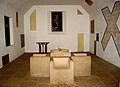 Interior of the old Migvie Kirk - geograph.org.uk - 1943170.jpg 1,024 × 740; 169 KB
-
 Junction for Groddie off A97 - geograph.org.uk - 1352320.jpg 640 × 480; 159 KB
-
 Junction on the A97 at Likeleys Hill - geograph.org.uk - 4290525.jpg 1,024 × 683; 182 KB
-
 Kirkhill Farm, Migvie - geograph.org.uk - 5942698.jpg 4,896 × 3,672; 7.05 MB
-
 Kirklands - geograph.org.uk - 4952348.jpg 640 × 427; 435 KB
-
 Knock Hill plantation - geograph.org.uk - 861825.jpg 640 × 480; 96 KB
-
 Knockargety Hill - geograph.org.uk - 861851.jpg 640 × 480; 93 KB
-
 Knockargety Wood - geograph.org.uk - 5112175.jpg 640 × 455; 114 KB
-
 Knockargety Wood - geograph.org.uk - 5112181.jpg 640 × 480; 103 KB
-
 Knockargety Wood - geograph.org.uk - 5112187.jpg 640 × 480; 97 KB
-
 Knockie track - geograph.org.uk - 5358047.jpg 4,272 × 2,848; 6.83 MB
-
 Knockie Wood - geograph.org.uk - 5357769.jpg 3,379 × 2,253; 1.85 MB
-
 Knockie Wood - geograph.org.uk - 5358011.jpg 4,097 × 2,732; 2.84 MB
-
 Knocksoul countryside - geograph.org.uk - 1378341.jpg 640 × 480; 96 KB
-
 Ladieswell Cottage - geograph.org.uk - 4952246.jpg 640 × 440; 477 KB
-
 Lane to Mains of Hopewell - geograph.org.uk - 5508399.jpg 4,573 × 3,429; 4.75 MB
-
 Lane to Mains of Hopewell - geograph.org.uk - 5508416.jpg 4,896 × 3,672; 7.03 MB
-
 Lane to Mains of Pronie - geograph.org.uk - 1752889.jpg 640 × 480; 137 KB
-
 Late summer verdure - geograph.org.uk - 5509233.jpg 4,896 × 3,672; 6.96 MB
-
 Lazy Well bothy - geograph.org.uk - 2024056.jpg 1,217 × 835; 307 KB
-
 Left fork at a Y-junction at Coynach Hill - geograph.org.uk - 5505996.jpg 4,896 × 3,672; 6.48 MB
-
 Leys covered reservoir - geograph.org.uk - 819281.jpg 640 × 480; 74 KB
-
 Leys farm - geograph.org.uk - 821965.jpg 640 × 480; 70 KB
-
 Leys farm buildings - geograph.org.uk - 819266.jpg 640 × 480; 84 KB
-
 Leys Reservoir, Tarland - geograph.org.uk - 819999.jpg 640 × 480; 67 KB
-
 Likeleys Hill crossroads - geograph.org.uk - 5504061.jpg 4,397 × 3,297; 2.72 MB
-
 Likeleys Hill plantation - geograph.org.uk - 5504033.jpg 4,896 × 3,672; 6.99 MB
-
 Little Corrie cottage - geograph.org.uk - 1752927.jpg 640 × 480; 85 KB
-
 Little Corrie cottage - geograph.org.uk - 1752950.jpg 640 × 480; 92 KB
-
 Lochnagar from Morven - geograph.org.uk - 2964144.jpg 2,056 × 1,465; 1.01 MB
-
 Log Piles - geograph.org.uk - 4952240.jpg 640 × 427; 509 KB
-
 Logie Coldstone Hall - geograph.org.uk - 4567853.jpg 2,848 × 2,136; 3.04 MB
-
 Looking east from the Braes of Fintock near Strathdon - geograph.org.uk - 4314748.jpg 4,608 × 3,456; 6.91 MB
-
 Looking south east from Morven - geograph.org.uk - 854169.jpg 640 × 429; 98 KB
-
 Looking towards Gow's Stone - geograph.org.uk - 1752369.jpg 640 × 480; 85 KB

_Mains_of_Coynach_-_geograph.org.uk_-_5504942.jpg)


_-_geograph.org.uk_-_3016770.jpg)


_-_geograph.org.uk_-_4951116.jpg)
_-_geograph.org.uk_-_4951262.jpg)
_-_geograph.org.uk_-_4951349.jpg)
_-_geograph.org.uk_-_4951355.jpg)
_-_geograph.org.uk_-_4951453.jpg)
_-_geograph.org.uk_-_4951457.jpg)


_to_Logie_Coldstone_(S)_-_geograph.org.uk_-_4568143.jpg)


_-_geograph.org.uk_-_5507263.jpg)


_-_geograph.org.uk_-_4952268.jpg)


&filefrom=Meadow+by+Howe+Burn+bridge+-+geograph.org.uk+-+2020464.jpg#mw-category-media)