Category:London SE16
Jump to navigation
Jump to search
Subcategories
This category has the following 5 subcategories, out of 5 total.
Media in category "London SE16"
The following 29 files are in this category, out of 29 total.
-
Albatross Way, SE16 - geograph.org.uk - 1618895.jpg 640 × 480; 97 KB
-
Albion Channel, SE16 - geograph.org.uk - 1621563.jpg 640 × 480; 98 KB
-
Albion, Rotherhithe, SE16 (2844311096).jpg 1,280 × 960; 348 KB
-
Blue Anchor Lane, SE16 - geograph.org.uk - 468113.jpg 640 × 480; 106 KB
-
Bradley House and Maydew House - geograph.org.uk - 468374.jpg 480 × 640; 106 KB
-
Brunel Road, SE16 - geograph.org.uk - 889577.jpg 640 × 480; 102 KB
-
Canada Water, SE16 - geograph.org.uk - 1618810.jpg 640 × 480; 110 KB
-
Canary wharf from Surrey Docks, SE16.jpg 2,133 × 1,600; 558 KB
-
Caulkers pub - geograph.org.uk - 1466891.jpg 640 × 480; 118 KB
-
Christ Apostolic Church, Deptford - geograph.org.uk - 1315940.jpg 640 × 480; 107 KB
-
Globe Wharf, London SE16 - geograph.org.uk - 1404243.jpg 640 × 480; 70 KB
-
Housing development, Surrey Docks.jpg 3,072 × 2,304; 1.44 MB
-
Housing, Surrey Docks, SE16.jpg 1,600 × 2,133; 661 KB
-
London bus (1).jpg 4,320 × 3,240; 4.57 MB
-
Raymouth Road, SE16 - geograph.org.uk - 468126.jpg 640 × 480; 79 KB
-
Rotherhithe New Road, SE16 - geograph.org.uk - 82215.jpg 640 × 460; 80 KB
-
Rotherhithe Old Road SE16 - geograph.org.uk - 80887.jpg 640 × 474; 120 KB
-
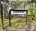
Russia Walk sign 2024-03-21.jpg 2,937 × 2,508; 4.78 MB
-
Southwark Park, Rotherhithe, SE16 - geograph.org.uk - 104570.jpg 640 × 480; 83 KB
-
St Gertrude's Catholic church, Debnams Street - geograph.org.uk - 3935959.jpg 1,024 × 768; 230 KB
-
St James's Road, SE16 - geograph.org.uk - 468110.jpg 640 × 480; 123 KB
-
St Marychurch Street.jpg 2,189 × 2,790; 2.31 MB
-
St Peter's Catholic church - geograph.org.uk - 2428936.jpg 1,024 × 768; 357 KB
-
Whelan's Free House SE16 - geograph.org.uk - 82234.jpg 480 × 640; 135 KB


